Niedersachsen
Description
Trails in this state
- AhornwegGPX
- ArminiuswegGPX
- Bückebergweg
- ButjadingerwegGPX
- E1GPX
- E11GPX
- E6GPX
- E9GPX
- Elb Höhenweg
- Elbe-Weser-WanderwegGPX
- EmmerwegGPX
- Ems-Hase-Hunte-ElsewegGPX
- Ems-HuntewegGPX
- Ems-JadewegGPX
- EmswegGPX
- Frau HollepfadGPX
- FreudenthalwegGPX
- FuldahöhenwegGPX
- GeestwegGPX
- Handelsweg
- HansawegGPX
- Harzer BaudensteigGPX
- Harzer HexenstiegGPX
- HünenwegGPX
- JadewegGPX
- KaiserwegGPX
- KarstwanderwegGPX
- KlötziestiegGPX
- Mühlenweg am WiehengebirgeGPX
- NoaberpadGPX
- North Sea TrailGPX
- Ostfriesland WanderwegGPX
- Pickerweg
- RunenwegGPX
- SigwardswegGPX
- StörtebekerwegGPX
- StudentenpfadGPX
- TöddenwegGPX
- Wendland RundwegGPX
- WeserberglandwegGPX
- WesergebirgswegGPX
- WittekindswegGPX
Links
Facts
Reports
Guides and maps
Lodging
Organisations
Tour operators
GPS
Other
Books

- Also available from:
- De Zwerver, Netherlands


Stanfords
United Kingdom
United Kingdom
- Purbeck & South Dorset - Poole, Dorchester - Weymouth & Swanage OS Explorer Active Map OL15 (waterproof)
- Purbeck and the southern part of Dorset on a detailed topographic and GPS compatible map OL15, waterproof version, from the Ordnance Survey’s 1:25,000 Explorer series. Coverage extends from Poole and Swanage in the east to Bridport in the west, and includes Dorchester, Tolpuddle, Bere Regis, Wareham, Weymouth, Chesil Beach, Portland Bill, the... Read more
- Also available from:
- The Book Depository, United Kingdom

The Book Depository
United Kingdom
United Kingdom

- Also available from:
- De Zwerver, Netherlands


- Also available from:
- De Zwerver, Netherlands


- Also available from:
- De Zwerver, Netherlands


- Also available from:
- De Zwerver, Netherlands


- Also available from:
- De Zwerver, Netherlands


- Also available from:
- De Zwerver, Netherlands


- Also available from:
- De Zwerver, Netherlands


- Also available from:
- De Zwerver, Netherlands

Maps

Stanfords
United Kingdom
United Kingdom
- Western Rhodopes / Rodopi - Falakro Geopsis 133
- Central Rhodopes Mountains on the border of north-eastern Greece and Bulgaria on a waterproof and tear-resistant, contoured and GPS compatible map from Geopsis highlighting nine recommended hiking trails and the local section of the E6 cross-Europe long-distance route. All place names are in both Greek and Latin alphabet, with several villages... Read more

Stanfords
United Kingdom
United Kingdom
- Central Rhodopes / Rodopi Geopsis 132
- Central Rhodopes Mountains on the border of north-eastern Greece and Bulgaria on a waterproof and tear-resistant, contoured and GPS compatible map from Geopsis highlighting nine recommended hiking trails and the local section of the E6 cross-Europe long-distance route. All place names are in both Greek and Latin alphabet, with several villages... Read more

Stanfords
United Kingdom
United Kingdom
- Eastern Rhodopes / Rodopi Geopsis 131
- Eastern Rhodopes Mountains on the border of north-eastern Greece and Bulgaria on a waterproof and tear-resistant, contoured and GPS compatible map from Geopsis highlighting nine recommended hiking trails and the local section of the E6 cross-Europe long-distance route. All place names are in both Greek and Latin alphabet, with several villages... Read more

Stanfords
United Kingdom
United Kingdom
- Porta Westfalica - Minden 50K Kümmerly + Frey Map No. 58
- Porta Westfalica – Minden area in Germany at 1:50,000 from Kümmerly+Frey in a series GPS compatible, double-sided maps printed on durable, waterproof and tear-resistant plastic paper; contoured, with hiking and cycle routes, other recreational activities, etc.Maps in this series are at a scale of either 1:50,000 or 1:35,000. Contour interval... Read more

Stanfords
United Kingdom
United Kingdom
- Istria K+F Outdoor Map
- Istria at 1:75,000 on a double-sided, durable, waterproof and tear-resistant, GPS compatible recreational map from Kümmerly + Frey, with street plans of Pula, Rovinj, Opatija, Umag, Novigrad, Porec and Vrsar. Topography is indicated by contours at 50m intervals, with relief shading and colouring for woodlands. Road network includes small local... Read more

Stanfords
United Kingdom
United Kingdom
- Hanover - Steinhuder Meer - Deister K+F Outdoor Map 57
- Hanover - Steinhuder Meer - Deister area in Germany at 1:50,000 from Kümmerly+Frey in a series GPS compatible, double-sided maps printed on durable, waterproof and tear-resistant plastic paper; contoured, with hiking and cycle routes, other recreational activities, etc.Maps in this series are at a scale of either 1:50,000 or 1:35,000. Contour... Read more
- Also available from:
- The Book Depository, United Kingdom
- De Zwerver, Netherlands

The Book Depository
United Kingdom
United Kingdom
- Hannover 57
- Hanover - Steinhuder Meer - Deister area in Germany at 1:50,000 from Kümmerly+Frey in a series GPS compatible, double-sided maps printed on durable, waterproof and tear-resistant plastic paper; contoured, with hiking and cycle routes, other recreational activities, etc.Maps in this series are at a scale of either 1:50,000 or 1:35,000. Contour... Read more

De Zwerver
Netherlands
Netherlands
- Wandelkaart 57 Outdoorkarte Hannover | Kümmerly & Frey
- Hanover - Steinhuder Meer - Deister area in Germany at 1:50,000 from Kümmerly+Frey in a series GPS compatible, double-sided maps printed on durable, waterproof and tear-resistant plastic paper; contoured, with hiking and cycle routes, other recreational activities, etc.Maps in this series are at a scale of either 1:50,000 or 1:35,000. Contour... Read more

- Also available from:
- De Zwerver, Netherlands


The Book Depository
United Kingdom
United Kingdom
- Prespa - Vitsi - Voras
- Uitstekende topografische kaarten van een deel van Griekenland: zonder meer hele goede kaarten voor wandeltochten in een onbekend stuk Griekenland! Ze zijn gedrukt op scheurvast en watervast papier op een schaal van 1:50.000 met een UTM grid voor GPS gebruikers. Op de meeste kaarten is geven de hoogtelijnen een interval van 20m. aan. Met... Read more
- Also available from:
- De Zwerver, Netherlands

De Zwerver
Netherlands
Netherlands
- Wandelkaart 6.2 Prespa - Vitsi - Voras | Anavasi
- Uitstekende topografische kaarten van een deel van Griekenland: zonder meer hele goede kaarten voor wandeltochten in een onbekend stuk Griekenland! Ze zijn gedrukt op scheurvast en watervast papier op een schaal van 1:50.000 met een UTM grid voor GPS gebruikers. Op de meeste kaarten is geven de hoogtelijnen een interval van 20m. aan. Met... Read more

De Zwerver
Netherlands
Netherlands
- Fietskaart ADFC Regionalkarte Hannover und umgebung | BVA BikeMedia
- Hannover – Weserbergland on a waterproof, tear-resistant, GPS compatible cycling map at 1:75,000 from the ADFC (Allgemeiner Deutscher Fahrrad-Club - the official German cycling federation), in a series of maps with extensive overprint for long-distance and local cycling routes. GPS waypoints, route profiles, details of online links for... Read more
De Zwerver
Netherlands
Netherlands
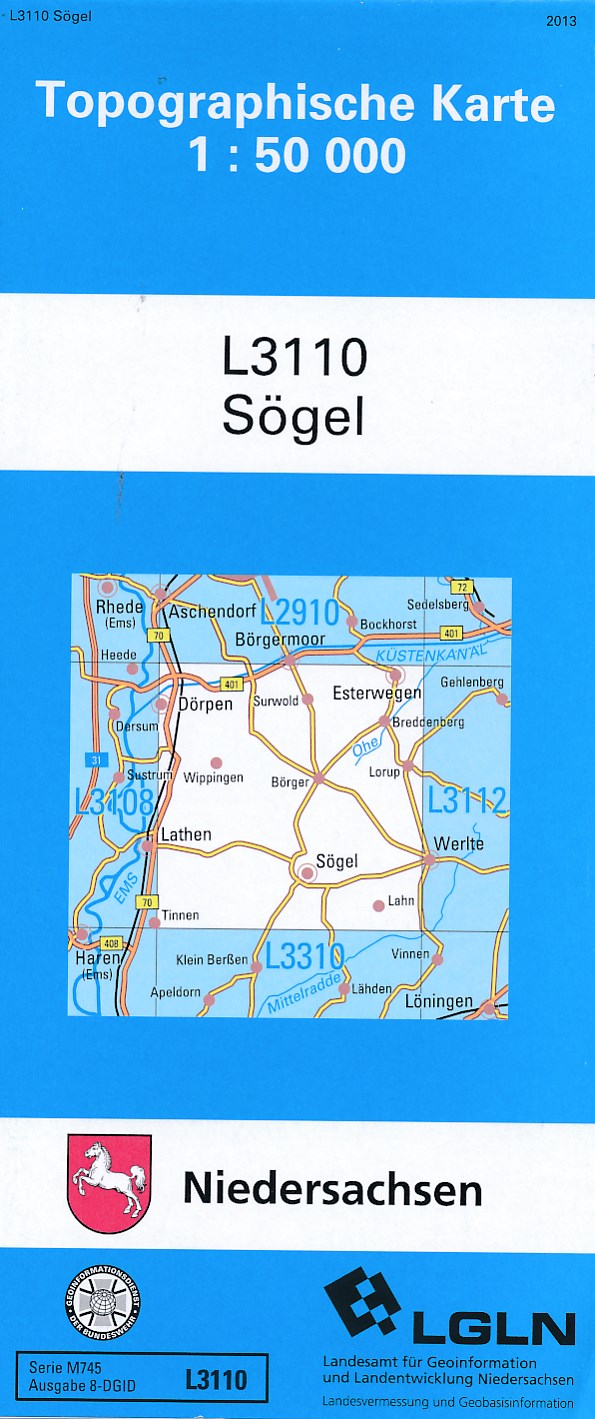
- Topografische kaart L3110 Sögel | LGL Niedersachsen
- Topografische kaart van een deelgebied van Niedersachsen. De kaart kent alle topografische details op een schaal van 1:50.000. Let op: het is een zuiver topografische kaart - zeer geschikt voor veldwerk e.d. - maar laat geen toeristische aspecten zien. Read more
De Zwerver
Netherlands
2021
Netherlands
2021

De Zwerver
Netherlands
Netherlands
- Wandelkaart 63 Eggegebirge (Nordteil) mit Eggeweg, E1, Jakobspilgerweg | GeoMap
- Topographische Wanderkarte für den nördlichen Teil des Eggegebirges mit Eggeweg, E1, Jakobspilgerweg. 4. Auflage. Read more
De Zwerver
Netherlands
2022
Netherlands
2022
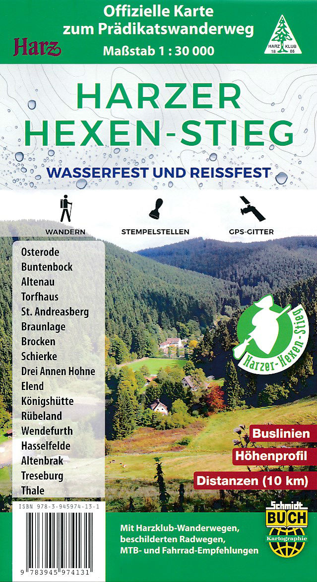
- Wandelkaart Harzer Hexen - Stieg | Schmidt Buch Verlag
- Scheur- en watervast wandelkaart van de Harzer Hexen stieg, het beroemde lange afstands wandelpad door de Harz, Met een schaal van 1:30.000 voor de hele route is de kaart bijzonder gedetailleerd, Op de kaart staat alle noodzakelijke informatie en heel veel meer, met veel extra symbolen worden naast de gewone kaartgegevens ook toeristische zaken... Read more
More maps…