
Ontario
Description
Map

Trails in this state
- Avon TrailGPX
- Bruce TrailGPX
- Cataraqui Trail
- Central Ontario Loop Trail
- Chrysler Canada Greenway
- Elgin Hiking Trail
- Elora Cataract TrailwayGPX
- Ganaraska Hiking TrailGPX
- Grand Valley TrailGPX
- Greater Niagara Circle Route
- La Cloche Silhouette TrailGPX
- National Hiking Trail of Canada
- Niagara River Recreation Trail
- Oak Ridges TrailGPX
- Ottowa-Temiskaming Highland Trail
- Park to Park TrailGPX
- Rideau TrailGPX
- Thames Valley TrailGPX
- Trans Canada TrailGPX
- Voyageur Trail
- Waterfront TrailGPX
- Welland Canals Trail
Links
Facts
Reports
Guides and maps
Lodging
Organisations
Tour operators
GPS
Other
Books

Stanfords
United Kingdom
United Kingdom
- DK Eyewitness Travel Guide Canada
- DK Eyewitness travel guides: award-winning guidebooksDiscover Canada with this essential travel guide, designed to help you create your own unique trip and to transport you to this incredible country before you`ve even packed your case - marvel at the magnificent thundering waterfalls of Niagara Falls, hike through spectacular scenery in Banff... Read more


The Book Depository
United Kingdom
United Kingdom
- The Best of The Great Trail -- Volume 1
- Newfoundland to Southern Ontario on the Trans Canada Trail Read more

The Book Depository
United Kingdom
United Kingdom
- The Best of The Great Trail
- British Columbia to Northern Ontario on the Trans Canada Trail Read more


The Book Depository
United Kingdom
United Kingdom
- The Great Himalaya Trail N3
- The Rara, Jumla & Mugu Section Read more

Bol.com
Netherlands
Netherlands
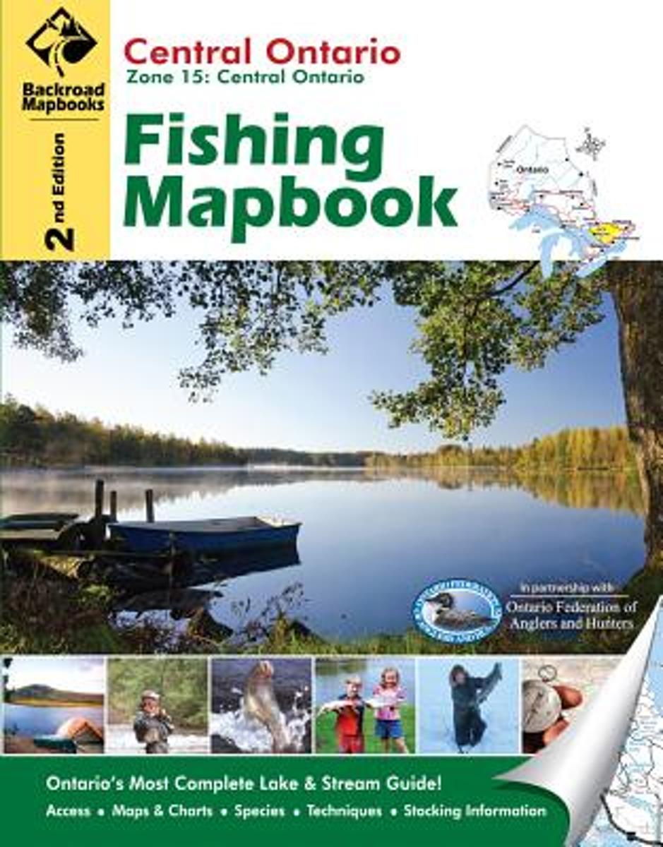
- Central Ontario
- This book covers the scenic central part of Ontario. The city of Barrie north along Georgian Bay to the French River frames the area's western edge, while the Ottawa River from the town of Arnprior north to Deux Rivieres makes the eastern edge. Haliburton, Huntsville, Parry Sound and Barry's Bay are just a few of the prominent cities or towns... Read more
- Also available from:
- Bol.com, Belgium
Bol.com
Belgium
Belgium
- Central Ontario
- This book covers the scenic central part of Ontario. The city of Barrie north along Georgian Bay to the French River frames the area's western edge, while the Ottawa River from the town of Arnprior north to Deux Rivieres makes the eastern edge. Haliburton, Huntsville, Parry Sound and Barry's Bay are just a few of the prominent cities or towns... Read more

Bol.com
Netherlands
Netherlands
- Horses - For Kids - Amazing Animal Books for Young Readers
- Bestselling author John Davidson presents ''Horses - For Kids Amazing Animal Books For Young Readers''. Beautiful Pictures and easy reading format will help children fall in love with horses. This is one of over 30 books in the Amazing Animal Books for Young Readers Series. http://AmazingAnimalBooks.com The series is known as one of the most... Read more
- Also available from:
- Bol.com, Belgium
Bol.com
Belgium
Belgium
- Horses - For Kids - Amazing Animal Books for Young Readers
- Bestselling author John Davidson presents ''Horses - For Kids Amazing Animal Books For Young Readers''. Beautiful Pictures and easy reading format will help children fall in love with horses. This is one of over 30 books in the Amazing Animal Books for Young Readers Series. http://AmazingAnimalBooks.com The series is known as one of the most... Read more
Bol.com
Netherlands
Netherlands
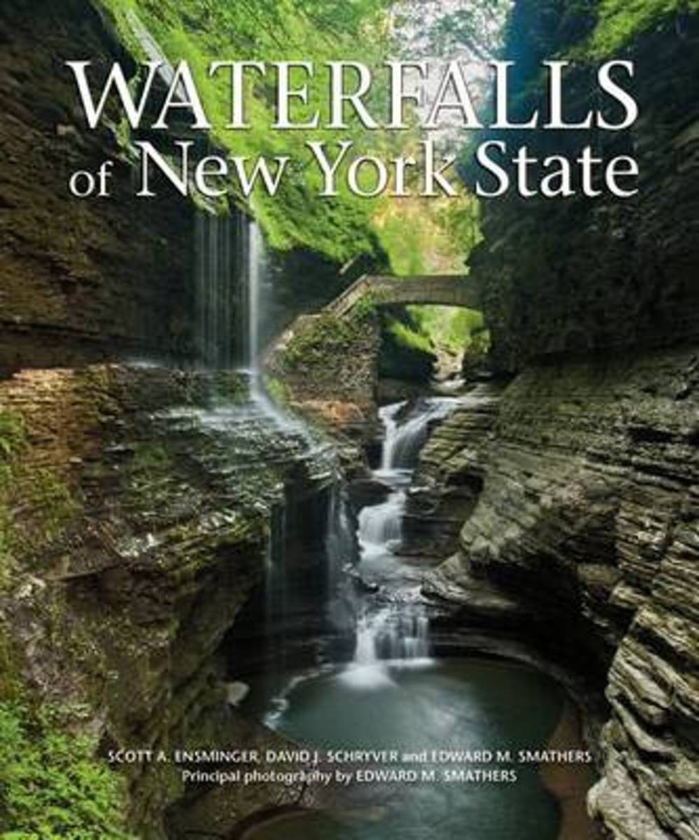
- Waterfalls of New York State
- Features more than 100 scenic waterfall destinations throughout New York State. New York State is home to arguably the most famous waterfall in the world, Niagara Falls. But thanks to its diverse terrain and an abundance of rivers and streams, the state also boasts more than 2,000 other waterfalls. From delicate cascades to thundering... Read more
- Also available from:
- Bol.com, Belgium
Bol.com
Belgium
Belgium
- Waterfalls of New York State
- Features more than 100 scenic waterfall destinations throughout New York State. New York State is home to arguably the most famous waterfall in the world, Niagara Falls. But thanks to its diverse terrain and an abundance of rivers and streams, the state also boasts more than 2,000 other waterfalls. From delicate cascades to thundering... Read more
Bol.com
Netherlands
Netherlands
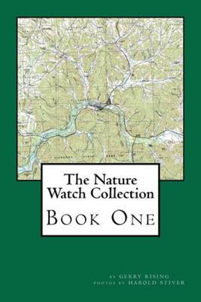
- The Nature Watch Collection
- The publisher is William R. Parks www.wrparks.com The books are printed by CreateSpace. To receive a free catalog via email in a PDF file attachment with sample chapters from our books listed at www.wrparks.com send your request via email to: wparkspublishing@aol.comThis B & W paperback edition is available for $9.95. The color paperback... Read more
- Also available from:
- Bol.com, Belgium
Bol.com
Belgium
Belgium
- The Nature Watch Collection
- The publisher is William R. Parks www.wrparks.com The books are printed by CreateSpace. To receive a free catalog via email in a PDF file attachment with sample chapters from our books listed at www.wrparks.com send your request via email to: wparkspublishing@aol.comThis B & W paperback edition is available for $9.95. The color paperback... Read more
Bol.com
Netherlands
Netherlands
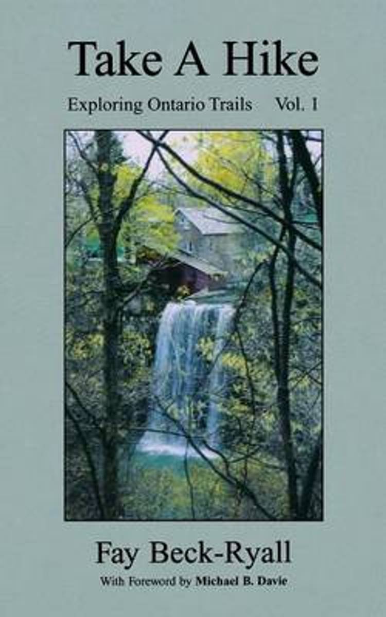
- Take a Hike
- Based on the author's popular hiking column for "The Hamilton Spectator", this book explores trails in and around Ontario's Hamilton-Niagara area and beyond. It is filled with useful advice and tips on taking the trails. It provides directions to each trail, sight-seeing highlights and trail degree of difficulty. Read more
- Also available from:
- Bol.com, Belgium
Bol.com
Belgium
Belgium
- Take a Hike
- Based on the author's popular hiking column for "The Hamilton Spectator", this book explores trails in and around Ontario's Hamilton-Niagara area and beyond. It is filled with useful advice and tips on taking the trails. It provides directions to each trail, sight-seeing highlights and trail degree of difficulty. Read more
Bol.com
Netherlands
Netherlands
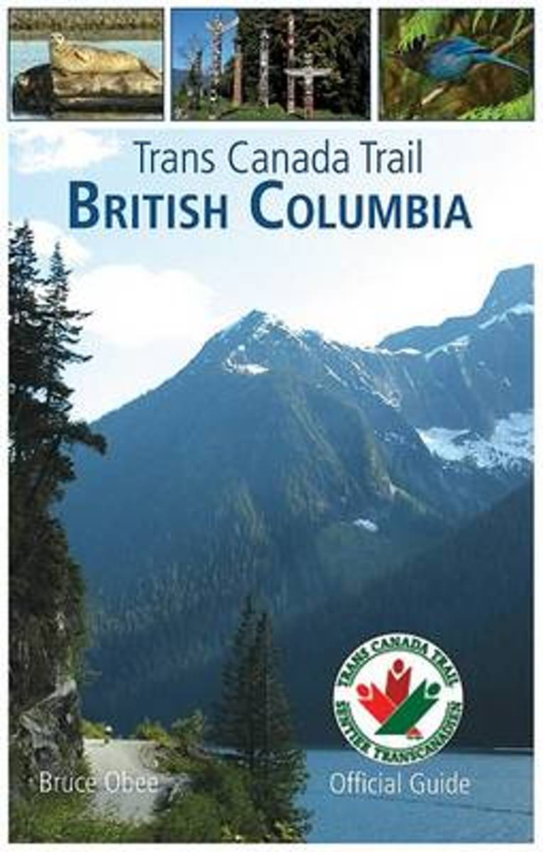
- Trans Canada Trail
- A spectacular journey through the heart of British Columbia. The Trans Canada Trail in southern British Columbia runs from Vancouver Island to the Rockies, weaving more than 1,000 miles through seven mountain ranges. In northern British Columbia, the trail follows the Alaska Highway for 650 miles, from Watson Lake, Yukon, to the British... Read more
- Also available from:
- Bol.com, Belgium
Bol.com
Belgium
Belgium
- Trans Canada Trail
- A spectacular journey through the heart of British Columbia. The Trans Canada Trail in southern British Columbia runs from Vancouver Island to the Rockies, weaving more than 1,000 miles through seven mountain ranges. In northern British Columbia, the trail follows the Alaska Highway for 650 miles, from Watson Lake, Yukon, to the British... Read more

Stanfords
United Kingdom
United Kingdom
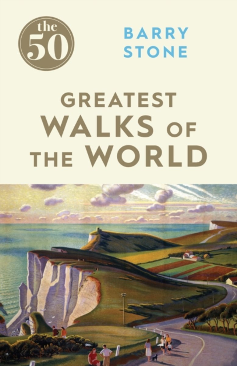
- The 50 Greatest Walks of the World
- Barry Stone, author of 1001 Walks You Must Experience Before You Die, delves into some of the lesser-known aspects of the world`s most famous - and not-quite-famous-yet - trails. The perfect accompaniment to practical guidebooks, Stone relates how slings and carabiners kept him from falling headlong off the Sydney Harbour Bridge, and reports on... Read more
- Also available from:
- Bol.com, Netherlands
- Bol.com, Belgium
Bol.com
Netherlands
Netherlands
- The 50 Greatest Walks of the World
- Barry Stone, author of 1,001 Walks You Must Experience Before You Die, delves into some of the lesser-known aspects of the world's most famous and not-quite-famous-yet trails.The perfect accompaniment to practical guidebooks, Stone relates how slings and carabiners kept him from falling headlong off the Sydney Harbour Bridge, and reports on the... Read more
Bol.com
Belgium
Belgium
- The 50 Greatest Walks of the World
- Barry Stone, author of 1,001 Walks You Must Experience Before You Die, delves into some of the lesser-known aspects of the world's most famous and not-quite-famous-yet trails.The perfect accompaniment to practical guidebooks, Stone relates how slings and carabiners kept him from falling headlong off the Sydney Harbour Bridge, and reports on the... Read more
Bol.com
Netherlands
Netherlands
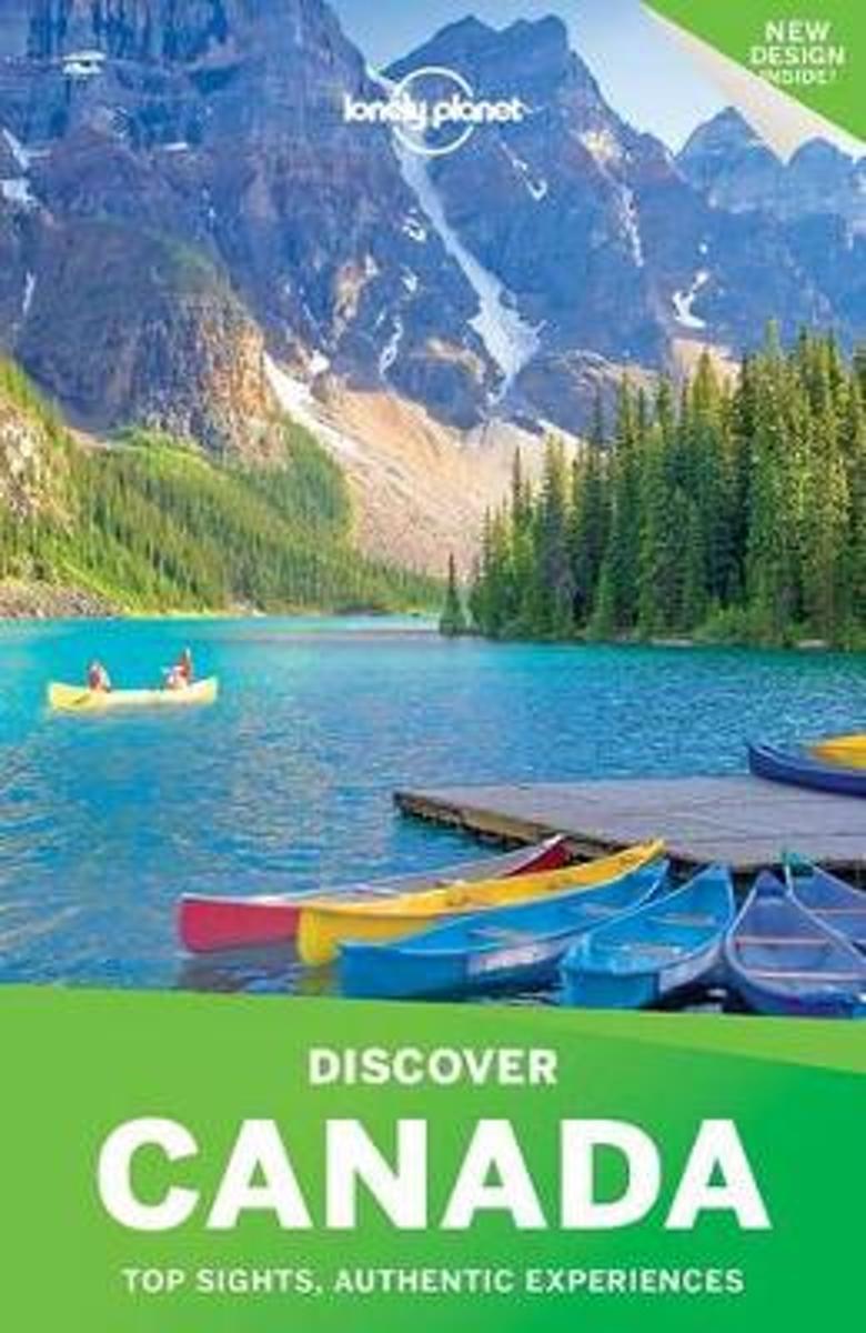
- Discover Canada
- Lonely Planet: The world's leading travel guide publisher Lonely Planet's Discover Canada is your passport to the most relevant, up-to-date advice on what to see and skip, and what hidden discoveries await you. Hit the ski slopes at Whistler, wander Quebec's stunning Old Town, marvel at Niagara Falls, hike in Banff National Park; all with your... Read more
- Also available from:
- Bol.com, Belgium
Bol.com
Belgium
Belgium
- Discover Canada
- Lonely Planet: The world's leading travel guide publisher Lonely Planet's Discover Canada is your passport to the most relevant, up-to-date advice on what to see and skip, and what hidden discoveries await you. Hit the ski slopes at Whistler, wander Quebec's stunning Old Town, marvel at Niagara Falls, hike in Banff National Park; all with your... Read more
Maps

Stanfords
United Kingdom
United Kingdom
- Rolwaling Region Great Himalaya Trail Map SUPERCEDED
- The Rolwaling, map no. 104, at 1:100,000 on a waterproof and tear-resistant trekking map from the Himalayan MapHouse in their series covering the whole of northern Nepal. The map highlights main trekking routes from Jiri, both north and south of the town, including the first sections of the Jiri/Everest and Jiri/Pikey Peak trails, the Numbur... Read more

Stanfords
United Kingdom
United Kingdom
- Mustang Great Himalaya Trail Map
- Mustang, map no. 108, at 1:100,000 on a waterproof and tear-resistant trekking map from the Himalayan MapHouse in their series covering the whole of northern Nepal. The map shows the region north of the upper section of the Annapurna Circuit, beyond Jomsom/Jomosom and Muktinath, and highlights the route to Garphu, the Mustang to Phu trek, the... Read more

Stanfords
United Kingdom
United Kingdom
- Ontario MapArt Pocket Road Atlas
- Pocket road atlas of Ontario presenting the southern part of the province at 1:700,000 with the northern part at 1:1,500,000, plus enlargements showing in greater detail 25 municipal areas and downtown street plans for 21 locations, a map showing Highway Service Centres, etc..The atlas presents the southern part of the province at 1:700,000,... Read more

Stanfords
United Kingdom
United Kingdom
- Solu Khumbu - Everest Region Great Himayala Trail Map
- Solu Khumbu/Everest Region, map no. 103, at 1:100,000 on a waterproof and tear-resistant trekking map from the Himalayan MapHouse in their series covering the whole of northern Nepal. The map highlights main trekking routes from Lukla, both north and south of the town: Everest Base Camp Trek, alternative routes to the Gokyo Lakes, Bhote Koshi... Read more

Stanfords
United Kingdom
United Kingdom
- Manning Park - Skagit River ITMB
- Manning Park - Skagit River at 1:50,000 in a series of topographic survey maps of selected areas of British Columbia and the Canadian Rockies from ITMB with cartography from Canada’s national survey organization. Most sheets are printed on light, waterproof and tear- resistant plastic paper.Whilst the Canadian Department of Natural Resources... Read more

Stanfords
United Kingdom
United Kingdom
- Monastry Circuit Trail
- The Monastery Trail south of Lukla at 1:100,000 in the Nepa Maps series which provides extensive coverage of trekking areas of Nepal on detailed contoured maps with trekking routes and hiking trails, huts and camp sites, local places of interest and other tourist information.The map covers an area from Namche Bazar southwards along the Dudh... Read more

Stanfords
United Kingdom
United Kingdom
- Peterborough - Lindsay
- Double-sided, indexed street plan of Peterborough (Ontario), including Cobourg, Havelock, Lakefield, Lindsay, Millwood, Norwood, and Port Hope. Street plans from the MapArt / Canadian Cartographics Corporation / JDM Géo publishing group are usually produced at scales around 1:25,000 to 1:35,000 with smaller towns often shown at more detailed... Read more

Stanfords
United Kingdom
United Kingdom
- Ontario Southwestern: Brantford - London - Kitchener/Waterloo - Bruce Peninsula
- The south-western part of Ontario on a detailed, double-sided road map at 1:250,000 extending from Lake Erie to Lake Huron and the Bruce Peninsula, with five street plans at 1:25,000 covering central London, Windsor, Sarnia, Owen Sound and Stratford.Coverage of the region is divided between the two sides of the map, with a good overlap between... Read more

Stanfords
United Kingdom
United Kingdom
- Ontario Northern and Cottage Country Street Atlas
- Street atlas of Northern Ontario and Cottage Country, including nBracebridge, Collingwood, Dryden, Elliot Lake, Espanola, Fort Frances, Geraldton, Hanover, Huntsville, Kincardine, Midland, North Bay, Orillia, Owen Sound, Penetanguishene, Port Elgin, Sault Ste. Marie, Southampton, Sudbury, Thunder Bay, Timmins, Walkerton, and Wasaga Beach. The... Read more

Stanfords
United Kingdom
United Kingdom
- Manitoba MapArt
- Indexed road map of Manitoba at 1:1,250,000 with an additional panel covering north-west Ontario with Lake Superior, plus Winnipeg and Brandon on more detailed road maps and plans of their downtown areas, and street plans of 10 more local towns. The whole province is shown at 1:1,250,000 on one side of the map. Topography is indicated by... Read more

Stanfords
United Kingdom
United Kingdom
- Kanchenjunga Region Great Himalaya Trail Map
- Kanchenjunga Region, map no. 101, at 1:100,000 on a waterproof and tear-resistant trekking map from the Himalayan MapHouse in their series covering the whole of northern Nepal. The map highlights main trekking routes from Taplejung, including Kanchenjunga Base Camp Trek, Yalung Base Camp Trek, Phathibhara Trek, the route along the Yangma Khola... Read more

Stanfords
United Kingdom
United Kingdom
- Ontario Western Street Atlas
- Street atlas of Western Ontario, inclding Amherstburg, Aylmer, Ayr, Belle River, Belmont, Blenheim, Blue Mountain, Brant, Brantford, and other locations. The atlas is part of an extensive coverage of Canadian cities and towns from the country’s largest map publisher, MapArt. The mapping is usually at 1:25,000 or 1:31,250. Colouring... Read more

Stanfords
United Kingdom
United Kingdom
- Ontario Northern FastTrack Map: North Bay - Sudbury - Thunder Bay - Lake of the Woods
- Waterproof and tear-resistant FastTrack map covering in a handy-size format the north-western part of Ontario, from North Bay and the border with Quebec to the province’s border with Manitoba, plus eight street maps of main cities and a distance table.On one side two panels present road maps. The main map at 1:1,930,000 covers the area from... Read more

Stanfords
United Kingdom
United Kingdom
- Rolwaling Region Great Himalaya Trail Map
- The Rolwaling, map no. 104, at 1:100,000 on a waterproof and tear-resistant trekking map from the Himalayan MapHouse in their series covering the whole of northern Nepal. The map highlights main trekking routes from Jiri, both north and south of the town, including the first sections of the Jiri/Everest and Jiri/Pikey Peak trails, the Numbur... Read more

Stanfords
United Kingdom
United Kingdom
- Niagara Region (Canada) FastTrack Map
- The Canadian side of the Niagara Falls region on an indexed, double-sided, waterproof and tear-resistant FastTrack map presenting the region on four panels. On one side are street plans of central Niagara Falls, including the border crossings and the adjoining part of the US side, plus Niagara-on-the-Lake (both at1:25,000). The downtown area of... Read more