
New York
Description
New York state has quite a few long distance trails and some true wilderness expanses in the mountainous Adirondack Park, with its High Peaks Wilderness.
The Appalachian Trail runs for 94 miles through the state, not far from the city of New York. The North Country Trail has 520 miles in the state, starting in the Adirondack Park. The East Coast Greenway, Eastern Continental Trail and Great Eastern Trail all pass New York.
Interesting is the Finger Lakes Trail System in New York, 562 miles of hiking trails. The 133 mile Northville-Pacid trail (in the Adirondacks) is confined to this state. New Jersey and New York both have a part of the 326 mile Long Path. The Highlands Trail is under construction.
Map

Trails in this state
Links
Facts
Reports
Guides and maps
Lodging
Organisations
Tour operators
GPS
Other
Books

Stanfords
United Kingdom
United Kingdom
- Rick Steves Pocket Munich & Salzburg (Second Edition)
- Make the most of every day and every dollar with Rick Steves! This colorful, compact guidebook is perfect for spending a week or less in Munich and Salzburg: City walks and tours: Five detailed self-guided walks including a Munich city walk, Nymphenburg Palace tour, Sound of Music tour, and more Rick`s strategic advice on what`s worth your time... Read more

Stanfords
United Kingdom
United Kingdom
- DK Eyewitness Germany
- Discover Germany - a haven for art aficionados and outdoor enthusiasts alike.Whether you want to hike the Bavarian Alps, discover health resorts and beautiful beaches on the Baltic coast, or seek out the coolest districts in Berlin, your DK Eyewitness travel guide makes sure you experience all that Germany has to offer.Synonymous with art and... Read more

Stanfords
United Kingdom
United Kingdom
- DK Eyewitness Travel Guide Cambodia and Laos
- Admire Siem Reap`s awe-inspiring Angkor Wat, sample French-Lao cuisine at Luang Prabang`s waterfront restaurants or take a boat down the Mekong and stop off at the stunning islands of Si Phan Don. This DK Eyewitness Guide covers the all the must-see sights and hidden backstreets, so you won`t miss a thing.- See Cambodia and Laos from a... Read more

Stanfords
United Kingdom
United Kingdom
- Rick Steves Pocket Athens (Third Edition)
- Make the most of every day and every dollar with Rick Steves! This colorful, compact guidebook is perfect for spending a week or less in Athens: *City walks and tours: Six detailed tours and walks showcase Athens`s essential sights, including the Acropolis, a tour of the Ancient Agora, the National Archaeological Museum, and more *Rick`s... Read more

Stanfords
United Kingdom
United Kingdom
- DK Eyewitness New England
- Discover New England - a region synonymous with fall foliage, seafood and historic sitesWhether you want to explore the rugged natural beauty of the Appalachian Mountains, follow the fascinating Freedom Trail through Boston, or indulge in fresh lobster from the coast of Cape Cod, your DK Eyewitness travel guide makes sure you experience all New... Read more

Stanfords
United Kingdom
2021
United Kingdom
2021
- DK Eyewitness Florence and Tuscany
- Divine cuisine and spectacular art await in Florence and TuscanyWhether you want to sample delicious Tuscan food and wine, gaze at the iconic Leaning Tower of Pisa or browse eclectic markets in Florence, your DK Eyewitness travel guide makes sure you experience all that this region has to offer.The birthplace of the Renaissance, Florence is... Read more

Stanfords
United Kingdom
United Kingdom
- DK Eyewitness Travel Guide London
- Find your corner of London with this essential travel guide to this great city, designed to help you create your own unique trip and to transport you there before you`ve even packed your case - step back in time at the Tower of London and the British Museum, get a bird`s eye view of London from the Shard, or relax in Hyde Park. The DK... Read more

Stanfords
United Kingdom
United Kingdom
- DK Eyewitness California
- Dreamin` of California?Whether you want to hike to the waterfalls in Yosemite National Park, tour a winery in Napa or ride a classic cable car in San Francisco, your DK Eyewitness travel guide makes sure you experience all that California has to offer.California`s dramatic landscape has inspired generations of artists and explorers - from... Read more

Stanfords
United Kingdom
2019
United Kingdom
2019
- DK Eyewitness Travel Guide Caribbean
- Take in the dizzying views from the top of Jamaica`s Blue Mountains, stroll the cobbled colonial plazas of Habana Vieja, or marvel at the majesty of St. Lucia`s volcanic spires - DK Eyewitness Travel Guide Caribbean covers the must-see sights and idyllic islands, so you won`t miss a thing.- Gorgeous, all-new colour photography so you can... Read more

Stanfords
United Kingdom
2021
United Kingdom
2021
- DK Eyewitness France
- Discover France`s special je ne sais quoiWhether you want to visit fairytale chateaux, stroll amid rolling fields of blossoming lavender or learn what makes a noble vintage, your DK Eyewitness travel guide makes sure you experience all that France has to offer.Few countries capture the imagination quite like France. The world-famous cuisine is... Read more

Stanfords
United Kingdom
United Kingdom
- Insight Guides Great Breaks Edinburgh
- Pocket-sized travel guides making the most of the British Isles through clearly laid-out walks and tours. Now with free eBook.Explore the best of Edinburgh with this indispensably practical Insight Great Breaks Guide. From making sure you don`t miss out on must-see attractions like Edinburgh Castle, the Scottish National Gallery, the Royal... Read more
Stanfords
United Kingdom
United Kingdom
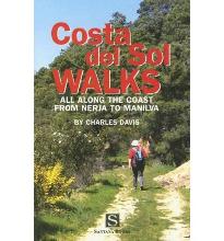
- Costa Del Sol Walks
- Full-color guide to thirty-four walks all within a short distance from the coast, from Nerja to Manilva. With easy-to-follow route notes, full-color maps and clear instructions on how to get to the start of each walk. Read more

Stanfords
United Kingdom
United Kingdom
- DK Eyewitness Northern Spain
- Your journey starts here. Featuring DK`s much-loved maps and illustrations, walks and information, plus all new, full-colour photography, this 100% updated guide to Northern Spain brings you the best of this stunning Spanish region in a brand-new, lightweight format. What`s inside? - full-colour photography, hand-drawn illustrations, and maps... Read more

Stanfords
United Kingdom
2013
United Kingdom
2013
- Malta, Gozo and Comino Sunflower Landscape Guide
- Malta, Gozo and Comino is the Sunflower Landscapes guide to exploring the best walking and touring possibilities on each island. The guide covers a range of routes including walks on each of the islands. A double-sided, fold-out touring map of Malta gives an overview of the island, basic street outlines of Victoria and Comino and the locations... Read more

Stanfords
United Kingdom
United Kingdom
- DK Eyewitness USA
- Spectacular scenery, vibrant cities and captivating culture - welcome to the USA.Whether you want to hike in breathtaking Yosemite National Park, take a road trip from coast to coast or sample southern soul food in the Deep South, your DK Eyewitness travel guide makes sure you experience all that the USA has to offer.Dramatic and diverse, the... Read more
Maps

Stanfords
United Kingdom
United Kingdom
- Damodar Himal
- Damodar Himal, sheet no. 2884-01, in the topographic survey of Nepal at 1:50,000 published by the Nepali Government in the late 1990s and early 2000s and produced from remote sensing data by Finnish cartographers as part of that country’s international aid program. The maps cover 15’ x 15’ quadrangles.IMPORTANT – PLEASE NOTE BEFORE ORDERING:... Read more
Stanfords
United Kingdom
United Kingdom
- Tilicho
- Tilicho, sheet no. 2883-08, in the topographic survey of Nepal at 1:50,000 published by the Nepali Government in the late 1990s and early 2000s and produced from remote sensing data by Finnish cartographers as part of that country’s international aid program. The maps cover 15’ x 15’ quadrangles.IMPORTANT – PLEASE NOTE BEFORE ORDERING:... Read more
Stanfords
United Kingdom
United Kingdom
- Hatiya
- Hariya, sheet no. 2787-06, in the topographic survey of Nepal at 1:50,000 published by the Nepali Government in the late 1990s and early 2000s and produced from remote sensing data by Finnish cartographers as part of that country’s international aid program. The maps cover 15’ x 15’ quadrangles.IMPORTANT – PLEASE NOTE BEFORE ORDERING:... Read more

Stanfords
United Kingdom
United Kingdom
- Europe High 5 Edition Camping Atlas
- The first physical atlas with direct access to useful additional information from the InternetThe entirety of Europe on 432 pages in a scale of 1:800,000 clearly presented, including lots more travel information:- Road Companion (roadmaps) in a scale of 1:800,000, inclusive of the High 5 - Edition app technology for calling up additional travel... Read more
Stanfords
United Kingdom
United Kingdom
- Lamsun
- Lamsun, sheet no. 2883-06, in the topographic survey of Nepal at 1:50,000 published by the Nepali Government in the late 1990s and early 2000s and produced from remote sensing data by Finnish cartographers as part of that country’s international aid program. The maps cover 15’ x 15’ quadrangles.IMPORTANT – PLEASE NOTE BEFORE ORDERING:... Read more
Stanfords
United Kingdom
United Kingdom
- Namche Bazar
- Namche Bazar, sheet no. 2786-03, in the topographic survey of Nepal at 1:50,000 published by the Nepali Government in the late 1990s and early 2000s and produced from remote sensing data by Finnish cartographers as part of that country’s international aid program. The maps cover 15’ x 15’ quadrangles.IMPORTANT – PLEASE NOTE BEFORE ORDERING:... Read more
Stanfords
United Kingdom
United Kingdom
- Talkot
- Talkot, sheet no. 2981-06, in the topographic survey of Nepal at 1:50,000 published by the Nepali Government in the late 1990s and early 2000s and produced from remote sensing data by Finnish cartographers as part of that country’s international aid program. The maps cover 15’ x 15’ quadrangles.IMPORTANT – PLEASE NOTE BEFORE ORDERING:... Read more
Stanfords
United Kingdom
United Kingdom
- Sarmi
- Sarmi, sheet no. 2982-14, in the topographic survey of Nepal at 1:50,000 published by the Nepali Government in the late 1990s and early 2000s and produced from remote sensing data by Finnish cartographers as part of that country’s international aid program. The maps cover 15’ x 15’ quadrangles.IMPORTANT – PLEASE NOTE BEFORE ORDERING:... Read more
Stanfords
United Kingdom
United Kingdom
- Dadapakhar
- Dadapakhar, sheet no. 2785-08, in the topographic survey of Nepal at 1:50,000 published by the Nepali Government in the late 1990s and early 2000s and produced from remote sensing data by Finnish cartographers as part of that country’s international aid program. The maps cover 15’ x 15’ quadrangles.IMPORTANT – PLEASE NOTE BEFORE ORDERING:... Read more
Stanfords
United Kingdom
United Kingdom
- Nepal/India Border: Latitude 27°15’ - 27°30’
- The quadrangle on the Nepal/India border latitude 27°15’ - 27°30’, sheet no. 2788-09, in the topographic survey of Nepal at 1:50,000 published by the Nepali Government in the late 1990s and early 2000s and produced from remote sensing data by Finnish cartographers as part of that country’s international aid program. The maps cover 15’ x 15’... Read more
Stanfords
United Kingdom
United Kingdom
- Nanikot
- Nanikot, sheet no. 2981-11, in the topographic survey of Nepal at 1:50,000 published by the Nepali Government in the late 1990s and early 2000s and produced from remote sensing data by Finnish cartographers as part of that country’s international aid program. The maps cover 15’ x 15’ quadrangles.IMPORTANT – PLEASE NOTE BEFORE ORDERING:... Read more
Stanfords
United Kingdom
United Kingdom
- Kimathanka
- Kimathanka, sheet no. 2787-02, in the topographic survey of Nepal at 1:50,000 published by the Nepali Government in the late 1990s and early 2000s and produced from remote sensing data by Finnish cartographers as part of that country’s international aid program. The maps cover 15’ x 15’ quadrangles.IMPORTANT – PLEASE NOTE BEFORE ORDERING:... Read more

Stanfords
United Kingdom
United Kingdom
- World Maps International Political Wall Map X-LARGE MAGNETIC-BOARD FRAMED
- Framed, 198 x 122cm (6ft 6’’ x 4ft approx.) version of the extra large political map of the world from Maps International mounted on *magnetic board* to which magnetic makers can be attached. Countries are shown in bright vivid colours against light blue oceans. Country names are in large, clearly legible print. English versions of all city... Read more
Stanfords
United Kingdom
United Kingdom
- Simi
- Simi, sheet no. 2884-11, in the topographic survey of Nepal at 1:50,000 published by the Nepali Government in the late 1990s and early 2000s and produced from remote sensing data by Finnish cartographers as part of that country’s international aid program. The maps cover 15’ x 15’ quadrangles.IMPORTANT – PLEASE NOTE BEFORE ORDERING:... Read more
Stanfords
United Kingdom
United Kingdom
- Muktinath
- Koban, sheet no. 2883-07, in the topographic survey of Nepal at 1:50,000 published by the Nepali Government in the late 1990s and early 2000s and produced from remote sensing data by Finnish cartographers as part of that country’s international aid program. The maps cover 15’ x 15’ quadrangles.IMPORTANT – PLEASE NOTE BEFORE ORDERING:... Read more