
Victoria
Description
Victoria in the south east of Australia has an attractive coastline as well as mountain ranges in the eastern end. Victoria hosts the popular Victorian Alps and Mount Bogong. The Australian Alps Walking Track offer a tough opportunity to explore all the ranges, into New South Wales.
Along the coastline several trails will keep you busy, including the Great South West Walk, the Great Ocean Walk, the Wilsons Promontory Circuits and the Croajingalong Wilderness Coast Walk.
The large city of Melbourne - 70% of Victoria's population - is the start of the 270 km long Great Dividing Trail.
Map

Trails in this state
- Australian Alps Walking TrackGPX
- Bicentennial National TrailGPX
- Bogong High Plains Circuit
- Croajingolong Wilderness Coast Walk
- East Gippsland Rail Trail
- Grampians Wild Walk
- Great Dividing TrailGPX
- Great Ocean WalkGPX
- Great South West WalkGPX
- McMillans Track
- Wilsons Promontory Northern Circuit
- Wilsons Promontory Southern CircuitGPX
Links
Facts
Reports
Guides and maps
Lodging
Organisations
Tour operators
GPS
Other
Books

Stanfords
United Kingdom
United Kingdom
- On a Pedestal: A Trip around Britain`s Statues
- This is a book for people who are interested in statues... and for people who aren`t. It explores those immortalised in marble and bronze - and what the rest of us think about them. As Roger Lytollis travels Britain he encounters a man at Liverpool`s Beatles statue convinced that Rod Stewart was in the Fab Four. In Edinburgh he walks into a row... Read more

Stanfords
United Kingdom
United Kingdom
- 150 Walks in Victoria
- “150 Walks in Victoria” contains 150 walks of varying degrees of difficulty and type, meaning it has at least one walk for every type of hiker.The start of the guide includes detailed sections on what to expect wherever you’re walking, with tips on hiking, the climate in Victoria, the flora and fauna, as well as the landscape itself. As well as... Read more

Stanfords
United Kingdom
United Kingdom
- Hampshire & the New Forest - Kiddiwalks
- A series of twenty short, circular walks especially designed for children. Includes routes at Danebury Hill Fort, Queen Victoria Country Park, Fort Nelson and Basingstoke Common. In colour. Read more

Stanfords
United Kingdom
2013
United Kingdom
2013
- Malta, Gozo and Comino Sunflower Landscape Guide
- Malta, Gozo and Comino is the Sunflower Landscapes guide to exploring the best walking and touring possibilities on each island. The guide covers a range of routes including walks on each of the islands. A double-sided, fold-out touring map of Malta gives an overview of the island, basic street outlines of Victoria and Comino and the locations... Read more

Stanfords
United Kingdom
2021
United Kingdom
2021
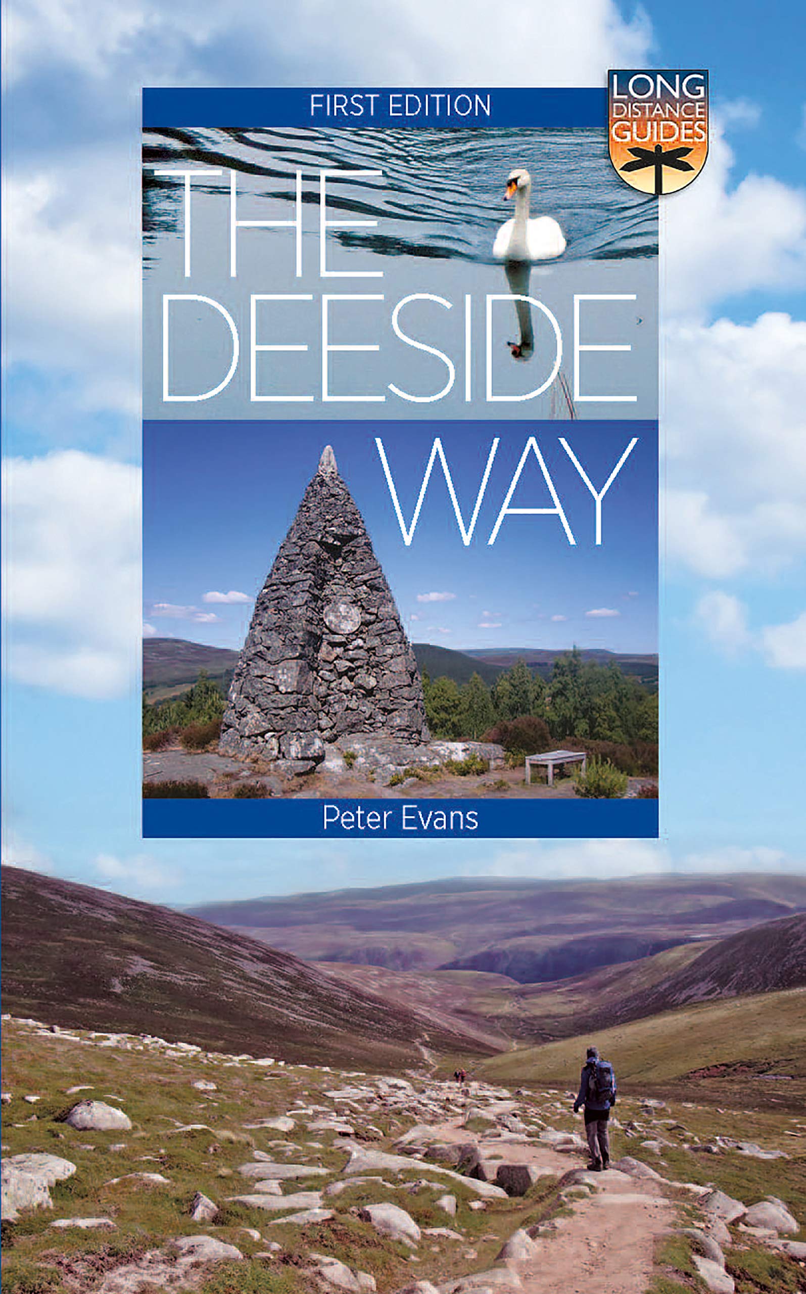
- The Deeside Way: Long Distance Guide
- The Deeside Way is a long-distance path running for 66km (41 miles) from Aberdeen, the oil capital of Europe, to Ballater in Royal Deeside in the Cairngorms National Park. Mainly following the course of old Royal Deeside Railway line, it is suitable for cyclists as well as walkers. There is much to be seen along the Way of scenic beauty,... Read more
- Also available from:
- The Book Depository, United Kingdom
- De Zwerver, Netherlands

De Zwerver
Netherlands
2021
Netherlands
2021
- Wandelgids The Deeside Way | Birlinn
- The Deeside Way is a long-distance path running for 66km (41 miles) from Aberdeen, the oil capital of Europe, to Ballater in Royal Deeside in the Cairngorms National Park. Mainly following the course of old Royal Deeside Railway line, it is suitable for cyclists as well as walkers. There is much to be seen along the Way of scenic beauty,... Read more

Stanfords
United Kingdom
United Kingdom
- Walks with History: Walks through the fascinating historic landscapes of the Yorkshire Dales
- This attractive and cleverly structured guide gives walkers the ten best walks through the fascinating historic landscapes of the Yorkshire Dales National Park in a popular pocketable format.With clear information, an overview and introduction for each walk, expertly written numbered directions, large scale Ordnance Survey maps, superb... Read more
- Also available from:
- The Book Depository, United Kingdom

The Book Depository
United Kingdom
United Kingdom
- Walks with History
- Walks through the fascinating historic landscapes of the Yorkshire Dales Read more
Bol.com
Netherlands
Netherlands
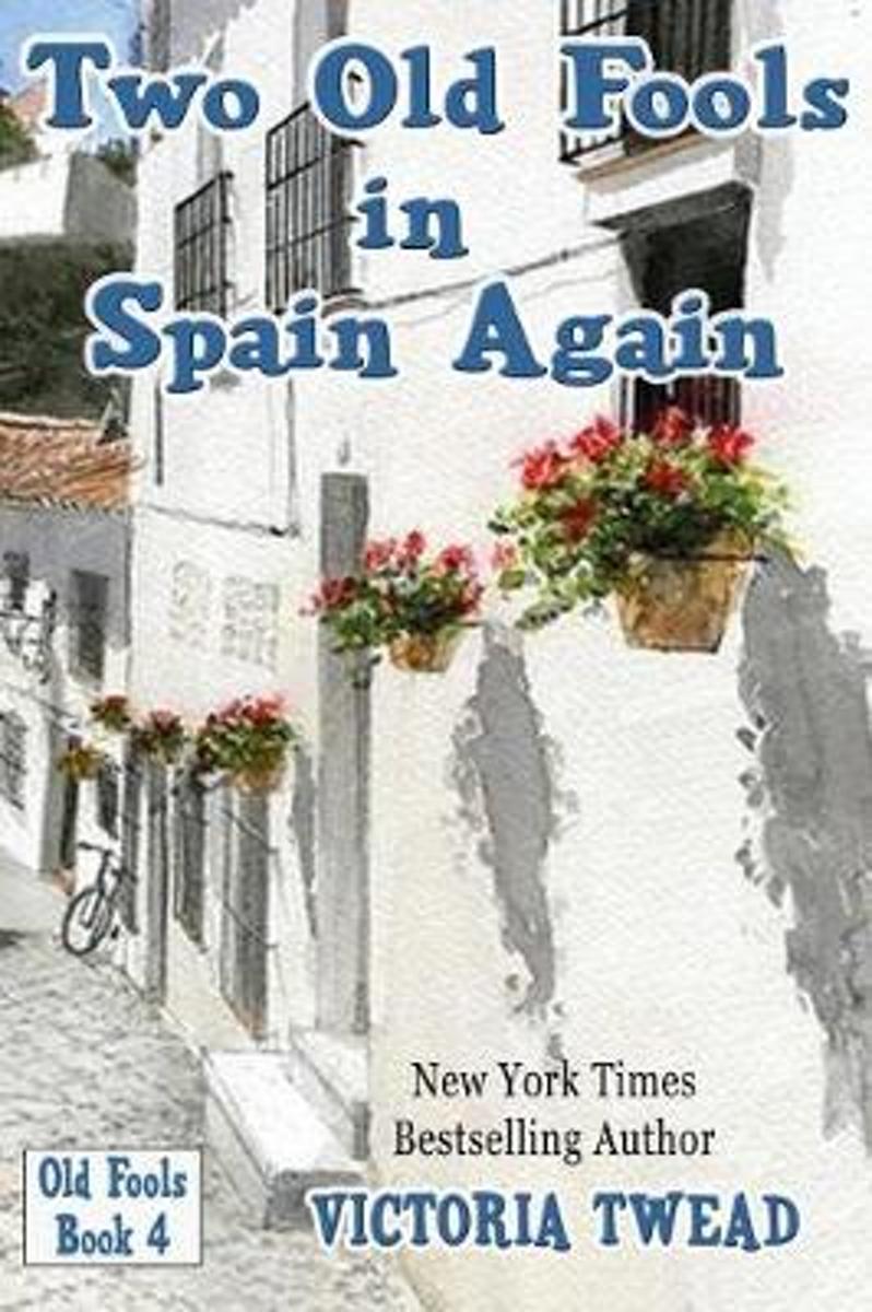
- Two Old Fools in Spain Again
- #4 in the bestselling Old Fools seriesWhen Victoria and Joe return to their Spanish mountain village, they are still reeling from their year in the Middle East. Sighing with relief, they prepare to settle down to a peaceful life with the familiar characters of the village.But life refuses to stand still, even in tiny El Hoyo. Lola Ufarte s... Read more
- Also available from:
- Bol.com, Belgium
Bol.com
Belgium
Belgium
- Two Old Fools in Spain Again
- #4 in the bestselling Old Fools seriesWhen Victoria and Joe return to their Spanish mountain village, they are still reeling from their year in the Middle East. Sighing with relief, they prepare to settle down to a peaceful life with the familiar characters of the village.But life refuses to stand still, even in tiny El Hoyo. Lola Ufarte s... Read more
Bol.com
Netherlands
Netherlands
- San Juan Islands Cruise Guide
- If you are planning to visit the San Juan’s by boat and are wondering where to go, what to expect, and how to get there, this guide is written for you.Written by a boater, and for boaters that are planning to visit the San Juan's and surrounding area. All the parks, resorts, marinas, cities and launching ramps are included with reviews and... Read more
- Also available from:
- Bol.com, Belgium
Bol.com
Belgium
Belgium
- San Juan Islands Cruise Guide
- If you are planning to visit the San Juan’s by boat and are wondering where to go, what to expect, and how to get there, this guide is written for you.Written by a boater, and for boaters that are planning to visit the San Juan's and surrounding area. All the parks, resorts, marinas, cities and launching ramps are included with reviews and... Read more
De Zwerver
Netherlands
2020
Netherlands
2020
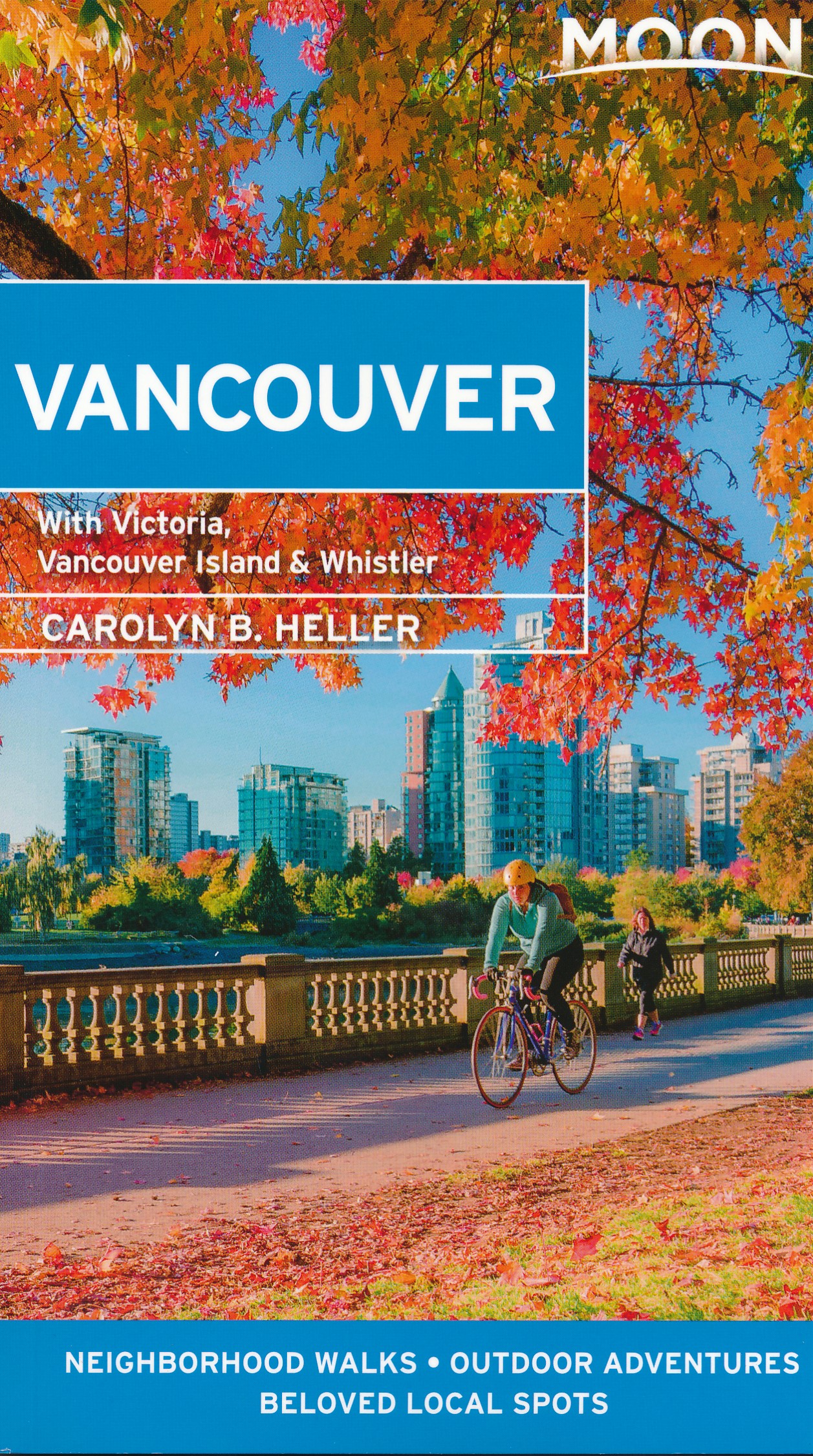
- Reisgids Vancouver | Moon Travel Guides
- Set on the edge of the Pacific and bursting with culture and life, Vancouver is a delight to explore. Immerse yourself in the best of the city with Moon Vancouver.* Explore the City: Navigate by neighbourhood or by activity with colour-coded maps, or follow one of our self-guided neighbourhood walks* See the Sights: Cycle along the coast at... Read more
Bol.com
Netherlands
Netherlands
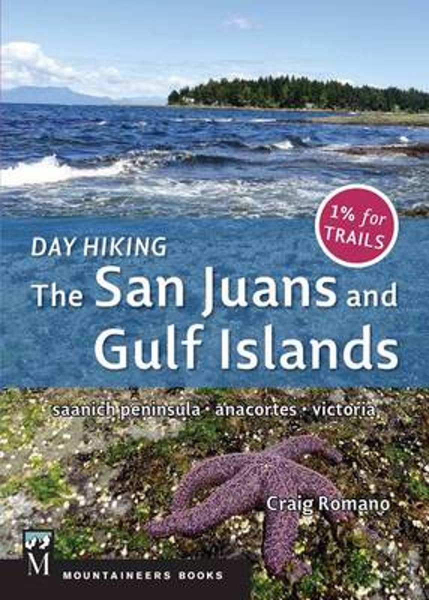
- Day Hiking
- •New volume in Washington's bestselling hiking guidebook series•Packable size filled with maps, elevation profiles, 130 photos, at-a-glance trail selection table, and more from a beloved trails author•1% of sales support trail maintenance in WashingtonAs a hiking destination, the San Juan Islands of Washington and their sister islands to the... Read more
- Also available from:
- Bol.com, Belgium
Bol.com
Belgium
Belgium
- Day Hiking
- •New volume in Washington's bestselling hiking guidebook series•Packable size filled with maps, elevation profiles, 130 photos, at-a-glance trail selection table, and more from a beloved trails author•1% of sales support trail maintenance in WashingtonAs a hiking destination, the San Juan Islands of Washington and their sister islands to the... Read more

Bol.com
Netherlands
Netherlands
- Kanada: Rocky Mountains Rundtour
- In den zwei kanadischen Provinzen British Columbia und Alberta l sst sich noch unber hrte Natur hautnah erleben, wenn man auf Wanderungen, Kanu- und Wildwasserfahrten, beim Jagen und Angeln der faszinierenden Flora und Fauna begegnet. Das Buch gibt eine genaue Darstellung der Provinzen, gegliedert in Geschichte, Geografie und Wirtschaft. In... Read more
- Also available from:
- Bol.com, Belgium
Bol.com
Belgium
Belgium
- Kanada: Rocky Mountains Rundtour
- In den zwei kanadischen Provinzen British Columbia und Alberta l sst sich noch unber hrte Natur hautnah erleben, wenn man auf Wanderungen, Kanu- und Wildwasserfahrten, beim Jagen und Angeln der faszinierenden Flora und Fauna begegnet. Das Buch gibt eine genaue Darstellung der Provinzen, gegliedert in Geschichte, Geografie und Wirtschaft. In... Read more
Bol.com
Netherlands
Netherlands
- Mountain and Prairie
- This scarce antiquarian book is included in our special Legacy Reprint Series. In the interest of creating a more extensive selection of rare historical book reprints, we have chosen to reproduce this title even though it may possibly have occasional imperfections such as missing and blurred pages, missing text, poor pictures, markings, dark... Read more
- Also available from:
- Bol.com, Belgium
Bol.com
Belgium
Belgium
- Mountain and Prairie
- This scarce antiquarian book is included in our special Legacy Reprint Series. In the interest of creating a more extensive selection of rare historical book reprints, we have chosen to reproduce this title even though it may possibly have occasional imperfections such as missing and blurred pages, missing text, poor pictures, markings, dark... Read more
Bol.com
Netherlands
Netherlands
- Tasmania Travel Guide
- Tasmania is the smallest and only island state in Australia with nearly half of its archipelago of 334 islands being protected. Tasmania s national parks and UNESCO World Heritage sites make the state a popular destination for tourists.Overview - Culture - Location & Orientation - Climate & When to Visit - Sightseeing Highlights - Hobart -... Read more
- Also available from:
- Bol.com, Belgium
Bol.com
Belgium
Belgium
- Tasmania Travel Guide
- Tasmania is the smallest and only island state in Australia with nearly half of its archipelago of 334 islands being protected. Tasmania s national parks and UNESCO World Heritage sites make the state a popular destination for tourists.Overview - Culture - Location & Orientation - Climate & When to Visit - Sightseeing Highlights - Hobart -... Read more
Bol.com
Netherlands
Netherlands
- Rick Steves Pocket London, 3rd Edition
- Rick Steves Pocket guidebooks truly are a tour guide in your pocket. This colorful, compact 220-page book includes Rick's advice for prioritizing your time, whether you're spending 1 or 7 days in a city. Everything a busy traveler needs is easy to access: a neighborhood overview, city walks and tours, sights, handy food and accommodations... Read more
- Also available from:
- Bol.com, Belgium
Bol.com
Belgium
Belgium
- Rick Steves Pocket London, 3rd Edition
- Rick Steves Pocket guidebooks truly are a tour guide in your pocket. This colorful, compact 220-page book includes Rick's advice for prioritizing your time, whether you're spending 1 or 7 days in a city. Everything a busy traveler needs is easy to access: a neighborhood overview, city walks and tours, sights, handy food and accommodations... Read more
Maps

Stanfords
United Kingdom
United Kingdom
- British Columbia - Alberta FastTrack
- British Columbia and Alberta, including the Banff and Jasper National Parks, on an indexed, double-sided road map presenting both provinces together at 1:2,000,000, plus more detailed mapping of the region’s main urban areas including Vancouver, Victoria, Calgary, etc.On one side both provinces are shown together at 1:2m with their road network... Read more

Stanfords
United Kingdom
United Kingdom
- British Columbia Pocket Road Atlas
- Pocket road atlas of British Columbia presenting the whole province at 1:1,500,000, plus enlargements for the Vancouver - Fraser Valley and Saanich Peninsula - Cowichan Valley areas, plus five downtown street plans including Vancouver and further 26 municipal maps.Road network, from motorways to selected loose surface and unimproved roads is... Read more

Stanfords
United Kingdom
United Kingdom
- Africa Overland - Cairo to Cape Town ITMB Travel Atlas
- The Cairo to Cape Town Route presented by ITMB in a handy-size A5 paperback atlas with extracts from the publishers’ mapping of the continent at 1:3,400,000, plus 50 additional pages of large city centre street plans of main cities and/or popular locations such as Victoria Falls. Coverage of the countries along the route is indicated on our... Read more

Stanfords
United Kingdom
United Kingdom
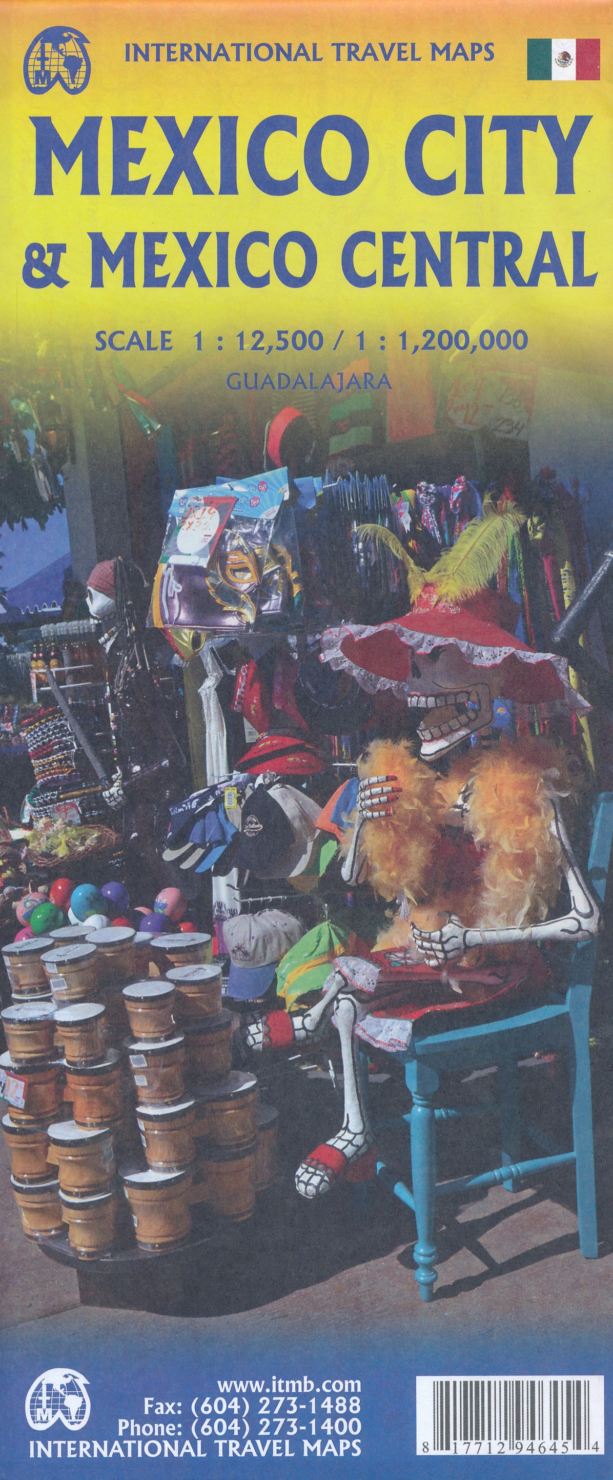
- Mexico Central & Mexico City ITMB
- Indexed road map covering central Mexico, with a large plan of central Mexico City on the reverse. The main map extends from Veracruz in the east to Leon in the west, and from Acapulco in the south to Ciudad Victoria in the north. Altitude tinting represents the general relief with spot heights for major peaks. Swamp areas, reefs and national... Read more
- Also available from:
- De Zwerver, Netherlands
De Zwerver
Netherlands
Netherlands
- Wegenkaart - landkaart Mexico Central & Mexico City | ITMB
- Indexed road map covering central Mexico, with a large plan of central Mexico City on the reverse. The main map extends from Veracruz in the east to Leon in the west, and from Acapulco in the south to Ciudad Victoria in the north. Altitude tinting represents the general relief with spot heights for major peaks. Swamp areas, reefs and national... Read more

Stanfords
United Kingdom
United Kingdom
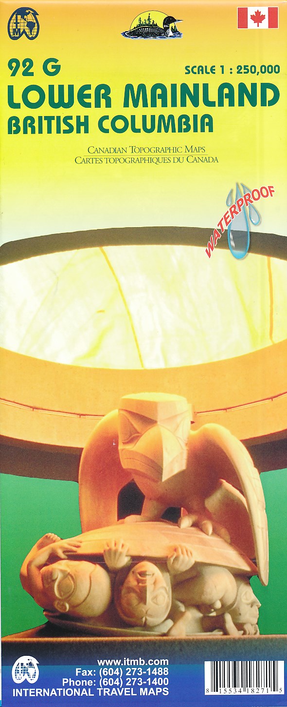
- Lower Mainland - Richmond & New Westminster ITMB
- Lower Mainland - Richmond and New Westminster at 1:250,000 and 1:50,000 in a series of topographic survey maps of selected areas of British Columbia and the Canadian Rockies from ITMB with cartography from Canada’s national survey organization. Most sheets are printed on light, waterproof and tear- resistant plastic paper.Whilst the Canadian... Read more
- Also available from:
- De Zwerver, Netherlands
De Zwerver
Netherlands
Netherlands
- Wegenkaart - landkaart 92G Lower Mainland British Columbia - Richmond and New Westminster | ITMB
- Lower Mainland - Richmond and New Westminster at 1:250,000 and 1:50,000 in a series of topographic survey maps of selected areas of British Columbia and the Canadian Rockies from ITMB with cartography from Canada Read more

Stanfords
United Kingdom
2016
United Kingdom
2016
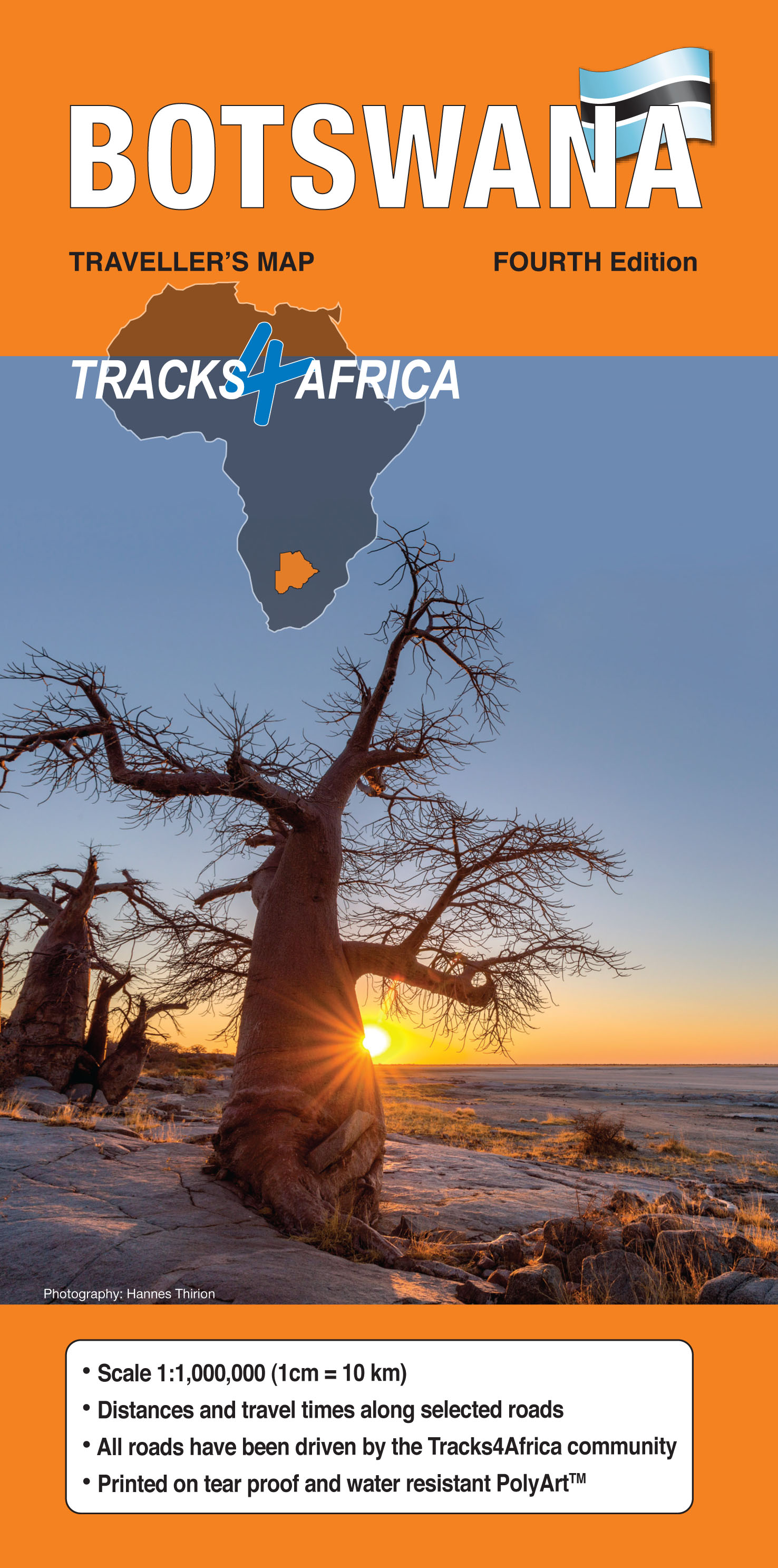
- Botswana Tracks4Africa
- Botswana at 1:1,000,000 on a large, waterproof and tear-resistant map from Tracks4Africa, with roads and tracks showing both driving times and distances, plus on the reverse GPS compatible enlargements of eight most visited protected area and/or towns and extensive advice about driving in Botswana.On one side is a map of the whole country at... Read more
- Also available from:
- De Zwerver, Netherlands
De Zwerver
Netherlands
2016
Netherlands
2016
- Wegenkaart - landkaart Botswana | Tracks4Africa
- Botswana at 1:1,000,000 on a large map from Tracks4Africa: GPS compatible, with roads and tracks showing both driving times and distances, and printed on light, waterproof and tear-resistant plastic paper.On one side is a map of the whole country, including Namibia’s Caprivi Strip, with the easternmost tip including the Tuli Game Reserve as an... Read more

Stanfords
United Kingdom
United Kingdom
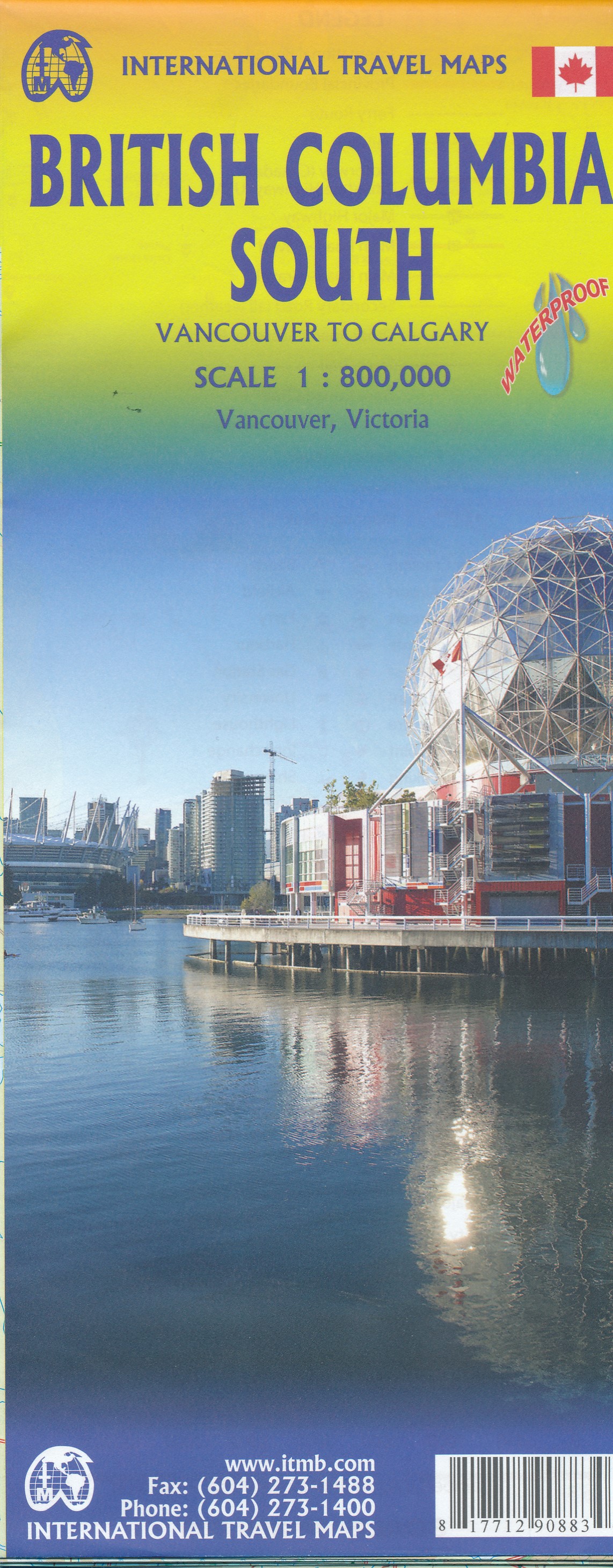
- British Columbia South ITMB
- Indexed double-sided road map at 1:800,000 from ITMB of the southern part of British Columbia, extending from Vancouver Island to Calgary to cover the whole of the Banff and Jasper National Parks, with plans of downtown Vancouver and Victoria. Coverage northwards extends to include the southern part of Haida Gwai (Queen Charlotte) Islands and... Read more
- Also available from:
- De Zwerver, Netherlands
De Zwerver
Netherlands
Netherlands
- Wegenkaart - landkaart British Columbia South (Canada) | ITMB
- Indexed double-sided road map at 1:900,000 from ITMB of the southern part of British Columbia, extending from Vancouver Island to Calgary to cover the whole of the Banff and Jasper National Parks, with plans of downtown Vancouver and Victoria. Coverage northwards extends to include the southern part of Haida Gwai (Queen Charlotte) Islands and... Read more

Stanfords
United Kingdom
United Kingdom
- High Country Victoria - North West Hema Explorer Map
- Part of a series of 4 waterproof maps of the Victorian High Country by Hema at 1:100,000. Read more

Stanfords
United Kingdom
United Kingdom
- British Columbia ITMB Pocket Road Atlas
- 75-page, A5 paperback atlas of British Columbia from the Vancouver based ITMB, with street plans of central Vancouver, Victoria and Whistler Village, plus enlargements for the southern tip of the Vancouver Island, the environs of Vancouver and the recreational area around Whistler.The southern half of the province, including most of the Queen... Read more

Stanfords
United Kingdom
United Kingdom
- Greater Victoria BC MapArt
- Double-sided, indexed street plan of Greater Victoria and the Saanich Peninsula at 1:27,000, with downtown Victoria shown in greater detail at 1:15,000. Coverage includes Colwood, Esquimalt, Langford, Oak Bay and Sidney.Also provided is road map showing the area covered by the street plan with the adjoining part of the Vancouver Island at... Read more

Stanfords
United Kingdom
2018
United Kingdom
2018
- The Great War 1914 - 1918 IGN Map
- Excellent World War I commemorative map from the IGN presenting an overview of the Western Front supported by three more detailed enlargements of the main battlefields including the Somme area, and highlighting 15 special Remembrance Trails, remaining trenches, numerous memorial sites, museums, cemeteries, etc.Prepared by the IGN in... Read more
Stanfords
United Kingdom
United Kingdom
- High Country Victoria - North East Hema Explorer Map
- Part of a series of 4 waterproof maps of the Victorian High Country by Hema at 1:100,000. Read more

Stanfords
United Kingdom
United Kingdom
- Lagos
- Large, indexed street plan Lagos, with more detailed coverage of Ikeja district, Victoria Island and Lagos island. On the main map at 1;35,000 coverage extends from Victoria Island in the south-east to Abule-Egba district in the north-west and thus comfortably includes the international airport. Main roads are named, as are districts, and... Read more

Stanfords
United Kingdom
United Kingdom
- British Columbia - Alberta MapArt
- British Columbia and Alberta, including the Banff and Jasper National Parks, on an indexed, double-sided road map presenting both provinces together at 1:2,000,000, plus more detailed mapping of the region’s main urban areas including Vancouver, Victoria, Calgary, etc.On one side both provinces are shown together at 1:2m with their road network... Read more

Stanfords
United Kingdom
United Kingdom
- Rincon de la Victoria CNIG Topo 1053-4
- Topographic coverage of mainland Spain at 1:25,000 published by the Centro Nacional de Información Geograficá, the country’s civilian survey organization. The maps have contours at 10m intervals and colouring and/or graphics to show different types of vegetation or land use. Boundaries of national parks and other protected areas are marked. In... Read more