
Stanfords
United Kingdom
- Le Perche Parc Naturel Régional à pied FFRP Topo-guide No. PN16
- Le Perche Parc Naturel Régional à pied, FFRP topo-guide Ref. No. PN16, with 20 day walks of varying length and difficulty in the park. Each walk is presented on a separate colour extract from IGN’s topographic survey of France at 1:25,000, with its description cross-referenced to the map. Current edition of this title was published in May... Read more

Stanfords
United Kingdom
- La Brenne Parc Naturel Régional IGN 83309
- Parc Naturel Régional de la Brenne east of Poitiers on a detailed map at 1:60,000 prepared by the IGN in collaboration with the park authorities, the FFRP and various tourist organizations. Current edition of this map was published in summer 2014.The map highlights numerous local and long-distance hiking trails, including specially selected... Read more
Stanfords
United Kingdom
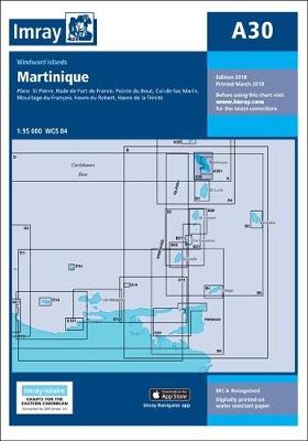
- A30 Martinique
- Plans included:St Pierre (1:20 000)Rade de Fort de France (1:15 000)Pointe du Bout (1:35 000)Cul-de-Sac Marin (1:35 000)Mouillage du François (1:50 000)Havre du Robert (1:45 000)Havre de la Trinité (1:30 000)On this 2018 edition the chart specification has been improved to show coloured light flashes. The plan of Rade de Fort de France has been... Read more

Stanfords
United Kingdom
- Largentiere - Aubenas - Villeneuve-de-Berg IGN 2938SB
- Topographic survey of France at 1:25,000 in IGN`s excellent TOP25 / Série Bleue series. All the maps are GPS compatible, with a 1km UTM grid plus latitude and longitude lines at 5’ intervals. Contours are at 5m intervals except for mountainous areas where the maps have contours at 10m intervals, vividly enhanced by hill shading and graphics for... Read more

Stanfords
United Kingdom

Stanfords
United Kingdom
- World War I Macedonian Front: Lake Dorjan
- Lake Dorjan, one of two maps covering the site of the Battle of Doiran between British and Greek troops against Bulgarian forces on the Macedonian Front during World War I. Both maps are reproductions by G.H. Smith & Son of the original British Army trench maps at approximately 7/10th of the original scale quoted against each title.This title,... Read more

Stanfords
United Kingdom

Stanfords
United Kingdom
- Forêt de Fontainebleau - Forêt des Trois Pignons IGN 2417OT
- Topographic survey of France at 1:25,000 in IGN`s excellent TOP25 / Série Bleue series. All the maps are GPS compatible, with a 1km UTM grid plus latitude and longitude lines at 5’ intervals. Contours are at 5m intervals except for mountainous areas where the maps have contours at 10m intervals, vividly enhanced by hill shading and graphics for... Read more

Stanfords
United Kingdom
- Ile d`Oleron - Ile d`Aix IGN 1330OT
- Topographic survey of France at 1:25,000 in IGN`s excellent TOP25 / Série Bleue series. All the maps are GPS compatible, with a 1km UTM grid plus latitude and longitude lines at 5’ intervals. Contours are at 5m intervals except for mountainous areas where the maps have contours at 10m intervals, vividly enhanced by hill shading and graphics for... Read more

Stanfords
United Kingdom
- Fecamp - Saint-Valery-en-Caux - Cote d`Albatre IGN 1809OT
- Topographic survey of France at 1:25,000 in IGN`s excellent TOP25 / Série Bleue series. All the maps are GPS compatible, with a 1km UTM grid plus latitude and longitude lines at 5’ intervals. Contours are at 5m intervals except for mountainous areas where the maps have contours at 10m intervals, vividly enhanced by hill shading and graphics for... Read more

Stanfords
United Kingdom
- Quimper - Concarneau - Iles de Glenan IGN 0519ET
- Topographic survey of France at 1:25,000 in IGN`s excellent TOP25 / Série Bleue series. All the maps are GPS compatible, with a 1km UTM grid plus latitude and longitude lines at 5’ intervals. Contours are at 5m intervals except for mountainous areas where the maps have contours at 10m intervals, vividly enhanced by hill shading and graphics for... Read more

Stanfords
United Kingdom
- Poitiers - Chauvigny IGN 1827SB
- Topographic survey of France at 1:25,000 in IGN`s excellent TOP25 / Série Bleue series. All the maps are GPS compatible, with a 1km UTM grid plus latitude and longitude lines at 5’ intervals. Contours are at 5m intervals except for mountainous areas where the maps have contours at 10m intervals, vividly enhanced by hill shading and graphics for... Read more

Stanfords
United Kingdom
- La Clusaz - Grand Bornand IGN 3430ET
- Topographic survey of France at 1:25,000 in IGN`s excellent TOP25 / Série Bleue series. All the maps are GPS compatible, with a 1km UTM grid plus latitude and longitude lines at 5’ intervals. Contours are at 5m intervals except for mountainous areas where the maps have contours at 10m intervals, vividly enhanced by hill shading and graphics for... Read more

Stanfords
United Kingdom
- Castellane - Lac de Castillon - PNR du Verdon IGN 3542OT
- Topographic survey of France at 1:25,000 in IGN`s excellent TOP25 / Série Bleue series. All the maps are GPS compatible, with a 1km UTM grid plus latitude and longitude lines at 5’ intervals. Contours are at 5m intervals except for mountainous areas where the maps have contours at 10m intervals, vividly enhanced by hill shading and graphics for... Read more

Stanfords
United Kingdom