The south-eastern part of the Dinara - Troglav mountain range on the border of southern Croatia and Bosnia-Herzegovina on a contoured and GPS compatible map at 1:25,000 from the Croatian Mountain Rescue Service. Coverage extends southwards from the peak of Troglav to Maljkovo near the Perucko Lake.Contours at 10m intervals enhanced by relief...Read more
The island of Brac on the Adriatic coast of Croatia on a contoured and GPS compatible map at 1:25,000 from the Croatian Mountain Rescue Service, highlighting recommended cycling routes, with 26 routes profiles. The island is shown on both sides of the map with similar cartography (contours at 10m intervals enhanced by relief shading to provide...Read more
The north-western part of the Dinara - Troglav mountain range on the border of southern Croatia and Bosnia-Herzegovina on a contoured and GPS compatible map at 1:25,000 from the Croatian Mountain Rescue Service. With the peak of Troglav towards the eastern edge of the map, coverage extends from the town of Vrlika northwards to the Martinova...Read more
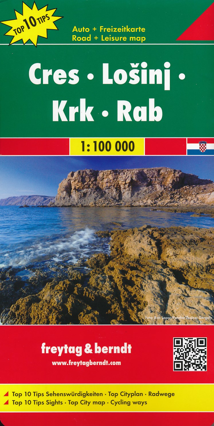
The island of Lošinj on the Adriatic coast of Croatia on a double-sided, contoured and GPS compatible map at 1:25,000 from the Croatian Mountain Rescue Service, highlighting hiking paths, including trails on the southern part of Cres and on the nearby islands of Unije, Susak and Ilovik.Contours at 10m intervals enhanced by relief shading...Read more
The course of the river Drava along the border of Hungary and Croatia and its section in Croatia to is confluence with the Danube on a detailed contoured map at 1:75,000 from Cartographia in Budapest highlighting waymarked and recommended cycling routes, etc.The course of the river is presented on four panels. An overprint highlights waymarked...Read more
The south-eastern part of the Dinara - Troglav mountain range on the border of southern Croatia and Bosnia-Herzegovina on a contoured and GPS compatible map at 1:25,000 from the Croatian Mountain Rescue Service. Coverage extends southwards from the peak of Troglav to Maljkovo near the Perucko Lake.Contours at 10m intervals enhanced by relief...Read more
Biokovo Mountains on the Adriatic coast of Croatia on a contoured and GPS compatible, double-sided map at 1:25,000 from the Croatian Mountain Rescue Service. Coverage includes the resorts of Baška Voda, Makarska,, Tucpi and Podgora.Contours at 10m intervals enhanced by relief shading provide excellent presentation of the terrain, with markings...Read more
Omiška Dinara Mountains on the Adriatic coast of Croatia on a contoured and GPS compatible, double-sided map at 1:25,000 from the Croatian Mountain Rescue Service. Coverage extends from Dugi Rat and Omiš to just beyond Vruja and inland beyond the A1 motorway to the hill along the Cetina River. Contours at 20m intervals enhanced by relief...Read more
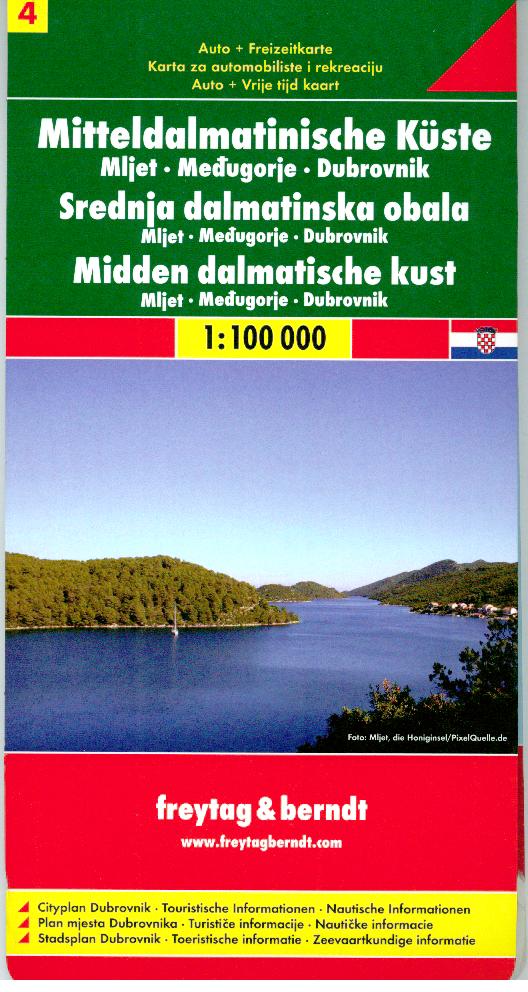
The southernmost part of the Dalmatian Coast of Croatia including Dubrovnik on a detailed map at 1:100,000 from Freytag & Berndt with large icons indicating various facilities including campsites and beaches, ferry connections, etc.Coverage includes the islands of Mljet and Sipan, and the southern part of the Peljesac peninsula. The map shows...Read more
The southernmost part of the Dalmatian Coast of Croatia including Dubrovnik on a detailed map at 1:100,000 from Freytag & Berndt with large icons indicating various facilities including campsites and beaches, ferry connections, etc.Coverage includes the islands of Mljet and Sipan, and the southern part of the Peljesac peninsula. The map shows...Read more
The northern part of the Dalmatian Coast of Croatia from Opatija and Rijeka to, on the mainland, beyond Jablanac on a detailed, indexed map at 1:100,000 from Freytag & Berndt, with the regions to 10 best sights given multilingual descriptions in a booklet attached to the map cover, plus a street plan of central Rijeka. Coverage includes the...Read more
The northern part of the Dalmatian Coast of Croatia from Opatija and Rijeka to, on the mainland, beyond Jablanac on a detailed, indexed map at 1:100,000 from Freytag & Berndt, with the regions to 10 best sights given multilingual descriptions in a booklet attached to the map cover, plus a street plan of central Rijeka. Coverage includes the...Read more