
Italy
Description

Italy is a country of enormous diversity and contrast. Most famous are the Alps. Coming from the efficient neatness of Switzerland or Austria, the Italian Alps are wilder and at the same time more tranquil, like stepping back in time. The most beautiful and popular areas are Gran Paradiso, Val Grande, Stelvio and the Dolomites.
In addition there are countless national parks, all very much worth hiking through. A series of mountain ranges runs from north to south like a backbone, starting from the hills of Tuscany, to the Apennines and Abruzzo to Italy's toe, Calabria. Southern Italy, too far for many tourists, has several attractive hiking regions, like Pollino and Aspromonte.
In the Alps you can walk from hut to hut, elsewhere you can do day hikes, such is the rule in general. However some genuine long distance hiking trails are under construction. European long distance trail E10 in the Alps, which coincides with the 1000km long Grande Alpine Trail and the international Via Alpina. The second large project is the E1, which coincides with the Grand Apennine Mountains Trail and the Ligurian Mountains High Trail. If this trail is ever completed, you can start from Como passing Genova and continue all the way to Reggio di Calabria and Palermo or Siracuse on Sicily. The third large project means to join all these trails into one 6000km long Sentiero Italia. Last but not least, there is the Alta Via in the Dolomites: splendid walking.
Mountain huts abound in the Alps. Hiking can be done all summer, from June until well into October. Further south spring is the best hiking season. In April you will still get stuck in the snow up in the mountains. Autumn is supposed to be fine as well, but alas, as one hiker put it: "you wake up to the sounds of church bells and gunfire". As hunters, Italians are best avoided.
Map


Trails
- Alta Via dei GigantiGPX
- Alta Via dei Monti LiguriGPX
- Alta Via Della Valle d'Aosta No 1
- Alta Via Della Valle d'Aosta No 2
- Alta Via Dolomiti 1GPX
- Alta Via Dolomiti 10
- Alta Via Dolomiti 2GPX
- Alta Via Dolomiti 3GPX
- Alta Via Dolomiti 4GPX
- Alta Via Dolomiti 5
- Alta Via Dolomiti 6GPX
- Alta Via Dolomiti 7
- Alta Via Dolomiti 8
- Alta Via Dolomiti 9
- Bassa Via del GardaGPX
- Cinque Terre
- E1GPX
- E10GPX
- E12GPX
- E5GPX
- E7GPX
- Florence - Siena
- GoethewegGPX
- GR58 - Tour du QueyrasGPX
- Grande Escursione AppenninicaGPX
- Grande Traversata del Gran Paradiso
- Grande Traversata delle AlpiGPX
- Meraner HöhenwegGPX
- Pfunderer HöhenwegGPX
- Santiago de Compostela Pilgrims WayGPX
- Südalpenweg - 3GPX
- SeealpentourGPX
- Sentiero della PaceGPX
- Sentiero ItaliaGPX
- Sentiero Roma
- Tiroler Höhenweg
- TMB - Tour du Mont BlancGPX
- Tour des CombinsGPX
- Tour des Grands Barrages
- Tour du MatterhornGPX
- Tour Monte RosaGPX
- Traumpfad München-VenedigGPX
- Via AlpinaGPX
- Via FrancigenaGPX
- Via SacraGPX
- Via SbrinzGPX
- Via SplugaGPX
- Via ValtellinaGPX
Regions
- Abruzzi
- Adamello
- Aeolian Islands
- Alpi Biellesi e Cusiane
- Alpi di Livigno
- Alpi Liguri
- Alpi Marittime
- Alpi Oróbie e Bergamasche
- Alpi Sarentini
- Alpi Vicentine
- Alps
- Amalfi Coast
- Appennini
- Apulia
- Ötztal
- Bernina
- Brenta
- Calabria
- Cilento
- Defereggengebirge
- Dolomiti
- Dolomiti di Fiemme
- Elba
- Friuli
- Garda
- Gran Paradiso
- Grand Combin
- Julische Alpen
- Karawanken
- Karnischer Alpen
- Lago di Como
- Lago Maggiore
- Liguria
- Lombardia
- Matterhorn
- Moncenisio
- Monginevro
- Mont Blanc
- Monte Leone
- Monte Rosa
- Monti Sibillini
- Monviso
- Nonstaler Alpen
- Ortler
- Paganella
- Platta Gruppe
- Presanella
- Rieserfernergruppe
- Sardinia
- Südtirol
- Sesvenna Gruppe
- Sicilia
- Sobretta
- Stelvio
- Stubai
- Texelgruppe
- Tirol
- Toscana
- Trentino
- Umbria
- Val d'Aosta
- Val Grande
- Val Venosta
- Valle d'Aosta
- Veneto
- Vinschgau
- Zillertal
Mountains


Links
Facts
Reports
Guides and maps
Lodging
Organisations
Tour operators
GPS
Other
Books

United Kingdom
- Bolzano and Environs Kompass 54
- Map No. 54, Bolzano and Environs, from Kompass, printed on waterproof and tear-resistant synthetic paper in a series of walking maps of selected areas of Italy at 1:50,000, with hiking routes on a topographic base, various types of accommodation, recreational facilities, places of interest, etc. Kompass are Europe’s largest publishers of... Read more

United Kingdom
- Cortina d`Ampezzo Kompass 55
- Map No. 55, Cortina d`Ampezzo - with a panorama map on the reverse, from Kompass, printed on sturdy, waterproof and tear-resistant synthetic paper in their series of walking maps of selected areas of Italy at 1:50,000, with hiking routes on a topographic base, various types of accommodation, recreational facilities, places of interest, etc.... Read more

United Kingdom
2018
- Italian Sunflower Landscape Guide
- This new 3rd edition of Italian Lakes has been carefully revised just a few months prior to publication. The topo maps now show waypoints, and free downloadable GPS tracks are available for all the walks. Colour coding on the Contents page enables you to see at a glance the grading of various walks. These great expanses of water, bound to the... Read more

United Kingdom
- Pale di San Martino - Primiero San Martino di Castrozza - Paneveggio - Valle del Vanoi Kompass 622
- Pale di S.Martino - Fiera di Primiero - Panaveggio - Valle del Vanoi area at 1:25,000 on a durable, waterproof and tear-resistant map from Kompass in their series of detailed maps of the Dolomites.CARTOGRAPHY: Kompass maps of the Dolomites at 1:25,000 have contours at 25-m intervals. An overprint shows local and long-distance footpaths,... Read more

United Kingdom
2015
- The Way of St Francis
- Via di Francesco: From Florence to Assisi and Rome Read more
- Also available from:
- De Zwerver, Netherlands

Netherlands
2019
- Wandelgids - Pelgrimsroute The Way of St Francis - Via Francigena | Cicerone
- Guidebook to walking the Way of St Francis, Via di Francesco. 550km pilgrimage from Florence, through Assisi to Rome through Central Italy visiting key sites from the saint's life. Described in 28 stages, the guide to the month-long route includes detailed maps, profiles and information about all the shrines, churches and towns along the way. Read more


- Also available from:
- De Zwerver, Netherlands


- Also available from:
- De Zwerver, Netherlands


Netherlands
2017
- Time to momo - Venetië
- Dit is de vernieuwde versie van de 100% Venetië-gids! Je gaat het bijzondere Venetië ontdekken. Natuurlijk wil je naar het San Marcoplein, het Dogepaleis en de Rialtobrug, en een tochtje maken over het Canal Grande. Net als kunst bewonderen in het Peggy Guggenheimmuseum of de vele kerken bezoeken. Maar we laten je ook genieten van heerlijke... Read more
- Also available from:
- Bol.com, Belgium
Belgium
2017
- Time to momo - Venetië
- Dit is de vernieuwde versie van de 100% Venetië-gids! Je gaat het bijzondere Venetië ontdekken. Natuurlijk wil je naar het San Marcoplein, het Dogepaleis en de Rialtobrug, en een tochtje maken over het Canal Grande. Net als kunst bewonderen in het Peggy Guggenheimmuseum of de vele kerken bezoeken. Maar we laten je ook genieten van heerlijke... Read more
Netherlands
2015
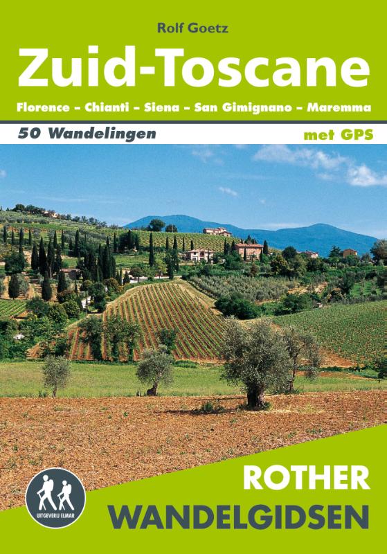
- Wandelgids Zuid-Toscane | Uitgeverij Elmar
- Florence - Chianti - Siena - San Gimignano - Maremma Deze wandelgids is een vertaling van de oorspronkelijke duitse versie. Het zijn klassiekers onder de wandelgidsen. Uitstekende wandelgids met een groot aantal dagtochten in dal en hooggebergte. Met praktische informatie en beperkt kaartmateriaal! Wandelingen in verschillende zwaarte... Read more
Netherlands
- Wander-Studien
- Travel & Languages Accommodation More Accomodation International Books Read more
- Also available from:
- Bol.com, Belgium
Belgium
- Wander-Studien
- Travel & Languages Accommodation More Accomodation International Books Read more

United Kingdom
2016
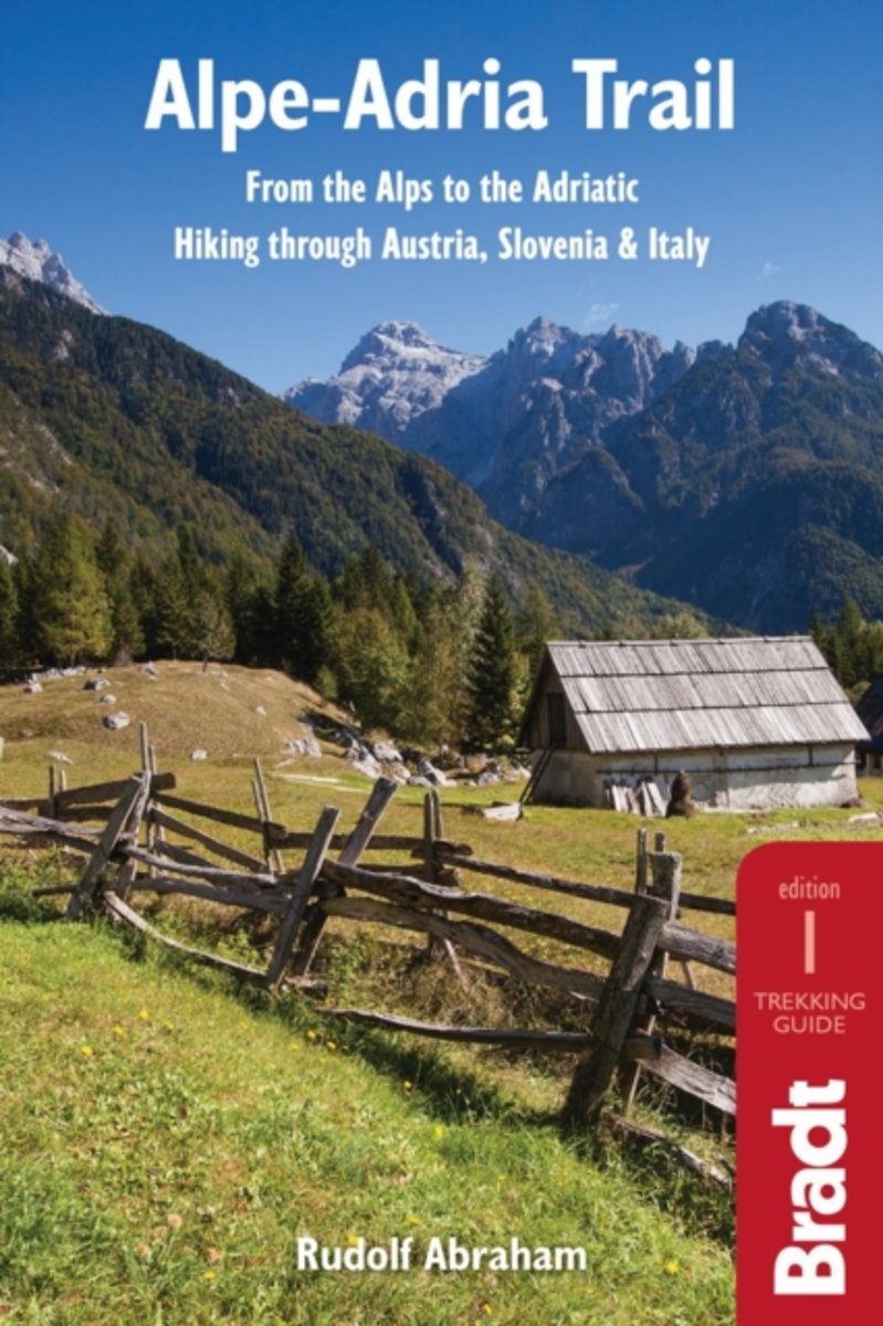
- Alpe-Adria Trail
- From the Alps to the Adriatic: Hiking through Austria, Slovenia & Italy Read more
- Also available from:
- Bol.com, Netherlands
- Bol.com, Belgium
Netherlands
2016
- Alpe-Adria trail
- The Alpe-Adria Trail is an epic long-distance hiking route, stretching 750 km through the mountains of Carinthia, Slovenia and northern Italy. Starting at the foot of Austria's highest peak, the Grossglockner, it meanders through spectacular mountain scenery, past pristine alpine lakes and plunging gorges. Bradt's new guide provides all you... Read more
Belgium
2016
- Alpe-Adria trail
- The Alpe-Adria Trail is an epic long-distance hiking route, stretching 750 km through the mountains of Carinthia, Slovenia and northern Italy. Starting at the foot of Austria's highest peak, the Grossglockner, it meanders through spectacular mountain scenery, past pristine alpine lakes and plunging gorges. Bradt's new guide provides all you... Read more
Netherlands
- Avanti!
- Informed by second-language acquisition research and supported by cutting-edge digital tools, the complete Avanti! program creates a dynamic learning environment that fosters communication and motivates students to succeed. With Connect and LearnSmart, Avanti's learning platform gives instructors maximum flexibility to structure the learning... Read more
- Also available from:
- Bol.com, Belgium
Belgium
- Avanti!
- Informed by second-language acquisition research and supported by cutting-edge digital tools, the complete Avanti! program creates a dynamic learning environment that fosters communication and motivates students to succeed. With Connect and LearnSmart, Avanti's learning platform gives instructors maximum flexibility to structure the learning... Read more
Netherlands
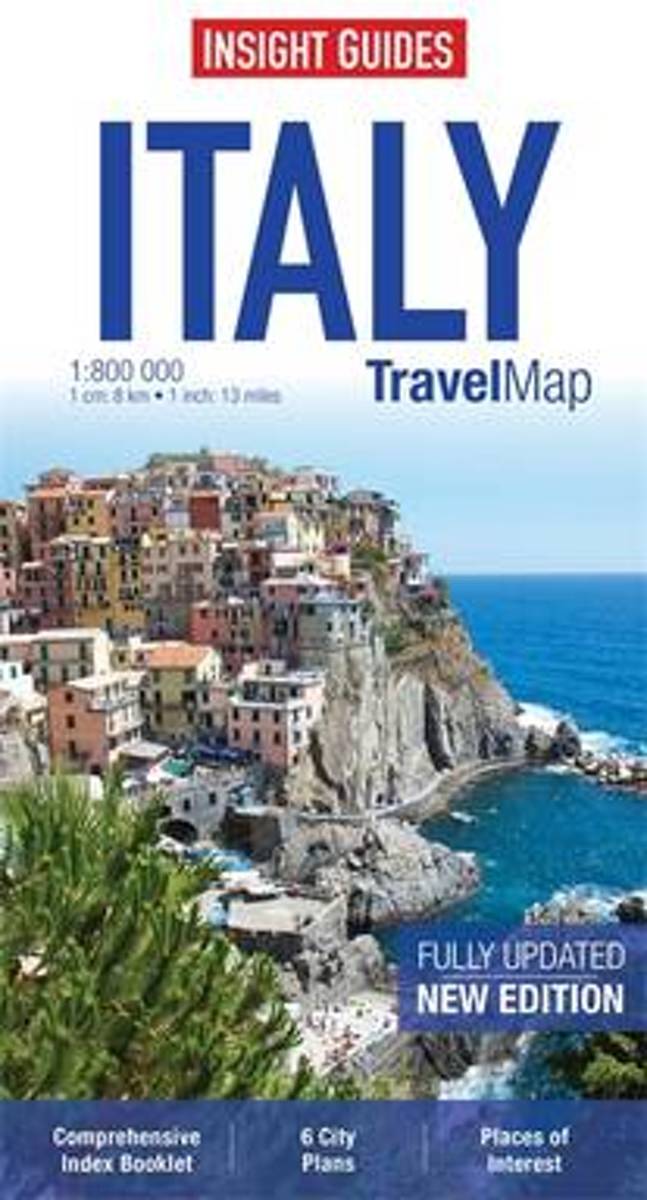
- Insight Guides Travel Map Italy
- Travel Map Italy is a double-sided, indexed, road map at 1:800 000. Detailed city plans of Bologna, Florence, Milan, Naples, Rome & Venice are included, each with its own separate listing in the attached index booklet. Places of interest are listed and accompanied by a wide range of pictorial symbols for instant recognition. These symbols have... Read more
- Also available from:
- Bol.com, Belgium
Belgium
- Insight Guides Travel Map Italy
- Travel Map Italy is a double-sided, indexed, road map at 1:800 000. Detailed city plans of Bologna, Florence, Milan, Naples, Rome & Venice are included, each with its own separate listing in the attached index booklet. Places of interest are listed and accompanied by a wide range of pictorial symbols for instant recognition. These symbols have... Read more
Netherlands
2012
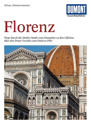
- Reisgids Kunstreiseführer Florence | Dumont
- Von woher man sich auch Florenz nähert, das erste, was man von der Toskana-Metropole wahrnimmt, ist die aus dem Dunstschleier emportauchende Domkuppel. Und mit dem weiten Blick von dort oben beginnt Klaus Zimmermanns seine umfassende Kulturgeschichte der Stadt am Arno. Dabei bürgen Namen wie Giotto, Fra Angelico, Botticelli, Brunelleschi,... Read more
Maps


United Kingdom
- Monte Grappa - Basano - Feltre Tabacco 051
- Monte Grappa - Basano - Feltre in a series of Tabacco maps at 1:25,000 covering the Dolomites and the mountains of north-eastern Italy - Stanfords’ most popular coverage for this region, with excellent cartography and extensive overprint for hiking routes and other recreational activities, local bus stops, etc. Additional overprint in this... Read more

United Kingdom
- Colli Euganei - Abano e Montegrotto Terme Tabacco 060
- Colli Euganei - Abano & Montegrotto Terme area in a series of Tabacco maps at 1:25,000 covering the Dolomites and the mountains of north-eastern Italy - Stanfords’ most popular coverage for this region, with excellent cartography and extensive overprint for hiking routes and other recreational activities, local bus stops, etc. Additional... Read more

United Kingdom
- Valsesia - Riva Valdobbia - Campertogno - Mollia - Rassa - Scopelllo
- 1:25,000 hiking map to the south west of Valsesia including Riva Valdobbia, Campertogno, Mollia, Rassa, Scopelllo.Published in association with the CAI, the Italian Alpine Club, who are responsible for the trails. Trails are marked on the map. The key information and more detailed information on the rear of the sheet are in Italian, German and... Read more

United Kingdom
- Valle Anzasca - Vanzone - Piedimulera SUPERCEDED
- 1:25,000 hiking map covering the east end of the Valle Anzasca, centred on Pieve Vergonte, including Villadossola and Anzola d`Ossola. Published in association with the CAI, the Italian Alpine Club, who are responsible for the hiking trails. Trails are marked on the map. The key information and more detailed information on the rear of the sheet... Read more

United Kingdom
- Alta Badia - Arabba - Marmolada Tabacco 07
- Alta Badia - Arabba - Marmolada area in a series of Tabacco maps at 1:25,000 covering the Dolomites and the mountains of north-eastern Italy - Stanfords’ most popular coverage for this region, with excellent cartography and extensive overprint for hiking routes and other recreational activities, local bus stops, etc. Additional overprint in... Read more

United Kingdom
- Lago d`Iseo - Valle Trompia - Franciacorta Kompass 106
- Lago d`Iseo - Valle Trompia - Franciacorta area on a GPS compatible hiking and recreational map at 1:50,000 from Kompass on durable, waterproof and tear-resistant synthetic paper. Coverage extends south to include Brescia.KOMPASS HIKING MAPS OF ITALY:This title is part of an extensive series of walking maps from Kompass covering selected areas... Read more

United Kingdom
- Val de Peio - Val di Rabbi - Val di Sole Tabacco 048
- Val de Peio - Val di Rabbi - Val di Sole area in a series of Tabacco maps at 1:25,000 covering the Dolomites and the mountains of north-eastern Italy - Stanfords’ most popular coverage for this region, with excellent cartography and extensive overprint for hiking routes and other recreational activities, local bus stops, etc. Additional... Read more

United Kingdom
- Siena - Volterra - Massa Marittima - Roccastrada Kompass 2462
- Siena - Volterra - Massa Marittima - Rocca Strada map at 1:50,000 from Kompass, printed on durable, waterproof and tear-resistant synthetic paper. Coverage includes Colle di Va d’Elsa, Casole d’Elsa, Metallifere hills, etc. Contours are at 40m intervals, with a 2-km UTM grid. Extensive overprint includes GEA - Grande Escursione Appenninica,... Read more

United Kingdom
- Cinque Terre - Golfo del Tigullio: La Spezia - Sestri Levante - Rapallo - Genoa 50K IGC Map No. 23
- Cinque Terre - Golfo del Tigullio area of the Italian Riviera from genoa to la Spezia including Sestri Levante and Rapallo in a series contoured hiking maps at 1:50,000 with local trails, long-distance footpaths, mountain accommodation, etc. from the Turin based Istituto Geografico Centrale.Maps in this series have contours at 50m intervals,... Read more

United Kingdom
- Levico - Altopiani di Folgaria Lavarone e Luserna Tabacco 057
- Levico - Altopiani di Folgaria Lavarone e Luserna area in a series of Tabacco maps at 1:25,000 covering the Dolomites and the mountains of north-eastern Italy - Stanfords’ most popular coverage for this region, with excellent cartography and extensive overprint for hiking routes and other recreational activities, local bus stops, etc.... Read more

United Kingdom
- Lake Bracciano - Monti della Tolfa - Civitavecchia Global Map Tourist Map
- Lake Bracciano - Monti della Tolfa – Civitavecchia area of Lazio north-west of Rome presented at 1:50,000 on a double-sided, detailed, contoured map from LAC in their GlobalMap imprint, highlighting sightseeing itineraries and various places of interest.Topography is shown by contours and relief shading, plus numerous spot heights and colouring... Read more

United Kingdom
- Regglberg - Latemar - Val d`Ega / Eggental Kompass 630
- Regglberg - Latemar - Val d`Ega/Eggental area of the Dolomites a waterproof and tear-resistant, contoured and GPS compatible map at 1:25,000 from Kompass. Contour interval is 25m, with extensive overprint for hiking trails, cycle routes including mountain bike trails, accommodation and recreational facilities, etc.To see the list of Kompass... Read more

United Kingdom
- Monti Nebrodi
- Parco Naturale dei Monti Nebrodi on the northern coast of Sicily on a contoured and GPS compatible map at 1:50,000 from Litografia Artistica Cartografica in their Global Map imprint, highlighting hiking trails plus various facilities and/or places of interest in and around the park.Topography is shown by contours at 25m intervals with light... Read more

United Kingdom
- Interlaken - Grindelwald - Lauterbrunnen - Wengen - Brienz Swisstopo SKI 254S
- Detailed ski map at 1:50,000 from Swisstopo, the country’s national survey organization, showing routes for skiing and/or snowboarding, access by public transport, recommended itineraries, lists of mountain huts, etc. The series uses the cartography of Switzerland’s topographic survey, with additional colouring to show slopes steeper than 30°.... Read more