
Great Eastern Trail
Description
- Name Great Eastern Trail (GET)
- Length of trail 2,575 km, 1,600 miles
- Length in days 170 days
- Traildino grading SW, Strenuous walk, mountain trail
- Hut tour grading T2, Mountain walk
 GET, 1600 miles (2575 km)
Hiking trail from Alabama to New York, in the eastern States, along the Appalachian Mountains. The proposed length is 1600 miles (2575 km) or even 2000 miles. The GET should get the pressure off the AT. Currently, many local organisations are working together to get a deffinite route proposal. Under construction.
Map


Links
Facts
Reports
Guides and maps
Lodging
Organisations
Tour operators
GPS
Other
Books

Stanfords
United Kingdom
United Kingdom
- A Horse Walks into a Bar
- The setting is a comedy club in a small Israeli town. An audience that has come expecting an evening of amusement instead sees a comedian falling apart on stage; an act of disintegration, a man crumbling, as a matter of choice, before their eyes. They could get up and leave, or boo and whistle and drive him from the stage, if they were not so... Read more

Stanfords
United Kingdom
United Kingdom
- The Wild Atlantic Way Route Atlas - Ireland West
- The Wild Atlantic Way is a 25,000 kilometre coastal route along Ireland’s Atlantic coast that stretches between the southerly point of Kinsale, County Cork up to Derry. This route is favoured by many in its entirety or broken down into more manageable, day trip sections. This Xploreit handy sized spiral bound route atlas contains 30 easy-to-use... Read more

Stanfords
United Kingdom
2019
United Kingdom
2019
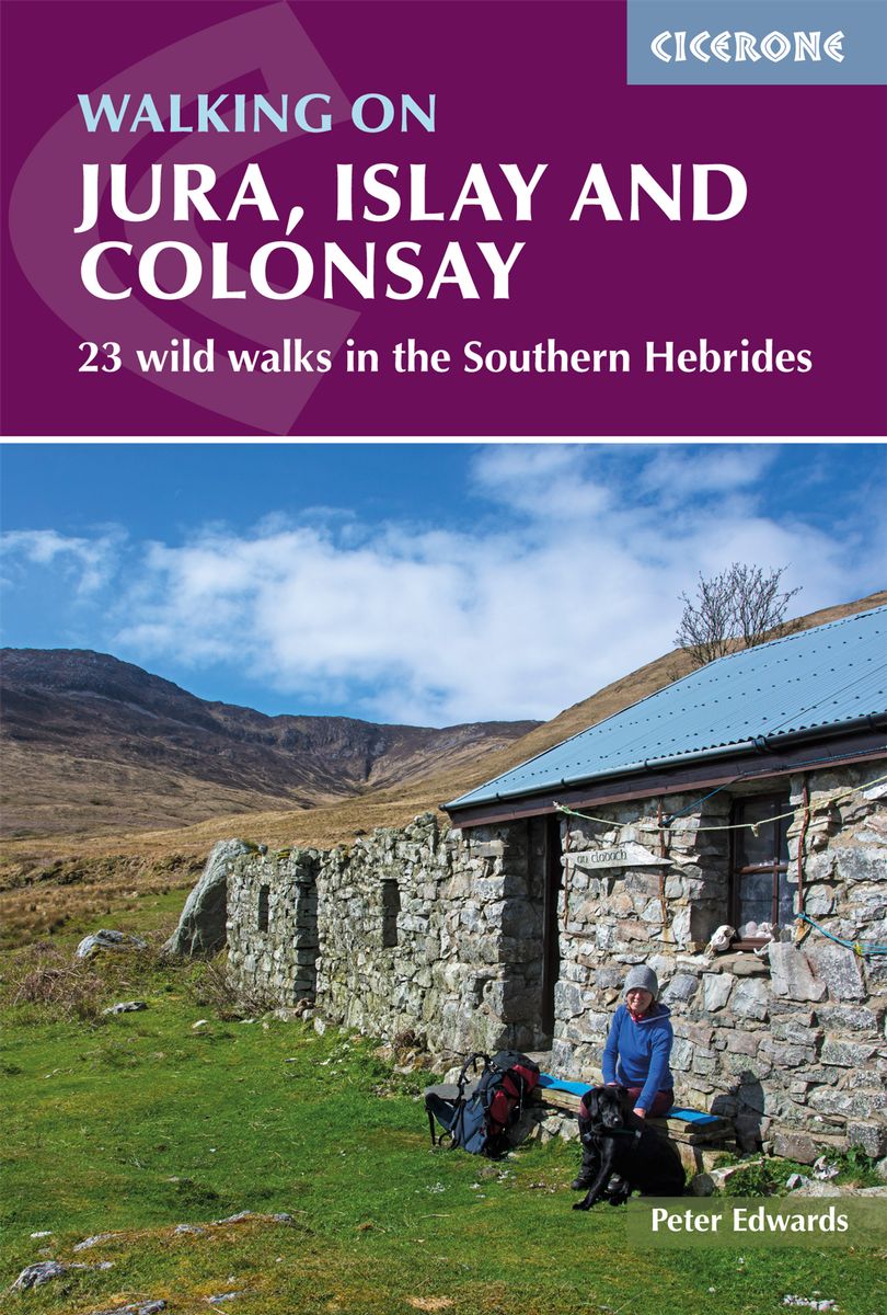
- Walking on Jura, Islay and Colonsay: 23 wild walks in the Southern Hebrides
- This guidebook presents a selection of 23 walking routes on the wild and beautiful southern islands of Scotland`s Inner Hebrides, with nine walks on Jura, one on neighbouring Scarba, seven on Islay and five on Colonsay, plus a spectacular 5-day trek along Jura`s dramatic west coast. The wildest of the southern Hebrides, the walking on Jura is... Read more
- Also available from:
- De Zwerver, Netherlands
De Zwerver
Netherlands
2019
Netherlands
2019
- Wandelgids Walking on Jura, Islay and Colonsay | Cicerone
- Guidebook to Jura, Scarba, Islay and Colonsay in the Hebrides, describing 22 walks plus a 5-day 89km trek along Jura's remote west coast. The routes range from 6.5 to 25km and cover rough - and often pathless - terrain suitable for fit, competent walkers. Even the coastal walks offer challenges. Read more

- Also available from:
- De Zwerver, Netherlands


The Book Depository
United Kingdom
2020
United Kingdom
2020
- Walking in the Salzkammergut: the Austrian Lake District
- 30 walks in Salzburg's lakes and mountains, including the Dachstein Read more
- Also available from:
- De Zwerver, Netherlands

De Zwerver
Netherlands
2020
Netherlands
2020

The Book Depository
United Kingdom
2019
United Kingdom
2019
- Walking in County Durham
- 40 walking routes exploring Pennine moors, river valleys and coastal paths Read more


- Also available from:
- De Zwerver, Netherlands


The Book Depository
United Kingdom
United Kingdom
- How To Get Started With Potty Training
- Great Advice For Successful Potty Training: Parenting Infants Read more

The Book Depository
United Kingdom
2019
United Kingdom
2019
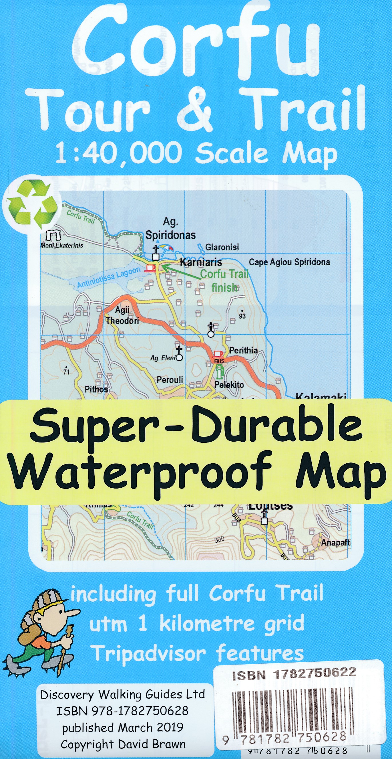
- Corfu Tour & Trail Super-Durable Map
- For better adventures, use the best map. Corfu Tour & Trail Super-Durable Map is the most detailed, accurate, toughest, large scale map of the island that you can buy. Our large 1:40,000 scale produces a double sided map sheet of 840mm by 680mm; big enough to show masses of detail but compact enough to use in the car or on the trail. Corfu... Read more
- Also available from:
- De Zwerver, Netherlands
De Zwerver
Netherlands
2019
Netherlands
2019
- Wandelkaart Tour & Trail Corfu - Korfoe | Discovery Walking Guides
- For better adventures, use the best map. Corfu Tour & Trail Super-Durable Map is the most detailed, accurate, toughest, large scale map of the island that you can buy. Our large 1:40,000 scale produces a double sided map sheet of 840mm by 680mm; big enough to show masses of detail but compact enough to use in the car or on the trail. Corfu... Read more

The Book Depository
United Kingdom
United Kingdom
- London's Secret Walks
- 25 Walks Around London's Most Historic Districts Read more

The Book Depository
United Kingdom
United Kingdom
- Barbell Training
- Step-to-step Guide to Get Fit and Move Pain Free ( A Weight Training Guide for Strength & Fitness That Won't Go Out of Fashion) Read more
Maps

Stanfords
United Kingdom
United Kingdom
- Khin
- Khin, sheet no. 2981-12, in the topographic survey of Nepal at 1:50,000 published by the Nepali Government in the late 1990s and early 2000s and produced from remote sensing data by Finnish cartographers as part of that country’s international aid program. The maps cover 15’ x 15’ quadrangles.IMPORTANT – PLEASE NOTE BEFORE ORDERING:... Read more
Stanfords
United Kingdom
United Kingdom
- Dorle Pahad
- Dorle Pahad, sheet no. 2885-16, in the topographic survey of Nepal at 1:50,000 published by the Nepali Government in the late 1990s and early 2000s and produced from remote sensing data by Finnish cartographers as part of that country’s international aid program. The maps cover 15’ x 15’ quadrangles.IMPORTANT – PLEASE NOTE BEFORE ORDERING:... Read more
Stanfords
United Kingdom
United Kingdom
- Khiratadi (114) (2980 08)
- Khiratadi, sheet no. 2980-08, in the topographic survey of Nepal at 1:50,000 published by the Nepali Government in the late 1990s and early 2000s and produced from remote sensing data by Finnish cartographers as part of that country’s international aid program. The maps cover 15’ x 15’ quadrangles.IMPORTANT – PLEASE NOTE BEFORE ORDERING:... Read more
Stanfords
United Kingdom
United Kingdom
- Namrun
- Namrun, sheet no. 2884-08, in the topographic survey of Nepal at 1:50,000 published by the Nepali Government in the late 1990s and early 2000s and produced from remote sensing data by Finnish cartographers as part of that country’s international aid program. The maps cover 15’ x 15’ quadrangles.IMPORTANT – PLEASE NOTE BEFORE ORDERING:... Read more
Stanfords
United Kingdom
United Kingdom
- Europe High 5 Edition Road Atlas
- The first physical atlas with direct access to useful additional information from the InternetThe entirety of Europe on 432 pages in a scale of 1:800,000 clearly presented, including lots more travel information:- Road Companion (roadmaps) in a scale of 1:800,000, inclusive of the High 5 - Edition app technology for calling up additional travel... Read more
Stanfords
United Kingdom
United Kingdom
- Damodar Kunda
- Damodar Kunda, sheet no. 2984-13, in the topographic survey of Nepal at 1:50,000 published by the Nepali Government in the late 1990s and early 2000s and produced from remote sensing data by Finnish cartographers as part of that country’s international aid program. The maps cover 15’ x 15’ quadrangles.IMPORTANT – PLEASE NOTE BEFORE ORDERING:... Read more
Stanfords
United Kingdom
United Kingdom
- Sabha Khola - Chainpur
- Sabha Khola - Chainpur, sheet no. 2787-10, in the topographic survey of Nepal at 1:50,000 published by the Nepali Government in the late 1990s and early 2000s and produced from remote sensing data by Finnish cartographers as part of that country’s international aid program. The maps cover 15’ x 15’ quadrangles.IMPORTANT – PLEASE NOTE BEFORE... Read more
Stanfords
United Kingdom
United Kingdom
- Chala Bhanjyan
- Chala Bhanjyan, sheet no. 2983-06, in the topographic survey of Nepal at 1:50,000 published by the Nepali Government in the late 1990s and early 2000s and produced from remote sensing data by Finnish cartographers as part of that country’s international aid program. The maps cover 15’ x 15’ quadrangles.IMPORTANT – PLEASE NOTE BEFORE ORDERING:... Read more
Stanfords
United Kingdom
United Kingdom
- Likhu Khola - Those
- Likhu Khola - Those, sheet no. 2786-06, in the topographic survey of Nepal at 1:50,000 published by the Nepali Government in the late 1990s and early 2000s and produced from remote sensing data by Finnish cartographers as part of that country’s international aid program. The maps cover 15’ x 15’ quadrangles.IMPORTANT – PLEASE NOTE BEFORE... Read more
Stanfords
United Kingdom
United Kingdom
- Dunai
- Dunai, sheet no. 2882-04, in the topographic survey of Nepal at 1:50,000 published by the Nepali Government in the late 1990s and early 2000s and produced from remote sensing data by Finnish cartographers as part of that country’s international aid program. The maps cover 15’ x 15’ quadrangles.IMPORTANT – PLEASE NOTE BEFORE ORDERING:... Read more
Stanfords
United Kingdom
United Kingdom
- Lower Dudh Kosi - Okhaldhunga
- Lower Dudh Kosi - Okhaldhunga, sheet no. 2786-11, in the topographic survey of Nepal at 1:50,000 published by the Nepali Government in the late 1990s and early 2000s and produced from remote sensing data by Finnish cartographers as part of that country’s international aid program. The maps cover 15’ x 15’ quadrangles.IMPORTANT – PLEASE NOTE... Read more

Stanfords
United Kingdom
United Kingdom
- Barcelona High 5 Edition Street Plan
- The first water-resistant “Comfort Map“ with direct access to useful additional information from the InternetBarcelona in a scale of 1:20,000 including detailed presentation of the old town in a scale of 1:11,000 presented on a practical map; inclusive of the High 5 Edition app technology for calling up additional travel information and many... Read more
Stanfords
United Kingdom
United Kingdom
- Rachuli
- Rachuli, sheet no. 2981-16, in the topographic survey of Nepal at 1:50,000 published by the Nepali Government in the late 1990s and early 2000s and produced from remote sensing data by Finnish cartographers as part of that country’s international aid program. The maps cover 15’ x 15’ quadrangles.IMPORTANT – PLEASE NOTE BEFORE ORDERING:... Read more
Stanfords
United Kingdom
United Kingdom
- Tiptala Bhañjyan
- Tiptala Bhanjyan, sheet no. 2787-03, in the topographic survey of Nepal at 1:50,000 published by the Nepali Government in the late 1990s and early 2000s and produced from remote sensing data by Finnish cartographers as part of that country’s international aid program. The maps cover 15’ x 15’ quadrangles.IMPORTANT – PLEASE NOTE BEFORE ORDERING:... Read more
Stanfords
United Kingdom
United Kingdom
- Philim
- Philim, sheet no. 2884-12, in the topographic survey of Nepal at 1:50,000 published by the Nepali Government in the late 1990s and early 2000s and produced from remote sensing data by Finnish cartographers as part of that country’s international aid program. The maps cover 15’ x 15’ quadrangles.IMPORTANT – PLEASE NOTE BEFORE ORDERING:... Read more