
Georgia
Description
The north of Georgia is mountainous. The Appalachian Trail starts here. Also, the Benton Mackaye Trail has 75 miles in the Chattahooche National Forest in the north, before it enters the state of Tennessee.
Georgia shares the 250 mile Pinhote Trail with Alabama.
Three long distance trails (will) run through Georgia. The Eastern Continental Trail, The East Coast Greenway and the Great Eastern Trail.
Map

Trails in this state
Links
Facts
Reports
Guides and maps
Lodging
Organisations
Tour operators
GPS
Other
Books

Stanfords
United Kingdom
United Kingdom
- The Broon`s Days Oot!
- The much-acclaimed The Broons Days Oot! is a cracking guide to Scotland. Now expanded with new information throughout, the new book includes new sections on the Scottish islands, Scotland`s whisky trails, cycling in Scotland, walking, arts and other festivals, and gala days. Ideal for the glovebox, the backpack, and the holiday cottage, this... Read more

Stanfords
United Kingdom
2019
United Kingdom
2019
- Insight Guides Explore Fiji
- Discover the best of Fiji with this indispensably practical Insight Explore Guide. From making sure you don`t miss out on must-see attractions like Viseisei Village, the sand dunes in Sigatoka, Mamanuca Islands, Levuka and the Hibiscus Highway, to discovering hidden gems, including Navala, the easy-to-follow, ready-made walking routes will save... Read more

Stanfords
United Kingdom
United Kingdom
- Athens: The Monocle Travel Guide Series
- Get to know the most atmospheric open-air cinemas and drawn up walks around Athens` neighborhoods -- one a leafy suburb, another by the sea. Think of Athens and the first things that spring to mind are ancient ruins and camera-toting crowds (before they hotfoot it to the island-bound ferries at the port of Piraeus, that is). It`s true, the... Read more

Stanfords
United Kingdom
2015
United Kingdom
2015
- Azores: Car Tours and Walks
- The Azores in the Sunflower Landscapes guide series; exploring the best walking and touring possibilities in the region or area. Detailed information about touring by hired car or public transport, as well as on foot, is provided, helping walkers to navigate and plan day-trips. Shorter strolls are also included as an alternative for each main... Read more
Stanfords
United Kingdom
United Kingdom
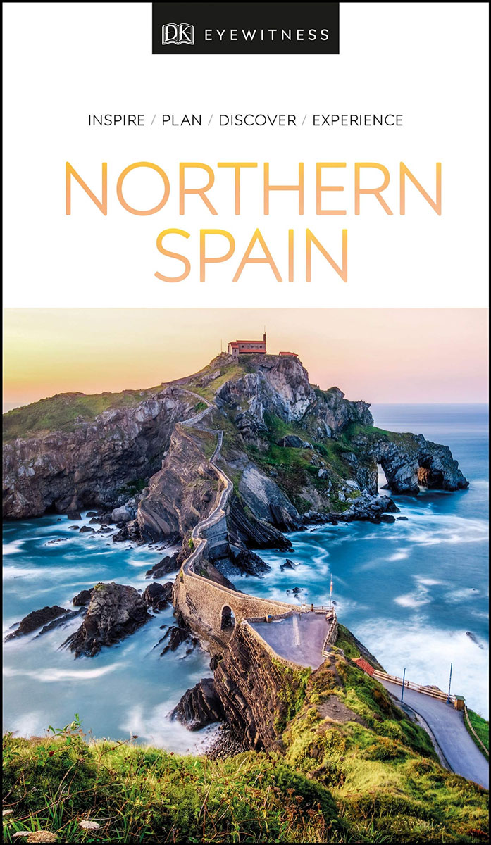
- DK Eyewitness Northern Spain
- Your journey starts here. Featuring DK`s much-loved maps and illustrations, walks and information, plus all new, full-colour photography, this 100% updated guide to Northern Spain brings you the best of this stunning Spanish region in a brand-new, lightweight format. What`s inside? - full-colour photography, hand-drawn illustrations, and maps... Read more

Stanfords
United Kingdom
2015
United Kingdom
2015
- Paxos: Car Tours and Walks
- Paxos is the Sunflower Landscapes guide to exploring the best walking and touring possibilities on the island. The guide covers a range of routes including walks in Gaios, Bogdanatika, Loggos, Lakka and Antixpaxos. A double-sided, fold-out touring map at the back of the book gives an overview of the island and the location of each walk.... Read more

Stanfords
United Kingdom
2020
United Kingdom
2020
- DK Eyewitness Pacific Northwest: Oregon, Washington and British Columbia
- Follow the call of the wild to the pristine Pacific NorthwestWhether you want to hike through the spellbinding landscape of the Rockies, unwind with homebrewed beer in Portland or venture to Vancouver for immersive galleries and innovative dining, your DK Eyewitness travel guide makes sure you experience all that the Pacific Northwest has to... Read more

Stanfords
United Kingdom
United Kingdom
- DK Eyewitness Travel Guide Washington DC
- Whether you want to stroll beneath the cherry blossoms, visit the iconic domed Capitol, or tour the magnificent White House, your DK Eyewitness travel guide makes sure you experience all that Washington, DC has to offer.Washington, DC delights at every turn. Wherever you go, there is a marvel of architecture to be discovered, a scenic view to... Read more
Stanfords
United Kingdom
United Kingdom
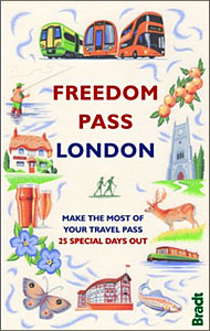
- Freedom Pass London
- Since its creation over 40 years ago, London`s Freedom Pass concessionary travel scheme has continued to grow in popularity and there are now over 1 million registered holders. Whether a fruit picker or forager, a rambler or angler, or simply someone who enjoys the quirky charm of a local pub, Bradt`s new Freedom Pass is the perfect read to... Read more

Stanfords
United Kingdom
United Kingdom
- Rick Steves Pocket London (Fourth Edition)
- Make the most of every day and every dollar with Rick Steves! This colorful, compact guidebook is perfect for spending a week or less in London: City walks and tours: Six detailed tours and walks showcase London`s essential sights, including the National Gallery, the Tower of London, and Westminster Abbey, plus handy neighborhood breakdowns... Read more

Stanfords
United Kingdom
United Kingdom
- London`s Secrets: Bizarre & Curious
- London is a city with an abundance of bizarre and curious places and stories, being ancient, vast and in a constant state of regeneration. Newcomers have, of course, a wealth of world-famous attractions to keep them occupied for a month of Sundays, which are more than adequately covered in a plethora of standard guidebooks. What London`s... Read more

Stanfords
United Kingdom
United Kingdom
- Middlesex and West London - Waterside Walks
- Waterside Walks in Middlesex and West London by David and Rosemary Hall presents a selection of twenty circular walks that take in some part of a local waterway. These include the rivers Thames and Colne, the Staines Reservoirs, Dollis Brook and the Grand Union Canal. The twenty routes in this book are all between 3 to 7 miles. Each walk is... Read more

Stanfords
United Kingdom
2022
United Kingdom
2022
- DK Eyewitness Thailand
- Discover the beating heart of Southeast AsiaWhether you want to experience legendary nightlife, spectacular forests or delectable cuisine, your DK Eyewitness travel guide makes sure you experience all that Thailand has to offer.Thailand is as diverse as it is beautiful. The extensive coastline and idyllic islands offer the opportunity to dive... Read more

Stanfords
United Kingdom
United Kingdom
- Insight Guides Explore New York
- From making sure you don`t miss out on must-see attractions like Times Square, Brooklyn Bridge, Empire State Building, Central Park and Statue of Liberty, to discovering hidden gems, including Greenwich Village, the easy-to-follow, ready-made walking routes will save you time, help you plan and enhance your visit to New York.Practical,... Read more

Stanfords
United Kingdom
United Kingdom
- DK Eyewitness Sicily
- Discover Sicily`s secluded coves, steaming volcanoes and storybook villages.Whether you want to visit Palermo`s cutting-edge galleries, explore mysterious ancient ruins in Segesta or hike the craterous trails around majestic Mount Etna, your DK Eyewitness travel guide makes sure you experience all that Sicily has to offer.Rising out of... Read more
Maps

Stanfords
United Kingdom
United Kingdom
- Khiratadi (114) (2980 08)
- Khiratadi, sheet no. 2980-08, in the topographic survey of Nepal at 1:50,000 published by the Nepali Government in the late 1990s and early 2000s and produced from remote sensing data by Finnish cartographers as part of that country’s international aid program. The maps cover 15’ x 15’ quadrangles.IMPORTANT – PLEASE NOTE BEFORE ORDERING:... Read more

Stanfords
United Kingdom
United Kingdom
- Oni - Utsera Resort - Ghebi Resort Geoland 7
- Oni - Utsera Resort - Ghebi Resort area of the Caucasus Mountains in Georgia at 1:50,000 on a double-sided, contoured and GPS compatible map from Geoplan, with an overprint providing tourist information including local accommodation and sights.Maps in this series have contours at 20m intervals, with additional relief shading and numerous spot... Read more
Stanfords
United Kingdom
United Kingdom
- Kolti
- Kolti, sheet no. 2981-07 in the topographic survey of Nepal at 1:50,000 published by the Nepali Government in the late 1990s and early 2000s and produced from remote sensing data by Finnish cartographers as part of that country’s international aid program. The maps cover 15’ x 15’ quadrangles.IMPORTANT – PLEASE NOTE BEFORE ORDERING:... Read more
Stanfords
United Kingdom
United Kingdom
- Topkegola
- Topkegola, sheet no. 2787-07, in the topographic survey of Nepal at 1:50,000 published by the Nepali Government in the late 1990s and early 2000s and produced from remote sensing data by Finnish cartographers as part of that country’s international aid program. The maps cover 15’ x 15’ quadrangles.IMPORTANT – PLEASE NOTE BEFORE ORDERING:... Read more

Stanfords
United Kingdom
United Kingdom
- St Andrews Bay - Royal Bay, South Georgia BAS Geomorphology Map
- Geomorphology map of the St Andrews Bay - Royal Bay area of South Georgia at 1:50,000 from the British Antarctic Survey. BAS ref. for this title is BAS (Misc) 1. Thei is the folded version of this title which is also available flat.PLEASE NOTE: to see the list of other detailed topographic and specialist maps from BAS please click on the series... Read more
Stanfords
United Kingdom
United Kingdom
- Samagau
- Samagau, sheet no. 2884-07, in the topographic survey of Nepal at 1:50,000 published by the Nepali Government in the late 1990s and early 2000s and produced from remote sensing data by Finnish cartographers as part of that country’s international aid program. The maps cover 15’ x 15’ quadrangles.IMPORTANT – PLEASE NOTE BEFORE ORDERING:... Read more
Stanfords
United Kingdom
United Kingdom
- Panlham
- Panlham, sheet no. 2983-12, in the topographic survey of Nepal at 1:50,000 published by the Nepali Government in the late 1990s and early 2000s and produced from remote sensing data by Finnish cartographers as part of that country’s international aid program. The maps cover 15’ x 15’ quadrangles.IMPORTANT – PLEASE NOTE BEFORE ORDERING:... Read more
Stanfords
United Kingdom
United Kingdom
- Ghunsa Khola - Olanchungola
- Ghunsa Khola - Olanchungola, sheet no. 2787-08, in the topographic survey of Nepal at 1:50,000 published by the Nepali Government in the late 1990s and early 2000s and produced from remote sensing data by Finnish cartographers as part of that country’s international aid program. The maps cover 15’ x 15’ quadrangles.IMPORTANT – PLEASE NOTE... Read more
Stanfords
United Kingdom
United Kingdom
- Mukot
- Mukot, sheet no. 2883-02, in the topographic survey of Nepal at 1:50,000 published by the Nepali Government in the late 1990s and early 2000s and produced from remote sensing data by Finnish cartographers as part of that country’s international aid program. The maps cover 15’ x 15’ quadrangles.IMPORTANT – PLEASE NOTE BEFORE ORDERING:... Read more
Stanfords
United Kingdom
United Kingdom
- Mt. Everest (Sagarmatha) - Hinku Himal
- Mount Everesr (Sagarmatha) - Hinku Himal, sheet no. 2786-04, in the topographic survey of Nepal at 1:50,000 published by the Nepali Government in the late 1990s and early 2000s and produced from remote sensing data by Finnish cartographers as part of that country’s international aid program. The maps cover 15’ x 15’ quadrangles.IMPORTANT –... Read more
Stanfords
United Kingdom
United Kingdom
- Sisne
- Sisne, sheet no. 2883-03, in the topographic survey of Nepal at 1:50,000 published by the Nepali Government in the late 1990s and early 2000s and produced from remote sensing data by Finnish cartographers as part of that country’s international aid program. The maps cover 15’ x 15’ quadrangles.IMPORTANT – PLEASE NOTE BEFORE ORDERING:... Read more
Stanfords
United Kingdom
United Kingdom
- Barhabise
- Barhabise, sheet no. 2785-04, in the topographic survey of Nepal at 1:50,000 published by the Nepali Government in the late 1990s and early 2000s and produced from remote sensing data by Finnish cartographers as part of that country’s international aid program. The maps cover 15’ x 15’ quadrangles.IMPORTANT – PLEASE NOTE BEFORE ORDERING:... Read more
Stanfords
United Kingdom
United Kingdom
- Khalanga Baja (Darchula)
- Khalanga Baja (Darchula), sheet no. 2980-03 / 3080-15, in the topographic survey of Nepal at 1:50,000 published by the Nepali Government in the late 1990s and early 2000s and produced from remote sensing data by Finnish cartographers as part of that country’s international aid program. The maps cover 15’ x 15’ quadrangles.IMPORTANT – PLEASE... Read more

Stanfords
United Kingdom
United Kingdom
- Busen Region - South Georgia BAS Wall Map
- South Georgia and its offshore islands in the South Atlantic presented by the British Antarctic Survey on a double-sided map combining topographic mapping of the whole island at 1:200,000 scale and detailed topographic mapping of the route of Shackleton’s crossing in May 1916 at 1:40,000 scale.On one side is a map presenting the topography by... Read more
Stanfords
United Kingdom
United Kingdom
- Kimathanka
- Kimathanka, sheet no. 2787-02, in the topographic survey of Nepal at 1:50,000 published by the Nepali Government in the late 1990s and early 2000s and produced from remote sensing data by Finnish cartographers as part of that country’s international aid program. The maps cover 15’ x 15’ quadrangles.IMPORTANT – PLEASE NOTE BEFORE ORDERING:... Read more