Switzerland
Description
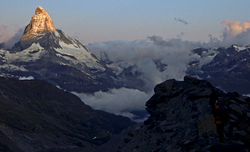
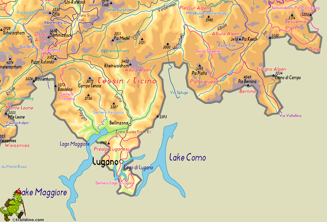
For the ultimate alpine experience, Switzerland is the place to be. Matterhorn, Jungfrau, Monte Rosa or Piz Bernina, these are just a few of the fifty peaks over four-thousand meters high. Famous massifs include Berner Oberland, Wallis (Valais) and Jura, and there are many, many more. Wintertime is for the skiing jet-set of course, but in summer, from July until September, hiking trails and mountain huts are open all across the country. Popular are the regions of Valais (Wallis) with the Jungfrau and the Aletsch glacier, Graubünden in the east, Tessin (Ticino) in the south, and Fribourg in the west.
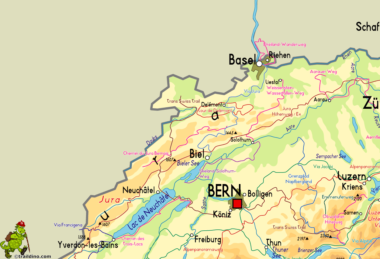
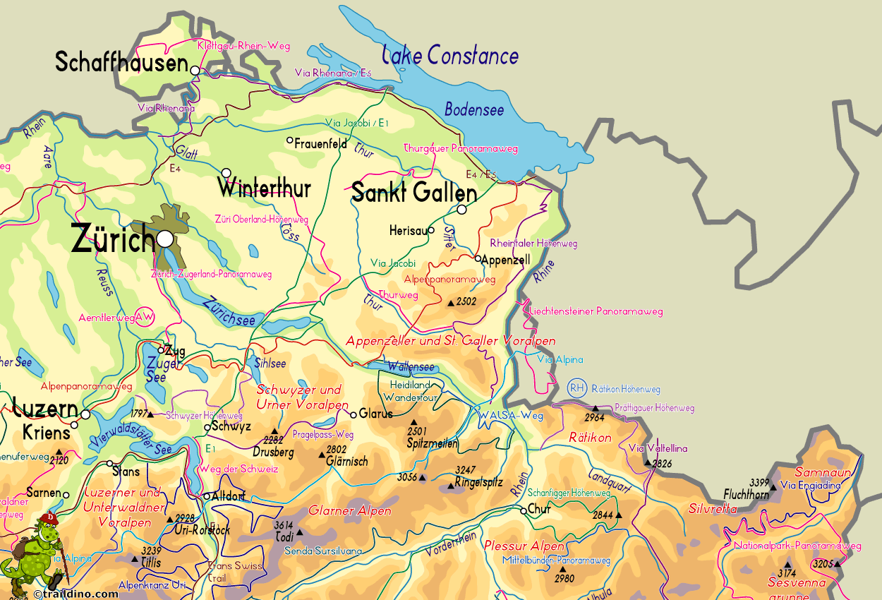
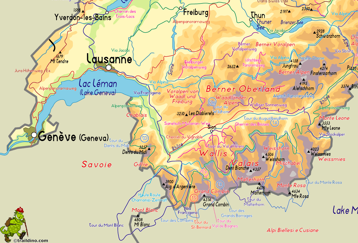
There are 6 official national long distance hiking trails, and 53 regional long distance trails. This number is growing. European long distance trail E1, E2 (small tip), E4 and E5 pass through Switzerland, coinciding with national trails. The Swiss Alps are literally strewn with more than 150 excellent mountain huts for hikers to stay overnight and have a meal. In the height of summer the huts in popular regions can get crowded. Given all the information available on the internet, in guide-books and on maps, you can easily plan your own hiking itinerary from hut to hut, combining day-hikes into a multi-day itinerary ranging from an easy hike with kids to crossing glaciers in full gear for the experienced mountaineer.
In addition, no other country in Europe is so completely neat and orderly as Switzerland. Truly everything is well-organized, from cable cars to accommodation, from trail maintenance to waymarking, from maps and guidebooks to around the clock alpine rescue from the air. The Swiss Alpine Club even boasts the world's most futuristic mountain hut, the dazzling New Monte Rosa Hut, to be opened late in 2009. If it were possible to order fine weather in advance, the Swiss would surely be the first to offer this service.
Opinions

- pc22
- Rate 9

- Robin Janssens
- Rate 9
Map
Trails
- Aargauer WegGPX
- Aletsch PanoramawegGPX
- Alpenkranz Uri
- Alpenpanorama-WegGPX
- AlpenpässewegGPX
- Ämtlerweg
- Berner Voralpenweg
- Bodensee RundwegGPX
- Chemin des BissesGPX
- Chemin des Trois LacsGPX
- Chemin du Jura BernoisGPX
- Chemin du VignobleGPX
- DreiländerwegGPX
- E1GPX
- E4GPX
- E5GPX
- EmmenuferwegGPX
- Freiburger VoralpenwegGPX
- Furka HöhenwegGPX
- GR5GPX
- Grenzpfad NapfberglandGPX
- Haute Route Chamonix-ZermattGPX
- Höhenweg Zürich - Gotthard
- Heidiland Wandertour
- Hintere Gasse
- Jakobsweg Waldshut-Vézelay
- Jura HöhenwegGPX
- Kesch Trek
- Klettgau-Rhein-WegGPX
- Lötschberg PanoramawegGPX
- Mittelbünden Panoramaweg
- Nationalpark PanoramawegGPX
- Obwaldner HöhenwegGPX
- Pragelpass-WegGPX
- Prättigauer HöhenwegGPX
- Rätikon Höhenweg
- Rheintaler HöhenwegGPX
- Sanetsch Muveran WegGPX
- Santiago de Compostela Pilgrims WayGPX
- Schanfigger HöhenwegGPX
- Schwyzer HöhenwegGPX
- Seeland-Soloturn Weg
- Senda Segantini
- Senda SursilvanaGPX
- Sentiero CristallinaGPX
- Sentiero Lago di LuganoGPX
- Sentiero VerzascaGPX
- Thurgauer PanoramawegGPX
- Thurweg
- TMB - Tour du Mont BlancGPX
- Tour de Delémont
- Tour des CombinsGPX
- Tour des Dents du MidiGPX
- Tour des Grands Barrages
- Tour du Augstbordhorn
- Tour du Jungfrau
- Tour du MatterhornGPX
- Tour du Saint-BernardGPX
- Tour du Val de BagnesGPX
- Tour du WildhornGPX
- Tour Monte RosaGPX
- Tour Val d'HérensGPX
- Trans-Swiss TrailGPX
- Via AlpinaGPX
- Via EngiadinaGPX
- Via FrancigenaGPX
- Via GebennensisGPX
- Via JacobiGPX
- Via Jura
- Via Jura Regio
- Via RhenanaGPX
- Via SbrinzGPX
- Via SplugaGPX
- Via StockalperGPX
- Via ValtellinaGPX
- Walliser SonnenwegGPX
- WALSA-wegGPX
- WalserwegGPX
- Weg der SchweizGPX
- Weissenstein-Wasserfallen Weg
- Züri Oberland HöhenwegGPX
- Zürich-Zugerland PanoramawegGPX
Regions
- Adula Alpen
- Albula Alpen
- Alpi di Livigno
- Alps
- Appenzeller und St. Galler Voralpen
- Bergell
- Berner Alpen
- Berner Oberland
- Berner Voralpen
- Bernina
- Bodensee
- Chablais
- Diablerets
- Engadin
- Giffre
- Glarner Alpen
- Grand Combin
- Graubünden
- Gruyère
- Jura
- Lac Léman
- Lago Maggiore
- Luzerner und Unterwaldner Voralpen
- Matterhorn
- Mischabel
- Mont Blanc
- Monte Leone
- Monte Rosa
- Ortler
- Platta Gruppe
- Plessur Alpen
- Prättigau
- Prealpi Luganesi
- Rätikon
- Samnaun
- Schwyzer und Urner Voralpen
- Sesvenna Gruppe
- Silvretta
- Surselva
- Ticino
- Urner Alpen
- Vierwaldstätter See
- Voralpen von Waadt und Freiburg
- Waadtländer Alpen
- Wallis
- Weisshorn
- Weissmies
- Zürichsee
Mountains
- Albis
- Aletschhorn
- Allalinhorn
- Alperschällihorn
- Alphubel
- Altmann
- Aubrig
- Bachtel
- Badus
- Balmhorn
- Bös Fulen
- Bietschhorn
- Bifertenstock
- Blüemlisalp
- Breithorn
- Breithorn VS
- Brienzer Rothorn
- Brisi
- Bruschghorn
- Burgfeldstand
- Castor
- Chöpfenberg
- Clariden
- Dammastock
- Dent Blanche
- Dents du Midi
- Dirruhorn
- Doldenhorn
- Dom
- Dreiländerspitze
- Dufourspitze
- Eiger
- Finsteraarhorn
- Gäbris
- Glärnisch
- Grand Combin
- Gross Schärhorn
- Gross Windgällen
- Gspaltenhorn
- Haldensteiner Calanda
- Hausstock
- Hüser
- Hinterrugg
- Hochflue (Rigi)
- Hochwang
- Hoh Brisen
- Hohgant
- Hundwiler Höhi
- Jungfrau
- Kleiner Mythen
- Kronberg
- Lagginhorn
- Lägern
- Les Diablerets
- Liskamm
- Ludwigshöhe
- Matterhorn
- Mönch
- Mürtschenstock
- Moleson
- Monte Basòdino
- Monte Generoso
- Monte Leone
- Monte San Giorgio
- Monte San Salvatore
- Monte Tamaro
- Morgenberghorn
- Mythen, Grosser
- Nadelhorn
- Napf
- Nesthorn
- Niederbauen Chulm
- Niesen
- Oberalpstock
- Ortstock
- Parrotspitze
- Pfannenstiel
- Pilatus
- Piz Bernina
- Piz Beverin
- Piz Buin
- Piz Caschleglia
- Piz Curvér
- Piz Daint
- Piz Ela
- Piz Fess
- Piz Forbesch
- Piz Mitgel
- Piz Morteratsch
- Piz Roseg
- Piz Segnas
- Piz Surlej
- Piz Terri
- Piz Toissa
- Piz Zupò
- Pizzo Campo Tencia
- Pizzo Tambo
- Rautispitz
- Regitzer Spitz
- Rheinwaldhorn
- Rienzenstock
- Rigi-Kulm
- Rinderhorn
- Rossberg
- Säntis
- Schilthorn
- Schrattenfluh
- Schreckhorn
- Signalkuppe
- Sigriswiler Rothorn
- Six Madun
- Speer
- Stanserhorn
- Stockhorn
- Sustenhorn
- Täschhorn
- Tödi
- Tinzenhorn
- Titlis
- Tomlishorn
- Tour Sallière
- Tweralpspitz
- Vanil Noir
- Wasenhorn
- Weisshorn
- Weissmies
- Wildhorn
- Wildstrubel
- Wissigstock
- Zinalrothorn
- Zumsteinspitze
Links
Facts
- Wandersite (German)
Private website by Ursula Brem, with loads of information and links on hiking in Switzerland. Some info in English. Don't get fooled by the somewhat outdated design: the information is usually up to date and very thorough. By the way, the shoes in the picture on the homepage are not Ursula's.....
- Swiss Panorama
Multilingual website and club dedicated to hiking, although mostly day-hikes. Some nice maps and info on accommodation.
Reports
- Hiking and Mountains [hikr.org]
Terrific website where everybody is invited to drop their own hiking reports. Great content, sublime interface, sympathetic people. The site mainly evolves around short walks and climbs in the Alpine countries, but trips from anywhere in the world can be found here.
- Tourenbeschreibungen: Bergtouren Hochtouren Klettersteige Klettertouren Mountainbiketouren Schneeschuhtouren Skitouren Tourenplanung Trekking (German)
A search engine for hiking reports. The main focus is on the Alps.
- www.GipfelStuermerin.de (German)
"Gipfelstürmerin" will keep you awake with her trail reports of Alpine high routes.
- Magic Mountainzones (German)
Well-written and designed blog about "Magic" life in the (Italian speaking) Alps.
- www.noth.ch: Hiking
Good page, describing many day hikes to huts and over passes, with good pictures.
Guides and maps
- Hiking in Switzerland
Interactive map showing a multitude of national, regional and even local hiking trails.
Lodging
- Swiss Alpine Club Huts
Multilingual website by the SAC, with detailed info on all SAC mountain huts.
Organisations
- Schweizer Wanderwege (German)
The organisation that - in cooperation with local hiking organisations - maintains and documents the (long distance) hiking trails in Switzerland. Schweizer Wanderwege is member of the European Ramblers' Association.
- Swiss Alpine Club
Multilingual website of the Swiss Alpine Club (SAC).
- Schweizer Wanderwege (German)
Website of the Swiss national association for maintenance of hiking trails. Also has a French version. Offers mostly general info, on types of hiking trails and markings, and addresses of 'kantonal' (regional) hiking trail maintenance organisations.
Tour operators
GPS
Other
- www.gipfelbuch.ch (German)
Portal for hikers and climbers in the (mainly German speaking) Alps, where users leave their own experience. Browse this if you plan an ascent yourself.
Books

United Kingdom
- Wandertagebuch Sachsische Schweiz
- Erinnerungsalbum zur Sachsischen Schweiz Read more

United Kingdom
- Cortina D'Ampezzo / Three Peaks 2012
- Tofane, Hohe Gaisl, Marmarole. Wanderwege, Radwanderwege, Nordic Walking, Skilanglauf, Skitouren Kümmerly und Frey Italien Outdoorkarte. 1. Auflage, Laufzeit bis 2016. Read more
- Also available from:
- De Zwerver, Netherlands

Netherlands
- Wandelkaart 06 Outdoorkarte IT Cortina d'Ampezzo - Drei Zinnen | Kümmerly & Frey
- Tofane, Hohe Gaisl, Marmarole. Wanderwege, Radwanderwege, Nordic Walking, Skilanglauf, Skitouren Kümmerly und Frey Italien Outdoorkarte. 1. Auflage, Laufzeit bis 2016. Read more

United Kingdom
- Wandern in der Sächsischen Schweiz
- Wandertagebuch Sächsische Schweiz Read more

United Kingdom
- Schweiz Reisefuhrer I love Switzerland
- Schweiz Reisefuhrer Bahn, Reisefuhrer Schweiz, Schweizer Schokolade, Zurich Reisefuhrer, Bern Reisefuhrer, Basel, Genf, Luzern, Lausanne Reisefuhrer Read more

United Kingdom
- Kiel - Ploner See 2012
- Wandern, Rad, Reiten. Kieler Förde, Malente, Eutin Kümmerly und Frey Deutschland Outdoorkarte. 1. Auflage Laufzeit bis 2015. Read more
- Also available from:
- Stanfords, United Kingdom
- De Zwerver, Netherlands

United Kingdom
- Kiel - Großer Plöner See 50K Kümmerly + Frey Map No. 10
- Kiel and Lake Plöner, the largest lake in Schleswig-Holstein, at 1:50,000 from Kümmerly+Frey in a series GPS compatible, double-sided maps printed on durable, waterproof and tear-resistant plastic paper; contoured, with hiking and cycle routes, other recreational activities, etc.Maps in this series are at a scale of either 1:50,000 or 1:35,000.... Read more

Netherlands
- Wandelkaart 10 Outdoorkarte Kiel - Plöner See | Kümmerly & Frey
- Wandern, Rad, Reiten. Kieler Förde, Malente, Eutin Kümmerly und Frey Deutschland Outdoorkarte. 1. Auflage Laufzeit bis 2015. Read more

United Kingdom
- Wandern in der Sächsischen Schweiz
- Meine schönsten Wandertouren Read more

United Kingdom
- Wandern in der Sächsischen Schweiz
- Meine schönsten Wanderungen Read more

United Kingdom
- Wandertagebuch Sächsische Schweiz
- Meine schönsten Wanderungen Read more

United Kingdom
- Sachsische und Boehmische Schweiz
- Infos zur Reisevorbereitung Read more

United Kingdom
- Baselland 9 2015
- Karten, Tourenführer, Fotos, waterproof, Höhenprofile, Zeitangaben, Restaurants, Autobusse Mit kostenlosem Download für Ihr Smartphone Hallwag Touren-Wanderkarten. 1. Auflage, Laufzeit bis 2019. Read more
- Also available from:
- Stanfords, United Kingdom

United Kingdom
- Baselland - Wasserfallen
- 33 specially selected hiking trails in the Baselland – Wasserfallen area of north-western Switzerland between Basel and Olten, presented at 1:50,000 on a waterproof and tear-resistant, contoured and GPS compatible map from the Hallwag/Kümmerly + Frey group, with route profiles, grading for the severity of the terrain and the degree of fitness... Read more

United Kingdom
- Wandertagebuch Sächsische Schweiz
- Die Sächsische Schweiz erleben Read more
Maps

United Kingdom
- Frankische Schweiz 2017
- Fränkische Schweiz region of the Franconian Jura in northern Bavaria at 1:35,000 from Kümmerly+Frey in a series GPS compatible, double-sided maps printed on durable, waterproof and tear-resistant plastic paper; contoured, with hiking and cycle routes, other recreational activities, etc.Maps in this series are at a scale of either 1:50,000 or... Read more
- Also available from:
- Stanfords, United Kingdom
- De Zwerver, Netherlands

United Kingdom
- Fränkische Schweiz K+F Outdoor Map 37
- Fränkische Schweiz region of the Franconian Jura in northern Bavaria at 1:35,000 from Kümmerly+Frey in a series GPS compatible, double-sided maps printed on durable, waterproof and tear-resistant plastic paper; contoured, with hiking and cycle routes, other recreational activities, etc.Maps in this series are at a scale of either 1:50,000 or... Read more

Netherlands
- Wandelkaart 37 Outdoorkarte Fränkische Schweiz | Kümmerly & Frey
- Fränkische Schweiz region of the Franconian Jura in northern Bavaria at 1:35,000 from Kümmerly+Frey in a series GPS compatible, double-sided maps printed on durable, waterproof and tear-resistant plastic paper; contoured, with hiking and cycle routes, other recreational activities, etc.Maps in this series are at a scale of either 1:50,000 or... Read more

United Kingdom
- Vierwaldstattersee 11 2016
- Zeer duidelijke wandelkaart van een deel van Zwitserland. Deze kaart - gemaakt op scheur en watervast papier - is bedoeld voor de gewone en gemiddelde bergwandelaar. Ook voor huttentochten is deze zeker geschikt. Slechts voor de gevorderde wandelaar die gletsjers gaat overschrijden zijn de 25.000 topografische kaarten aan te raden. Op deze... Read more
- Also available from:
- De Zwerver, Netherlands

Netherlands
- Wandelkaart 11 Vierwaldstättersee | Kümmerly & Frey
- Zeer duidelijke wandelkaart van een deel van Zwitserland. Deze kaart - gemaakt op scheur en watervast papier - is bedoeld voor de gewone en gemiddelde bergwandelaar. Ook voor huttentochten is deze zeker geschikt. Slechts voor de gevorderde wandelaar die gletsjers gaat overschrijden zijn de 25.000 topografische kaarten aan te raden. Op deze... Read more

United Kingdom
- Arosa - Davos 2013
- Een nieuwe serie van de Zwitserse topografische dienst: eindelijk goede wandelkaarten met ingetekende wandelroutes op scheur- en watervast papier. Vooralsnog zijn ze uitgebracht van de populaire wandelgebieden en niet landelijk dekkend (zie overzicht) Op een gedetailleerde schaal van 1:33.333 met als ondergrond de onovertroffen topografische... Read more
- Also available from:
- Stanfords, United Kingdom
- De Zwerver, Netherlands

United Kingdom
- Arosa - Davos Swisstopo Hiking 3309T
- Arosa - Davos area at 1:33,333 on light, waterproof and tear-resistant map No. 3309T published by Swisstopo in cooperation with the Swiss Hiking Federation. Cartography is the same as in Swisstopo’s 50K hiking maps, simply enlarged to 1:33,333 for extra clarity but without additional information. Coverage includes Klosters, Lenzerheide/Lei and... Read more

Netherlands
- Wandelkaart - Topografische kaart 3309T Arosa - Davos | Swisstopo
- Een nieuwe serie van de Zwitserse topografische dienst: eindelijk goede wandelkaarten met ingetekende wandelroutes op scheur- en watervast papier. Vooralsnog zijn ze uitgebracht van de populaire wandelgebieden en niet landelijk dekkend (zie overzicht) Op een gedetailleerde schaal van 1:33.333 met als ondergrond de onovertroffen topografische... Read more

United Kingdom
- Valsertal 2008
- Valsertal at 1:50,000 in a series from Hallwag covering Switzerland Read more

United Kingdom
- Basel / Aarau 4 2015
- KuF Schweiz Wanderkarte 04. Basel - Aarau / Basel-Landschaft - Olten ab 26.8 EURO Sehenswürdigkeiten. Unterkunft und Verpflegung. Autobuslinien mit Haltestellen. GPS. Neu mit Index Kümmerly und Frey Schweiz Wanderkarte Schweizer Wanderkarten. Laufzeit 99/2019 Read more
- Also available from:
- De Zwerver, Netherlands

Netherlands
- Wandelkaart 04 Basel - Bazel - Olten - Aarau, Zwitserse Jura | Kümmerly & Frey
- KuF Schweiz Wanderkarte 04. Basel - Aarau / Basel-Landschaft - Olten ab 26.8 EURO Sehenswürdigkeiten. Unterkunft und Verpflegung. Autobuslinien mit Haltestellen. GPS. Neu mit Index Kümmerly und Frey Schweiz Wanderkarte Schweizer Wanderkarten. Laufzeit 99/2019 Read more

United Kingdom
- Safiental - Lenzerheide 2013
- Een nieuwe serie van de Zwitserse topografische dienst: eindelijk goede wandelkaarten met ingetekende wandelroutes op scheur- en watervast papier. Vooralsnog zijn ze uitgebracht van de populaire wandelgebieden en niet landelijk dekkend (zie overzicht) Op een gedetailleerde schaal van 1:33.333 met als ondergrond de onovertroffen topografische... Read more
- Also available from:
- Stanfords, United Kingdom
- De Zwerver, Netherlands

United Kingdom
- Safiental - Lenzerheide Swisstopo Hiking 3310T
- Safiental - Lenzerheide area at 1:33,333 on light, waterproof and tear-resistant map No. 3310T published by Swisstopo in cooperation with the Swiss Hiking Federation. Cartography is the same as in Swisstopo’s 50K hiking maps, simply enlarged to 1:33,333 for extra clarity but without additional information. Coverage extends from Chur in the... Read more

Netherlands
- Wandelkaart - Topografische kaart 3310T Safiental - Lenzerheide | Swisstopo
- Een nieuwe serie van de Zwitserse topografische dienst: eindelijk goede wandelkaarten met ingetekende wandelroutes op scheur- en watervast papier. Vooralsnog zijn ze uitgebracht van de populaire wandelgebieden en niet landelijk dekkend (zie overzicht) Op een gedetailleerde schaal van 1:33.333 met als ondergrond de onovertroffen topografische... Read more

United Kingdom
- Craens - Montana 2013
- Een nieuwe serie van de Zwitserse topografische dienst: eindelijk goede wandelkaarten met ingetekende wandelroutes op scheur- en watervast papier. Vooralsnog zijn ze uitgebracht van de populaire wandelgebieden en niet landelijk dekkend (zie overzicht) Op een gedetailleerde schaal van 1:33.333 met als ondergrond de onovertroffen topografische... Read more
- Also available from:
- Stanfords, United Kingdom
- De Zwerver, Netherlands

United Kingdom
- Crans-Montana - Leukerbad - Val d`Anniviers - Zinal Swisstopo Hiking 3305T
- Crans-Montana - Leukerbad - Val d’Anniviers - Zinal area at 1:33,333 on light, waterproof and tear-resistant map No. 3305T published by Swisstopo in cooperation with the Swiss Hiking Federation. Cartography is the same as in Swisstopo’s 50K hiking maps, simply enlarged to 1:33,333 for extra clarity but without additional information. With... Read more

Netherlands
- Wandelkaart - Topografische kaart 3305T Crans-Montana | Swisstopo
- Een nieuwe serie van de Zwitserse topografische dienst: eindelijk goede wandelkaarten met ingetekende wandelroutes op scheur- en watervast papier. Vooralsnog zijn ze uitgebracht van de populaire wandelgebieden en niet landelijk dekkend (zie overzicht) Op een gedetailleerde schaal van 1:33.333 met als ondergrond de onovertroffen topografische... Read more

United Kingdom
- Creux du Van 2013
- Een nieuwe serie van de Zwitserse topografische dienst: eindelijk goede wandelkaarten met ingetekende wandelroutes op scheur- en watervast papier. Vooralsnog zijn ze uitgebracht van de populaire wandelgebieden en niet landelijk dekkend (zie overzicht) Op een gedetailleerde schaal van 1:33.333 met als ondergrond de onovertroffen topografische... Read more
- Also available from:
- Stanfords, United Kingdom
- De Zwerver, Netherlands

United Kingdom
- Creux du Van - Ste Croix - Val de Travers - Gorges de l`Areuse Swisstopo Hiking 3303T
- Creux du Van - Ste-Croix - Val de Travers - Geoges de l’Areuse area of the Swiss Jura at 1:33,333 on light, waterproof and tear-resistant map No. 3303T published by Swisstopo in cooperation with the Swiss Hiking Federation. Cartography is the same as in Swisstopo’s 50K hiking maps, simply enlarged to 1:33,333 for extra clarity but without... Read more

Netherlands
- Wandelkaart - Topografische kaart 3303T Creux du Van | Swisstopo
- Een nieuwe serie van de Zwitserse topografische dienst: eindelijk goede wandelkaarten met ingetekende wandelroutes op scheur- en watervast papier. Vooralsnog zijn ze uitgebracht van de populaire wandelgebieden en niet landelijk dekkend (zie overzicht) Op een gedetailleerde schaal van 1:33.333 met als ondergrond de onovertroffen topografische... Read more

United Kingdom
- Franches-Montagnes 2009
- Franches-Montagnes area of the Swiss Jura at 1:50,000 in a series from Hallwag covering Switzerland Read more

United Kingdom
- Lotschental 2013
- Map No. 2527, Lötschental, in the topographic survey of Switzerland at 1:25,000 from Swisstopo, covering the peaks and the valley north of the Rhone between Leuk and Visp. Swiss topographic survey at 1:25,000 covers the whole country on 247 small format sheets, with special larger maps published for popular regions including some titles now... Read more
- Also available from:
- Stanfords, United Kingdom
- De Zwerver, Netherlands

United Kingdom
- Lötschental Swisstopo 2527
- Map No. 2527, Lötschental, in the topographic survey of Switzerland at 1:25,000 from Swisstopo, covering the peaks and the valley north of the Rhone between Leuk and Visp. Swiss topographic survey at 1:25,000 covers the whole country on 247 small format sheets, with special larger maps published for popular regions including some titles now... Read more

Netherlands
- Wandelkaart - Topografische kaart 2527 Lötschental | Swisstopo
- Map No. 2527, Lötschental, in the topographic survey of Switzerland at 1:25,000 from Swisstopo, covering the peaks and the valley north of the Rhone between Leuk and Visp. Swiss topographic survey at 1:25,000 covers the whole country on 247 small format sheets, with special larger maps published for popular regions including some titles now... Read more

United Kingdom
- Zurich 2017
- Zürich Wanderkarte 1:60 000 Nr. 06 ab 26.8 EURO Free Map on Smartphone included! Kümmerly und Frey Schweiz Wanderkarte Schweizer Wanderkarten. 5. Auflage, Laufzeit bis 2021 Read more
- Also available from:
- De Zwerver, Netherlands

Netherlands
- Wandelkaart 06 Zürich - Zurich | Kümmerly & Frey
- Zürich Wanderkarte 1:60 000 Nr. 06 ab 26.8 EURO Free Map on Smartphone included! Kümmerly und Frey Schweiz Wanderkarte Schweizer Wanderkarten. 5. Auflage, Laufzeit bis 2021 Read more

United Kingdom
- Chasseral - Vue des Alpes 2014
- Een nieuwe serie van de Zwitserse topografische dienst: eindelijk goede wandelkaarten met ingetekende wandelroutes op scheur- en watervast papier. Vooralsnog zijn ze uitgebracht van de populaire wandelgebieden en niet landelijk dekkend (zie overzicht) Op een gedetailleerde schaal van 1:33.333 met als ondergrond de onovertroffen topografische... Read more
- Also available from:
- Stanfords, United Kingdom
- De Zwerver, Netherlands

United Kingdom
- Chasseral - Vue des Alpes Swisstopo Hiking 3315T
- Chasseral - Vue des Alpes area at 1:33,333 on light, waterproof and tear-resistant map No. 3315T published by Swisstopo in cooperation with the Swiss Hiking Federation. Cartography is the same as in Swisstopo’s 50K hiking maps, simply enlarged to 1:33,333 for extra clarity but without additional information. 1:33,333 editions of Swisstopo’s... Read more

Netherlands
- Wandelkaart - Topografische kaart 3315T Chasseral - Vue des Alpes | Swisstopo
- Een nieuwe serie van de Zwitserse topografische dienst: eindelijk goede wandelkaarten met ingetekende wandelroutes op scheur- en watervast papier. Vooralsnog zijn ze uitgebracht van de populaire wandelgebieden en niet landelijk dekkend (zie overzicht) Op een gedetailleerde schaal van 1:33.333 met als ondergrond de onovertroffen topografische... Read more

United Kingdom
- Lotschental - Aletschgebiet 2015
- Lotschental – Aletschgebiet area of the Bernese Oberland at 1:33,333 on light, waterproof and tear-resistant map No. 3324T published by Swisstopo in cooperation with the Swiss Hiking Federation. Cartography is the same as in Swisstopo’s 50K hiking maps, simply enlarged to 1:33,333 for extra clarity but without additional information. The title... Read more
- Also available from:
- Stanfords, United Kingdom
- De Zwerver, Netherlands

United Kingdom
- Lotschental - Aletschgebiet 33K Swisstopo Hiking 3324T
- Lotschental – Aletschgebiet area of the Bernese Oberland at 1:33,333 on light, waterproof and tear-resistant map No. 3324T published by Swisstopo in cooperation with the Swiss Hiking Federation. Cartography is the same as in Swisstopo’s 50K hiking maps, simply enlarged to 1:33,333 for extra clarity but without additional information. The title... Read more

Netherlands
- Wandelkaart - Topografische kaart 3324T Lötschental - Aletschgebiet | Swisstopo
- Lotschental – Aletschgebiet area of the Bernese Oberland at 1:33,333 on light, waterproof and tear-resistant map No. 3324T published by Swisstopo in cooperation with the Swiss Hiking Federation. Cartography is the same as in Swisstopo’s 50K hiking maps, simply enlarged to 1:33,333 for extra clarity but without additional information. The title... Read more

United Kingdom
- Hoch-Ybrig 2014
- Een nieuwe serie van de Zwitserse topografische dienst: eindelijk goede wandelkaarten met ingetekende wandelroutes op scheur- en watervast papier. Vooralsnog zijn ze uitgebracht van de populaire wandelgebieden en niet landelijk dekkend (zie overzicht) Op een gedetailleerde schaal van 1:33.333 met als ondergrond de onovertroffen topografische... Read more
- Also available from:
- Stanfords, United Kingdom
- De Zwerver, Netherlands

United Kingdom
- Hoch-Ybrig Swisstopo Hiking 3312T
- Hoch-Ybrig area at 1:33,333 on light, waterproof and tear-resistant map No. 3312T published by Swisstopo in cooperation with the Swiss Hiking Federation. Cartography is the same as in Swisstopo’s 50K hiking maps, simply enlarged to 1:33,333 for extra clarity but without additional information.1:33,333 editions of Swisstopo’s hiking maps have... Read more

Netherlands
- Wandelkaart - Topografische kaart 3312T Hoch-Ybrig | Swisstopo
- Een nieuwe serie van de Zwitserse topografische dienst: eindelijk goede wandelkaarten met ingetekende wandelroutes op scheur- en watervast papier. Vooralsnog zijn ze uitgebracht van de populaire wandelgebieden en niet landelijk dekkend (zie overzicht) Op een gedetailleerde schaal van 1:33.333 met als ondergrond de onovertroffen topografische... Read more

United Kingdom
- Chateau-d'Oex 2013
- Een nieuwe serie van de Zwitserse topografische dienst: eindelijk goede wandelkaarten met ingetekende wandelroutes op scheur- en watervast papier. Vooralsnog zijn ze uitgebracht van de populaire wandelgebieden en niet landelijk dekkend (zie overzicht) Op een gedetailleerde schaal van 1:33.333 met als ondergrond de onovertroffen topografische... Read more
- Also available from:
- Stanfords, United Kingdom
- De Zwerver, Netherlands

United Kingdom
- Château-d‘Oex - Montreux - Rochers de Naye - Saanen Swisstopo Hiking 3302T
- Château-d‘Oex - Montreux - Rochers de Naye - Saanen area at 1:33,333 on light, waterproof and tear-resistant map No. 3302T published by Swisstopo in cooperation with the Swiss Hiking Federation. Cartography is the same as in Swisstopo’s 50K hiking maps, simply enlarged to 1:33,333 for extra clarity but without additional information. Coverage... Read more

Netherlands
- Wandelkaart - Topografische kaart 3302T Château d'Oex | Swisstopo
- Een nieuwe serie van de Zwitserse topografische dienst: eindelijk goede wandelkaarten met ingetekende wandelroutes op scheur- en watervast papier. Vooralsnog zijn ze uitgebracht van de populaire wandelgebieden en niet landelijk dekkend (zie overzicht) Op een gedetailleerde schaal van 1:33.333 met als ondergrond de onovertroffen topografische... Read more
Walking holidays
Netherlands
- Zwitserland - Jungfrau
- Bergwandelvakantie vanuit Wengen, aan de voet van het beroemdste bergtrio van Zwitserland: Jungfrau, Mönch en Eiger. Wandel door een van de fraaiste berglandschappen van Europa. Laat je per trein, seilbahn en tandradbaan naar de mooiste plekken brengen, zoals het Jungfraujoch, het hoogstgelegen treinstation van Europa. Verblijf in een charmant... Read more
- Also available from:
- Snp Wandelreizen, Netherlands
Netherlands
- Zwitserland - Jungfrau
- Lichte bergwandelvakantie vanuit Wengen, aan de voet van het beroemdste bergtrio van Zwitserland: Jungfrau, Mönch en Eiger. Wandel door een van de fraaiste berglandschappen van Europa. Laat je per trein, seilbahn en tandradbaan naar de mooiste plekken brengen, zoals het Jungfraujoch, het hoogstgelegen treinstation van Europa. Verblijf in een... Read more
Netherlands
- Italië - Aosta - Val del Lys
- Ten zuiden van de beroemde Monte Rosa doezelt een veel minder beroemde vallei in de zomerzon. Trek te voet door de stille, ongerepte Val de Lys. Deze wandelvakantie in Aosta biedt de perfecte combinatie van pittige bergwandelingen en zeer comfortabele onderkomens. Overdag maak je schitterende tochten over de almen en langs vredige bergdorpjes.... Read more
Netherlands
- Zwitserland - Braunwald
- U bent een week te gast in een zeer rustig gelegen en gastvrij familiehotel met prachtig uitzicht over het kanton Glarus. Er is een aantal zeer gevarieerde, niet al te zware, wandelingen voor u uitgezet door het parkachtige landschap rond het autovrije dorp Braunwald, dat een uitbundige bloemenpracht en schitterende herfstkleuren kent. De... Read more
Netherlands
- Zwitserland - Engadin Guarda
- Te gast in het fraaie, authentieke Ladiner bergdorp Guarda en een week lang bergwandelen in de uitlopers van de Silvretta en het Zwitsers Nationaal Park. Langs hooilanden en over almen, door dennen- en sparrenbossen en af en toe een bergtop. Regelmatig met de Rhätische Bahn en de Postbus door een gevarieerd en ongeëvenaard Alpenlandschap. Read more
Netherlands
- Duitsland - Bodensee
- Fietsen langs de Bodensee: een onvervalste fietsklassieker over de goed bewegwijzerde fietsroute door drie Alpenlanden. Tijdens deze fietsvakantie is het optimaal genieten langs het natuurpark Rijndelta, het bloemeneiland Mainau en de historische steden Lindau en Bregenz. Volg over stille wegen de oevers de Bodensee (een van Europa’s grootste... Read more
Netherlands
- Duitsland - Oost-Duitsland
- Tijdens deze wandelvakantie in de voormalige DDR rijd je met je eigen auto langs drie Nationale Parken: Sächsische Schweiz, het Thüringer Wald met Hainich en de Harz. Overal zijn heerlijke rondwandelingen uitgezet en bovendien ontdek je nog de nodige sporen uit de oude DDR-tijd. Je begint de reis iets voorbij Dresden in de Sächsische Schweiz.... Read more
Netherlands
- Italië - Südtirol - Meraner Höhenweg
- Hoog boven het sfeervolle stadje Merano in Südtirol loopt een schitterende wandelroute rond het ruige Texel bergmassief. Onderweg passeer je kleine bergdorpjes, woeste watervallen, hooiende bergboeren, stille bossen, steile kloven en uitnodigende terrasjes. Al wandelend kijk je van grote hoogte neer op het cultuurlandschap in het Vinschgau, de... Read more
Netherlands
- Groot-Brittannië - Schotland - Islandhopping
- Verken de zuidwestelijke Schotse eilanden per fiets! Rustige en zacht glooiende weggetjes leiden je over de eilanden Arran, Islay, Jura en Colonsay. Proef de unieke sfeer van deze eilanden die elk hun eigen karakter hebben. Arran is met zijn heidevelden en hoge toppen een soort Schotland-in-het-klein, Islay is beroemd vanwege zijn whisky’s,... Read more
Netherlands
- Frankrijk - Haute Savoie
- De GR5 is de roemruchte, meer dan 2000 km lange wandelroute van Hoek-van-Holland naar Nice. SNP gaat de komende jaren het spectaculairste stuk GR5 van het Meer van Genève door de ruige Franse Alpen naar Nice aanbieden in 4 etappes. Etappe 1 loopt van Evian-les-Bains naar de Mont-Blanc. Je overnacht om en om in een sfeervol berghotelletje en een... Read more
- Also available from:
- Snp Wandelreizen, Netherlands
Netherlands
- Frankrijk - Haute Savoie
- Volg de Tour du Mont Blanc door Frankrijk, Italië en Zwitserland en pik van elke cultuur wat mee. Het uitzicht is steeds indrukwekkend en tijdens deze trektocht op grote hoogte loop je over goede paden door ruig terrein, vaak dicht onderlangs de vele gletsjers van het massief. Aan de Italiaanse kant kom je door het sfeervolle centrum van... Read more
Netherlands
- Zwitserland - Binntal
- Vanuit het rustieke pension Albrun maakt u fraaie dagwandelingen door het stille, geïsoleerde Binntal in Wallis. Deze ruige en nauwelijks door mensenhanden beïnvloede bergwereld van Wallis is beroemd om zijn grote rijkdom aan mineralen en bergbloemen. De 5-daagse basisreis kunt u naar keuze verlengen. Read more
Netherlands
- Zwitserland - Kesch Trek
- Steenbokken, alpenmarmotten, schilderachtige Walliser nederzettingen en zeer mooie Zwitserse bergpanorama’s. Dat zijn de ingredienten van deze nieuwe huttentrektocht in Graubünden. Je wandelt van Davos naar St. Moritz en overnacht in bijzonder gelegen berghutten, zoals de Kesch Hut (2625 m). Je wandelt door het Sertigdal en klimt over de... Read more
Netherlands
- Zwitserland - Aletsch
- De Zwitserse Aletschgletsjer is zonder twijfel de indrukwekkendste gletsjer van Europa. Vanuit het hooggelegen en autovrije dorpje Bettmeralp in Wallis verken je, met behulp van enkele liften en bergbanen, op relatief eenvoudige wijze dit overweldigende gebied. Je onderkomen is het comfortabele Hotel Bettmerhof. De gastvrije familie Eyholzer... Read more
Netherlands
- Italië - Aosta - Tour du Mont Fallère
- Heerlijke korte huttentocht tussen het Val d'Aosta en de Grote Sint Bernhard. Wandel met schitterend uitzicht op Matterhorn, Gran Paradiso en Mont Blanc. Volg de perfect gemarkeerde route door groene almweiden met besneeuwde Alpenreuzen als behang. Verblijf in 2 prachtige berghutten, met heerlijk eten en sluit af in het middeleeuwse bergdorp... Read more
Forum

- lkjhg87 2020-06-12 03:49:46
Buy fast weight loss pills from easylooseweight.com
Buy weight loss pills from easylooseweight.com
https://easylooseweight.com/
People gain weight by consuming more energy than they burn, so consuming fewer calories, or energy, can help. however,Being overweight or obese can lead to a range of health problems. Although many different medications are available, a balanced lifestyle and nutritious diet are the key to healthful living and better weight control. our online shop(easylooseweight.com) has the best and fast weight loss pills in the market. Our medications are effective with little or no exercise. It cuts calories within a day and you can lose 30Ibs in a week.
https://easylooseweight.com/
IFA Lose Mazindol 2mg 30 Capsules/Box,
Asenlix,Benturex 30mg/30 capsules,Benture

- viginius65 2020-06-09 14:44:40
Buy fast weight loss pills from easylooseweight.com
- buy fast weight loss pills from easyloseweight.com
https://easylooseweight.com/
IFA Lose Mazindol 2mg 30 Capsules/Box,
Asenlix,Benturex 30mg/30 capsules,Benturex 30mg/30 capsules,Ezbencx Clobenzorex 30mg/60mg Caps,Itravil clobenzorex (AP/IFA) 60mg/30mg,Obeclox c(Phentermine),Phentermine,Acxion Fentermina(phentermine) 30mg,Adipex-75 (Phentermine),Adipex-P 37.5 (Phentermine),Buy Contrave 8mg/90mg online,buy Leptitox online (60 Count),DISEBSIN TERFAMEX PHENTERMINE 30 CAPS,ESBELCAPS FENPROPOREX 20 /6 Mg,Metformin,Mysimba(Contrave) Bupropion and Naltrexone,NOREX AMFEPRAMONE HYDROCHLORIDE 50 MG,Neobes Amfepramone,Saxenda (Liraglutide),Ozempic
call/text/whatsapp +19783310093
https://easylooseweight.com/shop/

- emputt 2016-02-16 01:35:28
Long distance hike in end of May/June?
- Hi there,
I am from the USA and am looking to do a long-distance hike in the end of May through early June, was thinking of doing about 21 days (give or take) and covering anywhere from 100-375km in that time (upper end would have to be an easier trail to cover the distance in my allotted time) and was initially looking into Europe (particularly Germany) but am really up to go anywhere in the world.
What I want from it:
- Stunning scenery - ideally GREEN landscape/rolling hills/mountains/forests to rivers to castles, etc etc.
- Scattered small villages along the trail (they don't have to be every night but maybe every 3 nights at least?)
- Not super overpopulated
Any help would be much appreciated! Thank you!!
Emily