Greece
Description
Greece is a famous beach destination, and many island hoppers like to go for a walk now and again. Most islands are quite suitable for hiking, and locally guides and maps are available giving good descriptions of trails. But the crowded summer season is hot and dry. April is a much better month for hiking, with all flowers in full bloom, and also May, although it will start to get busier. June is more quiet but very hot. The busy season then lasts until winter. Although common in the past, your chances of actually following in the footsteps of mules carrying their loads in the traditional manner are dim.
But there is more. If you've had enough of the island's oregano, you can head for the mainland Pindos Mountains in the province of Epirus, on the border with Albania. European long distance trail E6, running from west to east, leads right across the Pindos. In the wide expanse of forests and pastures you may cross tracks with a bear (see the picture of a bear track which caused the author to freeze with fear), or if not, then at least with one or two herdsmen smelling of the inevitable ewe's cheese. Smolikos is the highest peak, reaching up to 2637m. Walking season in the mountains is from May, when the mountain tops are still covered in snow, until mid October. Greek mountain ranges have been made increasingly accessible over the years thanks to over 100 mountain huts.
Make an effort, and find out Greece has almost twenty national trails, maintained by regional mountaineering clubs. European long distance trail E4 enters Northern Greece from Bulgaria, and runs south via Mount Olympus (2918m), highest mountain of Greece and pleasant abode of Zeus. If you plan to spend the night there yourself in July or August, make sure to reserve in advance. The trail then leads across the Peleponessos, leaving it in the south, and continues on the island of Crete. Crete of course is famous for its Samaria gorge, the longest in Europe. It is impossible to lose your way here, simply join the crowd.
The Internet is not yet a very good source of information on Greek hiking, but maps and guides are easy to find. More information can be obtained through the Hellenic Federation of Mountaineering and Climbing.
Opinions

- John P April 2019
- Rate 8
- Positive A mountainous country with plenty of good scenery, forests, high mountain pastures, olive groves and some very pleasant cafes in village squares beneath plane trees. As well as popular places like Mount Olympus and Crete, there are little visited beautiful areas in the north of Greece and in the Pindus mountains. Churches, monasteries and some archeological remains add cultural interest.
- Negative It can be very hot so best avoid the middle of summer, but if you go too early or too late snow prevents easy walking.

- pc22
- Rate 7
Trails
Regions
- Agatohonissi, Dodecanese
- Amorgos, Cyclades
- Anafi, Cyclades
- Andros, Cyclades
- Antiparos, Cyclades
- Arki, Dodecanese
- Astipalea, Dodecanese
- Corfu
- Crete
- Cyclades Islands
- Dodecanese Islands
- Donoussa, Cyclades
- Folegandros, Cyclades
- Fourni, Dodecanese
- Greek Islands
- Ikaria, Dodecanese
- Ionian Islands
- Ios, Cyclades
- Iraklia, Cyclades
- Kalymnos, Dodecanese
- Karpathos
- Kea, Cyclades
- Kefalonia
- Kimolos, Cyclades
- Kithnos, Cyclades
- Kos
- Koufonisi, Cyclades
- Leros, Dodecanese
- Lesbos
- Lipsi, Dodecanese
- Milos, Cyclades
- Naxos, Cyclades
- Paros, Cyclades
- Patmos, Dodecanese
- Paxos
- Peleponnese
- Peloponnesos
- Pindos Mountains
- Rhodos
- Samos, Dodecanese
- Santorini, Cyclades
- Schinoussa, Cyclades
- Serifos, Cyclades
- Sifnos, Cyclades
- Sikinos, Cyclades
- Syros, Cyclades
- Telendos, Dodecanese
- Thirassia, Cyclades
- Tinos, Cyclades
- Zakynthos
Links
Facts
- STO PEZOPORIA.GR - To site for hiking the trails of Greece. (Greek)
Probably you don't master Greek. Nor do we. But if you take the patience to work with Google Translate, this page will disclose a wealth of independent information on walking possibilities in Greece.
- Details of E4 and E6 in Greece
Under the "Mountains" tab details of E4, E6 and O trails in Greece can be found
- Εθνικά μονοπάτια - National trails (Greek)
In this short list you will find some clues regarding the E4 and E6 in Greece.
Reports
- Blog of walking E4 in Greece
Daily blog of walking length of E4 in Greece from Bulgarian border to Florina, Mount Olympus , Meteora, Pindus mountains, Peloponnese and Crete
Guides and maps
- topoguide.gr
A unique outdoor map of Greece, offering detailed description and very accurate data for hundreds of trails, MTB rides and other adventures.
- Website for E6 in Greece
This is an effort to map and document the trail. Currently the section from Kastoria to Vrontou (close to Seres) has been mapped. The site contains detailed description of sections and GPS tracks.
Lodging
Organisations
- Greek Federation of Mountaineering - Climbing (Greek)
This is the national organisation for Greece for hikers and climbers. THe EOOA is member of the European Ramblers' Association. Three European Long Distance Trails cross Greece: the E4 and E6, and the planned E12.
Tour operators
GPS
- HellasPath (Greek)
Website specialising on GPS hiking in Greece.
Other
Books
- Also available from:
- De Zwerver, Netherlands

Netherlands
2018
- Wandelgids Trekking in Greece - Griekenland | Cicerone
- Guidebook describing challenging treks in the mountains of Greece, traversing the Pindhos Range, near Athens, and the Peloponnese, plus a handful of shorter routes including Mount Olympus. The treks demand a high level of commitment and fitness due to their remoteness and difficult terrain, and boast stunning unspoilt scenery. Read more

United Kingdom
2015
- Kythnos Hiking Guide 2015
- Kythnos Hiking Guide by Terrain Editions, includes eleven walks into history, nature and the most interesting sights of Kythnos, one of the beautiful Cyclades islands in the Aegean sea. Explore Kythnos on foot, a small island boasting ninety sheltered bays, sixty exceptional sandy beaches, famous hot springs and a spa centre by the sea, nine... Read more
- Also available from:
- Stanfords, United Kingdom
- De Zwerver, Netherlands

United Kingdom
2015
- Kythnos Hiking Guide
- Kythnos Hiking Guide by Terrain Editions, includes eleven walks into history, nature and the most interesting sights of Kythnos, one of the beautiful Cyclades islands in the Aegean sea. Explore Kythnos on foot, a small island boasting ninety sheltered bays, sixty exceptional sandy beaches, famous hot springs and a spa centre by the sea, nine... Read more

Netherlands
2015
- Wandelgids Kythnos hiking guide | Terrain maps
- Kythnos Hiking Guide by Terrain Editions, includes eleven walks into history, nature and the most interesting sights of Kythnos, one of the beautiful Cyclades islands in the Aegean sea. Explore Kythnos on foot, a small island boasting ninety sheltered bays, sixty exceptional sandy beaches, famous hot springs and a spa centre by the sea, nine... Read more
- Also available from:
- De Zwerver, Netherlands
- Also available from:
- De Zwerver, Netherlands

United Kingdom
- The Unwritten Places
- Wanderings in the Mountains of Northern Greece Read more

United Kingdom
2019
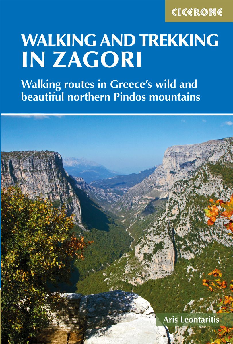
- Walking and Trekking in Zagori
- Walking routes in Greece's wild and beautiful northern Pindos mountains Read more
- Also available from:
- Stanfords, United Kingdom
- De Zwerver, Netherlands

United Kingdom
2019
- Walking and Trekking in Zagori: Walking routes in Greece`s wild and beautiful northern Pindos mountains
- Zagori in Greece`s Northern Pindos National Park is among the last relatively undiscovered and unspoilt hiking destinations in Europe. This guide presents a selection of thirty walks and three short treks showcasing the region`s captivating scenery, from dramatic gorges to mystical forests, crystal-clear turquoise rivers, rugged alpine peaks... Read more

Netherlands
2019
- Wandelgids Walking and Trekking in the Zagori | Cicerone
- Guidebook to 30 walks and 3 treks centred on Zagori and Konitsa in mainland Greece. From easy strolls to demanding hikes along remote mountainous traverses, including the rugged peaks of Mt Timfi and Mt Smolikas in the Pindos range, Drakolimni Lake, and the dramatic Vikos Gorge. With background information on architecture, history and wildlife. Read more

United Kingdom
2006
- Greece Mountain Walks
- The Mountains of Greece is Tim Salmon’s Cicerone guide to walking in some of Europe’s most demanding peaks, with contributions from Michael Cullen. The guide describes a traverse of the Pindhos range and walks in regions including Athens and the east coast, the Peleponnese and the Mani. Most of Greece’s mountains are undeveloped and remote, yet... Read more

Netherlands
- Remember Greece
- Summer shone late over Western Europe in 1939, but in Icaria the sun had done its work by the fourth week of August figs bursting, grapes heavy under their bloom, and the paths on the hillsides powdering beneath one s feet. The earth, saturated with the long months of heat, flung back sunlight as we crossed the ravine and skirted the walls - we... Read more
- Also available from:
- Bol.com, Belgium

Belgium
- Remember Greece
- Summer shone late over Western Europe in 1939, but in Icaria the sun had done its work by the fourth week of August figs bursting, grapes heavy under their bloom, and the paths on the hillsides powdering beneath one s feet. The earth, saturated with the long months of heat, flung back sunlight as we crossed the ravine and skirted the walls - we... Read more

Netherlands
- The Rough Guide to Greece
- Make the most of your time with The Rough Guide to Greece, the ultimate handbook to the Greek mainland and islands right down to the tiniest one-village outcrops. Flick through the full-colour section for an overview of all of Greece''s highlights, from Mount Pilio''s lush countryside and Prespa''s beautiful lakes to the fish market in... Read more
- Also available from:
- Bol.com, Belgium

Belgium
- The Rough Guide to Greece
- Make the most of your time with The Rough Guide to Greece, the ultimate handbook to the Greek mainland and islands right down to the tiniest one-village outcrops. Flick through the full-colour section for an overview of all of Greece''s highlights, from Mount Pilio''s lush countryside and Prespa''s beautiful lakes to the fish market in... Read more

Netherlands
- LAS Vegas Periphery
- Laurie Brown has long been fascinated with what happens at the edge of cities. In her pioneering, photographic work on Los Angeles, her focus was on the terraforming activities in that quintessential modern metropolis, where nature is literally scraped away and terraced to accommodate the most recent version of the American Dream: more roads... Read more
- Also available from:
- Bol.com, Belgium

Belgium
- LAS Vegas Periphery
- Laurie Brown has long been fascinated with what happens at the edge of cities. In her pioneering, photographic work on Los Angeles, her focus was on the terraforming activities in that quintessential modern metropolis, where nature is literally scraped away and terraced to accommodate the most recent version of the American Dream: more roads... Read more

Netherlands
- Wandelkaart 10.12 Skopelos | Anavasi
- Topografische Wanderkarte 10. 12. Griechische Inseln - Ägäis - Sporaden - Aegean Sporades. Neuauflage. Read more

Netherlands
2016
- Reisgids Chalkidiki | Marco Polo
- MARCO POLO Reiseführer Chalkidiki ab 12.99 EURO Reisen mit Insider-Tipps. Inklusive kostenloser Touren-App & Update-Service Marco Polo. 12., komplett überarbeitete und neu gestaltete Auflage Read more

Netherlands
2014
- Reisgids Thassos natuurlijk | Boekscout.nl
- Twee Nederlandse vrouwen geven een gedetailleerd beeld van het leven op Thassos, het bosrijke, bergachtige Griekse eiland. Ze geven inzicht in het leven van de Thassiten, die van hun voorouders geleerd hebben in harmonie met de natuur te leven en alles te gebruiken wat deze hen biedt. Een beschrijving van flora en fauna, van olijventeelt,... Read more
Maps

United Kingdom
- Monemvasia - Maleas - Elafonisos 2009
- Monemvasia - Maleas - Elafonisos area, the eastern finger of the Peloponnese and the Elsfonisos Island, at 1:50,000 in a series of waterproof and tear-resistant hiking maps from Anavasi with a UTM grid for GPS users. On one side is a topographic map of the area with contours at 20m intervals and a 1-km UTM grid. On the reverse a simplified... Read more
- Also available from:
- Stanfords, United Kingdom
- De Zwerver, Netherlands

United Kingdom
- Monemvasia - Maleas - Elafonisos Anavasi 8.9
- Monemvasia - Maleas - Elafonisos area, the eastern finger of the Peloponnese and the Elsfonisos Island, at 1:50,000 in a series of waterproof and tear-resistant hiking maps from Anavasi with a UTM grid for GPS users. On one side is a topographic map of the area with contours at 20m intervals and a 1-km UTM grid. On the reverse a simplified... Read more

Netherlands
- Wandelkaart 8.9 Monemvasia - Maleas - Peloponnesos | Anavasi
- Monemvasia - Maleas - Elafonisos area, the eastern finger of the Peloponnese and the Elsfonisos Island, at 1:50,000 in a series of waterproof and tear-resistant hiking maps from Anavasi with a UTM grid for GPS users. On one side is a topographic map of the area with contours at 20m intervals and a 1-km UTM grid. On the reverse a simplified... Read more

United Kingdom
- Erimanthos 2005
- Mt Erymanthos in a series of waterproof and tear-resistant hiking maps at scales varying from 1:50,000 to 1:10,000, with a UTM grid for GPS users. Contour interval varies depending on the scale, on most maps it is 20m. Relief shading, spot heights, springs, seasonal streams and, in most titles, landscape/land-use variations, e.g. forests,... Read more
- Also available from:
- Stanfords, United Kingdom
- De Zwerver, Netherlands

United Kingdom
- Mt Erymanthos Anavasi 8.61
- Mt Erymanthos in a series of waterproof and tear-resistant hiking maps at scales varying from 1:50,000 to 1:10,000, with a UTM grid for GPS users. Contour interval varies depending on the scale, on most maps it is 20m. Relief shading, spot heights, springs, seasonal streams and, in most titles, landscape/land-use variations, e.g. forests,... Read more

Netherlands
- Wandelkaart 8.61 Mt. Erimanthos - Peloponessos | Anavasi
- Mt Erymanthos in a series of waterproof and tear-resistant hiking maps at scales varying from 1:50,000 to 1:10,000, with a UTM grid for GPS users. Contour interval varies depending on the scale, on most maps it is 20m. Relief shading, spot heights, springs, seasonal streams and, in most titles, landscape/land-use variations, e.g. forests,... Read more

United Kingdom
- Delos - Mykonos - Rheneia 2015
- Mykonos with the nearby islands of Delos and Rineia / Rheneia on a light, waterproof and tear-resistant, GPS compatible map at 1:25,000 from Anavasi. The reverse side shows a large, very detailed plan of the archaeological remains on Delos of the temples of Apollo, Artemis and Leto.Topography of the islands is shown by contours with hill... Read more
- Also available from:
- Stanfords, United Kingdom
- De Zwerver, Netherlands

United Kingdom
- Mykonos - Delos - Rheneia / Rineia Anavasi 10.42
- Mykonos with the nearby islands of Delos and Rineia / Rheneia on a light, waterproof and tear-resistant, GPS compatible map at 1:25,000 from Anavasi. The reverse side shows a large, very detailed plan of the archaeological remains on Delos of the temples of Apollo, Artemis and Leto.Topography of the islands is shown by contours with hill... Read more

Netherlands
- Wandelkaart 10.42 Delos - Mykonos (Mikonos) - Rheneia (Reneia) | Anavasi
- Mykonos with the nearby islands of Delos and Rineia / Rheneia on a light, waterproof and tear-resistant, GPS compatible map at 1:25,000 from Anavasi. The reverse side shows a large, very detailed plan of the archaeological remains on Delos of the temples of Apollo, Artemis and Leto.Topography of the islands is shown by contours with hill... Read more

United Kingdom
- Attika Viotia 2012
- Attica and Boeotia at 1:100,000 in a series from Anavasi covering selected popular areas of central mainland Greece and the Peloponnese on GPS compatible, detailed topographic road maps printed on light, waterproof and tear-resistant synthetic paper. Coverage extends north well beyond Thebes/Thiva and Livadia to Atlanadi and includes Salamina... Read more
- Also available from:
- Stanfords, United Kingdom
- De Zwerver, Netherlands

United Kingdom
- Attica - Boeotia Anavasi 10
- Attica and Boeotia at 1:100,000 in a series from Anavasi covering selected popular areas of central mainland Greece and the Peloponnese on GPS compatible, detailed topographic road maps printed on light, waterproof and tear-resistant synthetic paper. Coverage extends north well beyond Thebes/Thiva and Livadia to Atlanadi and includes Salamina... Read more

Netherlands
- Wegenkaart - landkaart 10 Atiki - Attika | Anavasi
- Attica and Boeotia at 1:100,000 in a series from Anavasi covering selected popular areas of central mainland Greece and the Peloponnese on GPS compatible, detailed topographic road maps printed on light, waterproof and tear-resistant synthetic paper. Coverage extends north well beyond Thebes/Thiva and Livadia to Atlanadi and includes Salamina... Read more

United Kingdom
- Kythnos 2015
- Het eiland Kithnos heeft twee charmante nederzettingen, Hora en Dryopida, wat zeker een bezoekje waard is. Ook heeft Kithnos prachtige stranden en een goed bewaard netwerk van paden. De kaarten van Anavasi zijn zeer gedetailleerd, beschikken over een helder kaartbeeld en zijn uitstekende kaarten voor diverse activiteiten. Ze beschikken over... Read more
- Also available from:
- De Zwerver, Netherlands
Netherlands
- Wandelkaart 10.44 Kythnos | Anavasi
- Het eiland Kithnos heeft twee charmante nederzettingen, Hora en Dryopida, wat zeker een bezoekje waard is. Ook heeft Kithnos prachtige stranden en een goed bewaard netwerk van paden. De kaarten van Anavasi zijn zeer gedetailleerd, beschikken over een helder kaartbeeld en zijn uitstekende kaarten voor diverse activiteiten. Ze beschikken over... Read more

United Kingdom
- Exo Mani 2018
- Uitstekende wandelkaart op scheur- en watervast papier van het wandelgebied rond Kardamyli maar ook nog met Agios Nikolaos. De wandelpaden staan er op ingetekend, zo ook alle bezienswaardigheden als klooster, kastelen en meerdere opgravingen. Mani is the middle and southernmost peninsula of the Peloponnese and is split between Laconia and... Read more
- Also available from:
- Stanfords, United Kingdom
- De Zwerver, Netherlands

United Kingdom
- Exo Mani - Verga - Kardamyli - Trachila Anavasi 8.10
- The northern part of the western coast of the Mani Peninsula, the “middle finger” of the Peloponnese, on a light, waterproof and tear-resistant, double-sided, contoured and GPS-compatible map at 1:20,000 from Anavasi highlighting 24 hiking trails and various facilities and places of interest. Coverage, with a good overlap between the sides,... Read more

Netherlands
- Wandelkaart 8.10 Exo Mani | Anavasi
- Uitstekende wandelkaart op scheur- en watervast papier van het wandelgebied rond Kardamyli maar ook nog met Agios Nikolaos. De wandelpaden staan er op ingetekend, zo ook alle bezienswaardigheden als klooster, kastelen en meerdere opgravingen. Mani is the middle and southernmost peninsula of the Peloponnese and is split between Laconia and... Read more

United Kingdom
- Chalki 2008
- wandelkaart schaal 1:20.000 met hoogtelijnen, wandelpaden, toeristische informatie en UTM grid, de kaart is geschikt voor gebruik met GPS. A tiny island though very rich in monuments and ancient remains. More than 50 byzantine chappels, dozens of rock carved cisterns and old agricultural settlements and a well-preserved medieval caslte with a... Read more
- Also available from:
- Stanfords, United Kingdom
- De Zwerver, Netherlands

United Kingdom
- Chalki Anavasi 10.33
- The island of Chalki at 1:20,000 on a waterproof and tear-resistant, contoured and GPS compatible map from Anavasi, with highlighting five recommended hiking routes and other useful tips, plus an enlargement showing in greater detail the Chorio archaeological site.On one side is a map of Chalki with contours at 20m intervals and hill shading to... Read more

Netherlands
- Wandelkaart 10.33 Chalki | Anavasi
- wandelkaart schaal 1:20.000 met hoogtelijnen, wandelpaden, toeristische informatie en UTM grid, de kaart is geschikt voor gebruik met GPS. A tiny island though very rich in monuments and ancient remains. More than 50 byzantine chappels, dozens of rock carved cisterns and old agricultural settlements and a well-preserved medieval caslte with a... Read more

United Kingdom
- Skyros 2014
- De kaarten van Anavasi zijn zeer gedetailleerd, beschikken over een helder kaartbeeld en zijn uitstekende kaarten voor diverse activiteiten. Ze beschikken over vele interessante punten voor wandelaars, fietsers of andere toeristen die het gebied bezichtigen. De wandelkaarten bevatten ook een uitzonderlijke reliefaanwijzing, verschillende vormen... Read more
- Also available from:
- De Zwerver, Netherlands

Netherlands
- Wandelkaart 10.14 Skyros | Anavasi
- De kaarten van Anavasi zijn zeer gedetailleerd, beschikken over een helder kaartbeeld en zijn uitstekende kaarten voor diverse activiteiten. Ze beschikken over vele interessante punten voor wandelaars, fietsers of andere toeristen die het gebied bezichtigen. De wandelkaarten bevatten ook een uitzonderlijke reliefaanwijzing, verschillende vormen... Read more

United Kingdom
- Nisyros 2009
- Nisyros and the nearby island of Ghyali at 1:20,000 on a contoured, GPS compatible hiking map published by Terrain Cartography group together with Skai Maps, and printed on light, waterproof and tear-resistant Polyart plastic paper, with extensive tourist information.Topography is very well presented by contours, enhanced by spot heights,... Read more
- Also available from:
- Stanfords, United Kingdom
- De Zwerver, Netherlands

United Kingdom
- Nisyros Terrain Editions 339
- Nisyros and the nearby island of Ghyali at 1:20,000 on a contoured, GPS compatible hiking map published by Terrain Cartography group together with Skai Maps, and printed on light, waterproof and tear-resistant Polyart plastic paper, with extensive tourist information.Topography is very well presented by contours, enhanced by spot heights,... Read more

Netherlands
- Wandelkaart 339 Nisyros | Terrain maps
- Nisyros and the nearby island of Ghyali at 1:20,000 on a contoured, GPS compatible hiking map published by Terrain Cartography group together with Skai Maps, and printed on light, waterproof and tear-resistant Polyart plastic paper, with extensive tourist information.Topography is very well presented by contours, enhanced by spot heights,... Read more

United Kingdom
- Elikon 2005
- Mt Elikon in a series of waterproof and tear-resistant hiking maps at scales varying from 1:50,000 to 1:10,000, with a UTM grid for GPS users. Contour interval varies depending on the scale, on most maps it is 20m. Relief shading, spot heights, springs, seasonal streams and, in most titles, landscape/land-use variations, e.g. forests, orchards,... Read more
- Also available from:
- Stanfords, United Kingdom
- De Zwerver, Netherlands

United Kingdom
- Mt Elikon Anavasi 2.6
- Mt Elikon in a series of waterproof and tear-resistant hiking maps at scales varying from 1:50,000 to 1:10,000, with a UTM grid for GPS users. Contour interval varies depending on the scale, on most maps it is 20m. Relief shading, spot heights, springs, seasonal streams and, in most titles, landscape/land-use variations, e.g. forests, orchards,... Read more

Netherlands
- Wandelkaart 2.6 Mt. Elikon - Griekenland vasteland | Anavasi
- Mt Elikon in a series of waterproof and tear-resistant hiking maps at scales varying from 1:50,000 to 1:10,000, with a UTM grid for GPS users. Contour interval varies depending on the scale, on most maps it is 20m. Relief shading, spot heights, springs, seasonal streams and, in most titles, landscape/land-use variations, e.g. forests, orchards,... Read more

United Kingdom
- Mount Pelion - Mount Mavrovouni 2018
- Uitstekende topografische kaarten van een deel van Griekenland: zonder meer hele goede kaarten voor wandeltochten in een onbekend stuk Griekenland! Ze zijn gedrukt op scheurvast en watervast papier op een schaal van 1:45.000 met een UTM grid voor GPS gebruikers. Op de meeste kaarten is geven de hoogtelijnen een interval van 20m. aan. Met... Read more
- Also available from:
- De Zwerver, Netherlands

Netherlands
- Wandelkaart 4.3/4.4 Mt. Pilio - Mt. Mavrovouni | Anavasi
- Uitstekende topografische kaarten van een deel van Griekenland: zonder meer hele goede kaarten voor wandeltochten in een onbekend stuk Griekenland! Ze zijn gedrukt op scheurvast en watervast papier op een schaal van 1:45.000 met een UTM grid voor GPS gebruikers. Op de meeste kaarten is geven de hoogtelijnen een interval van 20m. aan. Met... Read more

United Kingdom
- Kythnos 2015
- Kythnos at 1:25,000 on a contoured, GPS compatible hiking map published by Terrain Cartography group together with Skai Maps, and printed on light, waterproof and tear-resistant Polyart plastic paper, with extensive tourist information.Topography is very well presented by contours, enhanced by spot heights, subtle relief shading and additional... Read more
- Also available from:
- Stanfords, United Kingdom
- De Zwerver, Netherlands

United Kingdom
- Kythnos Terrain Editions 302
- Greek island of Kythnos on a light, waterproof and tear-resistant, contoured and GPS compatible map at 1:25,000 from Terrain Editions, with astreet plan of the Hora of Kythnos at 1:2,500, plus descriptions of 13 specially selected hiking trails. All place names are shown in both Greek and Latin alphabet. Map legend and all the text include... Read more

Netherlands
- Wandelkaart 302 Kythnos | Terrain maps
- Kythnos at 1:25,000 on a contoured, GPS compatible hiking map published by Terrain Cartography group together with Skai Maps, and printed on light, waterproof and tear-resistant Polyart plastic paper, with extensive tourist information.Topography is very well presented by contours, enhanced by spot heights, subtle relief shading and additional... Read more

United Kingdom
- Hydra 2017
- Greek island of Hydra at 1:25,000 on a waterproof and tear-resistant, contoured and GPS compatible map from Anavasi, showing hiking trails annotated with useful tips.On one side is a map of Hydra with contours at 20m intervals and hill shading to show the topography. The map indicates dirt roads in poor condition and distinguishes between cart... Read more
- Also available from:
- Stanfords, United Kingdom
- De Zwerver, Netherlands

United Kingdom
- Hydra Anavasi 10.40
- Greek island of Hydra at 1:25,000 on a waterproof and tear-resistant, contoured and GPS compatible map from Anavasi, showing hiking trails annotated with useful tips.On one side is a map of Hydra with contours at 20m intervals and hill shading to show the topography. The map indicates dirt roads in poor condition and distinguishes between cart... Read more

Netherlands
- Wandelkaart 10.40 Hydra | Anavasi
- Greek island of Hydra at 1:25,000 on a waterproof and tear-resistant, contoured and GPS compatible map from Anavasi, showing hiking trails annotated with useful tips.On one side is a map of Hydra with contours at 20m intervals and hill shading to show the topography. The map indicates dirt roads in poor condition and distinguishes between cart... Read more

United Kingdom
- Pindos South 2016
- Uitstekende topografische kaarten van een deel van Griekenland: zonder meer hele goede kaarten voor wandeltochten in een onbekend stuk Griekenland! Ze zijn gedrukt op scheurvast en watervast papier op een schaal van 1:50.000 met een UTM grid voor GPS gebruikers. Op de meeste kaarten is geven de hoogtelijnen een interval van 20m. aan. Met... Read more
- Also available from:
- Stanfords, United Kingdom
- De Zwerver, Netherlands

United Kingdom
- South Pindos - Tzoumerka – Peristeri – Koziakas – Aygo Anavasi 3.2/4.2
- South Pindos: Tzoumerka – Peristeri – Koziakas – Aygo area at 1:50,000 in a series of GPS compatible, waterproof and tear-resistant hiking maps from Anavasi. The map is double-sided: on one side are the peaks of Peristeri, Kakardhitsa and Tzoumerka with the map extending north to Metsovo; on the reverse coverage extend westwards beyond the... Read more

Netherlands
- Wandelkaart 3.2-4.2 South Pindos | Anavasi
- Uitstekende topografische kaarten van een deel van Griekenland: zonder meer hele goede kaarten voor wandeltochten in een onbekend stuk Griekenland! Ze zijn gedrukt op scheurvast en watervast papier op een schaal van 1:50.000 met een UTM grid voor GPS gebruikers. Op de meeste kaarten is geven de hoogtelijnen een interval van 20m. aan. Met... Read more

United Kingdom
- Kitheron - Pateras - Gerania 2018
- Mt Gherania in a series of waterproof and tear-resistant hiking maps at scales varying from 1:50,000 to 1:10,000, with a UTM grid for GPS users. Contour interval varies depending on the scale, on most maps it is 20m. Relief shading, spot heights, springs, seasonal streams and, in most titles, landscape/land-use variations, e.g. forests,... Read more
- Also available from:
- De Zwerver, Netherlands
Netherlands
- Wandelkaart 1.4-1.5 Mt Kitheron - Mt Pateras - Mt Gerania | Anavasi
- Mt Gherania in a series of waterproof and tear-resistant hiking maps at scales varying from 1:50,000 to 1:10,000, with a UTM grid for GPS users. Contour interval varies depending on the scale, on most maps it is 20m. Relief shading, spot heights, springs, seasonal streams and, in most titles, landscape/land-use variations, e.g. forests,... Read more
Walking holidays
Netherlands
- Griekenland - Cycladen, Andros relaxed
- Actief genieten in het ‘wandelparadijs van Griekenland’: het Cycladeneiland Andros. Hier vind je rust en wandel je relaxed over historische paden langs fraaie zandstranden, weelderig groene dalen, natuurstenen huisjes in schilderachtige dorpjes en een prachtig hoofdstadje. Met de stichting Andros Routes maak je op bijzondere manier kennis met... Read more
Netherlands
- Griekenland - Cycladen 1, Andros & Tinos
- De Cycladen, de bekendste en fotogeniekste eilandengroep van Griekenland. Ontdek onbekend Andros en Tinos. Op Andros volg je de prachtige oude paden van de Andros Route naar fraaie zandstranden, weelderig groene dalen en natuurstenen huizen. Op Tinos vind je witte labyrintdorpen, de burcht Exoburgo, kunstzinnige duiventorens en bizarre... Read more
Netherlands
- Griekenland - Kreta, Zuidkust
- Met de zee aan je voeten over prachtige paden langs een van de mooiste kusten van Europa. Witte zandstranden, marmeren kliffen en zoet water bij de branding. Uitkijken over blauwe zee en blauwe luchten. Via spectaculaire oleander-kloven een uitstapje naar het ruige binnenland. Via de Samaria-kloof en een kustpad volgt de fraaie finale door de... Read more
Netherlands
- Griekenland - Cycladen, Andros Route
- Het Cycladen-eiland Andros is het nieuwe wandelparadijs van Griekenland. Samen met de stichting Andros Routes bieden we, van zuid naar noord, een prachtige lange-afstandswandelroute aan: de Andros Route. Gecertificeerd als Leading Quality Trail, is de markering perfect en de schoonheid van de oude, historische paden bijzonder. Onderweg biedt... Read more
Netherlands
- Griekenland - Macedonië en Ipiros 'totaal'
- Alle hoogtepunten van Noord Griekenland zijn verenigd in één reis. Een greep: de Prespameren, de Vikoskloof, de Meteora-kloosters en natuurlijk de godenberg Olympos. Je hebt optimale vrijheid door gebruik van een (huur)auto en geniet wandelend van de bijzondere sfeer. Je overnacht in archontika, authentieke herenhuizen.Er is van deze reis ook... Read more
Netherlands
- Griekenland - Cycladen 4, Santorini
- Santorini: het meest bizarre en fotogenieke eiland van de eilandengroep Cycladen. Santorini, of Thira, is eigenlijk het restant van een ontplofte vulkaan; is dit wellicht Atlantis? De spierwitte huizen contrasteren sterk met de diepblauwe zee en de rode, witte en zwarte rotsen. En vergeet de heerlijke wijn op de gezellige terrasjes niet. Je... Read more
Netherlands
- Griekenland - Kreta, rondreis oost-west
- Doorkruis met een huurauto van Lassithi tot Sfakia de mooiste uithoeken van landelijk Kreta. Ervaar het beste dat dit landschappelijk zeer gevarieerde eiland te bieden heeft: Minoïsche paleizen, verlaten kloven en hoogvlaktes, dromerige dorpjes, kliffen en baaitjes. Kreta is een eiland waar alle zintuigen van kunnen genieten: prachtige natuur,... Read more
Netherlands
- Griekenland - Kefalonia
- Volg de galerijweg langs de kust met uitzicht op zee en beleef de avonturen uit het vermaarde boek 'Kapitein Corelli's mandoline'. Geniet van ruige kliffen, prachtige zandstranden, weelderige plantengroei, heerlijke baaitjes en mysterieuze grotten. Strijk neer in een kleurrijk haventje voor een glas locale 'Robola'. Je verblijft in mooie en... Read more
Netherlands
- Griekenland - Pindos, Zagoria - Vikoskloof
- Langs en door één van de grootste Canyons van Europa: de Vikoskloof in het Griekse Pindosgebergte. Niet alleen deze Grand Canyon van Griekenland is een unieke parel tijdens deze wandelreis door de Zagoria. De trektocht loodst je over fraai geplaveide 'kalderimia' en oude boogbruggen langs bijzondere beschermde bergdorpen. Opgebouwd uit dezelfde... Read more
Netherlands
- Griekenland - Peloponnesos, klassiek Hellas
- 9-daagse rondreis per (huur)auto door de arcadische landschappen van de Peloponnesos. Bezoek 'Klassiek Hellas' met bekende én onbekende antieke opgravingen. Ga sfeer proeven bij Olympia en Delphi, in de spectaculaire Lousioskloof en bij de verborgen kloosters Filosofou en Prodromos. Geniet van de mythologische verhalen over Herakles en de... Read more
Netherlands
- Griekenland - Peloponnesos 'totaal'
- Een complete 15-daagse actieve auto-rondreis die een feest is voor alle zintuigen! Er zijn weinig landstreken met zoveel historische rijkdom en zo’n grote afwisseling aan landschappen als de Peloponnesos. De besneeuwde toppen van de Taygetos liggen vlakbij het rustieke strand van Kardamilli, de diepe Lousioskloof leid je naar idyllische dorpjes... Read more
Netherlands
- Griekenland - Peloponnesos
- De Peloponnesos is een ideale bestemming voor een combinatie van natuur én cultuur. Hier beleefde het Klassieke Hellas haar culturele hoogtepunt en de schoonheid van het landschap is legendarisch. In dit klassieke land van melk en honing bezoeken we beroemde opgravingen als Olympia en Delphi, maar we ontdekken ook minder bekende mythische en... Read more
Netherlands
- Griekenland - Pindos, Zagoria - Astrakas
- Vanaf het uiteinde van Vikoskloof tot de bergweides en kliffen van het Astrakasmassief. Bergwandelen over oude herdersroutes op zoek naar de Pindosdraak, die leeft in het fameuze Drakenmeer. De bergdorpen Papingo, Tsepelovo en Kipi bieden je een kijkje in de rijke cultuurhistorie van de Zagoria. Onderweg op eenzame hoogte overnachten in de... Read more
Netherlands
- Griekenland - Centraal Corfu
- Het fameuze dorpsplein bij Kostas Taverna is voor veel mensen een begrip. Al ruim 20 jaar is Agios Ioannis een startpunt om te wandelen, fietsen en te genieten van rust en natuur. Het dorp is gelegen in het rustieke middengedeelte van het eiland Corfu en daarom ideaal als basis om dit hele eiland te bereiken. Hier vind je speciaal voor SNP... Read more
Netherlands
- Griekenland - Kreta, rondreis
- Ontdek per huurauto het landelijke Kreta en ervaar de unieke combinatie van spectaculaire natuur en rijke culturele erfenis van dit zeer gevarieerde eiland. Maak een reis door de tijd langs overblijfselen uit Minoïsche, Romeinse en Byzantijnse tijden. Geniet tijdens dagwandelingen met al uw zintuigen van geurende kruiden, kleine strandjes, zon... Read more
Forum

- yawa level 2020-12-20 17:15:20
Πώς αγόρασα την άδεια οδήγησης στο Διαδίκτυο από (www.buydocsonline247.com)
- Γνωρίζατε ότι μπορείτε να αποκτήσετε άδεια οδήγησης στο διαδίκτυο;
ΕΠΙΚΟΙΝΩΝΙΑ ΜΕ ΤΑ ΜΙΑ
WhatsApp ........ + 44 7404 518117
Γνωρίζατε ότι μπορείτε να αποκτήσετε άδεια οδήγησης στο διαδίκτυο ;, Μπορείτε να αγοράσετε την άδεια B, C, D και ούτω καθεξής.
Αυτή είναι μια ιστορία που θα ήθελα να μοιραστώ
ΕΠΙΚΟΙΝΩΝΗΣΤΕ ΜΕ ΤΑ ΜΕΣΩ
WhatsApp ........ + 44 7404 518117
Είδα μια ανάρτηση στο Διαδίκτυο σχετικά με τον τρόπο αγοράς μιας εγγεγραμμένης άδειας οδήγησης. Η επαφή εκτός αυτού ήταν (info@buydocsonline247.com) και ο ιστότοπος www.buydocsonline247.com ήμουν απελπισμένος και χρειαζόμουν άδεια οδήγησης για αυτή τη νέα ευκαιρία εργασίας που έκανε τα πράγματα καλύτερα για μένα.
Αποφάσισα αμέσως να επικοινωνήσω μαζί τους γ

- F Plowden 2014-12-21 18:27:51
E6 in Greece
- I am hoping to walk across Greece from Igoumenitsa to Istanbul using the E6. Can anyone give me any information (a) about the state of the E6 (b) whether there is any map(s) which marks the whole route (c) whether they have done this walk and any problems encountered?.
Many thanks
Francis